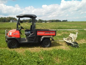
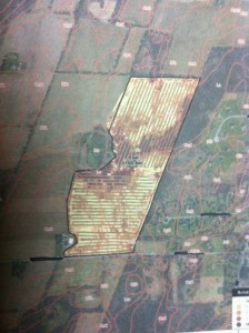
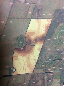
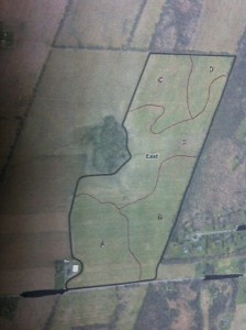
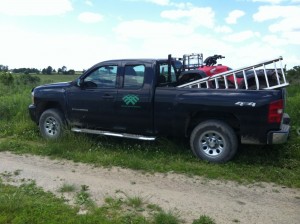
During the last week of my internship I had the opportunity to learn about electr0conductivity mapping. In field data is collected with the use of Veris Technologies’ EC machine, which can be pulled behind a truck or a smaller machine such as a Kubota RTV. Collecting data with the EC machine allows a farm to map soil type variation within field very accurately. The EC machine allows a technician to make passes in the field every sixty feet, while data and GPS location is collected every second by the Veris Surveyor and YUMA (GPS unit). The raw data is then sent to the GIS group that analysis the data and then makes a map with five different EC values from low (lightest color) to high (darkest color). After that the maps are then sent back to the service manager that works with the farm to make the final say in how the field is broke up into subsections. A work order is then made to have a field technician soil sample within these subsections so there is a more accurate understanding of the variation within the field. Also with these new maps their is the potential for the grower to begin variable rate application of certain inputs such as fertilizer.
Soil Sampling and PSNT
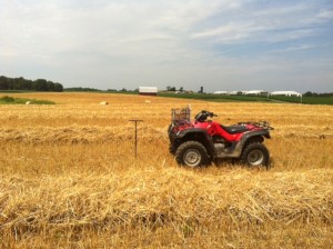
For about the last two weeks or so growers have been harvesting their wheat crop, which gives ACS the opportunity to start soil sampling. Each field that is sample usually has a couple samples to be pulled. A sample is pulled from each section of the field and these section can be broken up topographically, by soil type, or by the electro-conductivity mapping that was done previously to sampling. The procedure for soil sampling is pretty straight forward and the tools we use include soil probe, screw driver, sampling boxes or bags depending on work order, ATV to get around the field, and a GPS unit if necessary. Also on the soil probe there are markings at six, eight, and twelve inches because it is important to be fairly accurate with your depth. When pulling a regular soil sampling it is important to keep your depth between six and eight inches so having the markings on the probe really helps. When actually pulling the samples in each section
it takes eight to ten probes to fill a small cardboard box that goes to Dairy One for soil analysis and when we are sending a sample to Spectrum it takes five to six probes to fill those bags properly. When pulling the samples I usually fallow a W or M pattern on the ATV and it is important to avoid wet spots and we also try not to sample in the headlands because they can both alter the sample. Earlier in the summer I also had the opportunity to pull some PSNTs for a couple farms. These are very similar to soils samples but it is important to pull the samples to a depth of twelve inches so that you can determine the full amount of nitrogen available in the soil. These PSNTs are usually pulled around the time when corn has reached the V5 stage just before farms begin to side dress. When pulling the samples you also want to make sure that you avoid taking the sample close to the corn because you could hit the strip of fertilizer they put down while planting.
Scouting Corn
For the last couple weeks I have been doing a lot of scouting in Western NY. Mainly I have been looking at corn but I have also seen alfalfa and soybeans. When scouting, we are usually looking for the presence of diseases, insect damage, and anything else that could be causing stress to the crop including nutrient deficiencies, weeds, or injury from earlier sprays.
Since I have been spending a lot of time scouting corn I have been able to scout for weed pressure, present diseases, and insect damage. Weed pressure was the first thing we began scouting for once the corn had emerged because it is very important to take out the weeds before they can compete with the crop for things such as water, nutrients, light, and space. The procedure for scouting weed pressure in corn is fairly straight forward with weather permitting we are usually able to ride the ATV’s at least around the perimeter to get an understanding of the field and see if there are any problem areas. While riding the perimeter I will step off the ATV in a couple areas to walk into the field and see what other weeds are present away from the edge and towards the center. At first I found it a little difficult to determine what was moderate or heavy pressure for the weeds present in the field but once I got my first couple fields under my belt I was able to get the hang of it. Some of the weeds that I found consistently in the corn fields included, chickweed, ragweed, lambs quarters, crabgrass, milkweed, and wild mustard. Once I am done scouting for the day I send my reports to the service manager that is working with said farm and they will make recommendations from the data I collected.
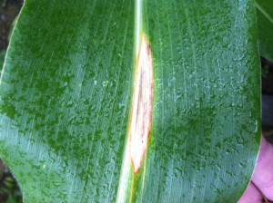
Scouting for diseases and insects in corn was also another main priority in the recent couple weeks. Some of the diseases that are important to scout for include Northern Corn Leaf Blight, Grey Leaf Spot, Anthracnose, and Eyespot. In the fields that I have scouted there hasn’t been much
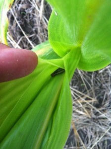
disease pressure. I have found these diseases out in the field; however they were only in trace amounts nothing that was of concern and needed action to be taken. While walking through the corn searching for disease pressure I also try to keep an eye out for any insect damage. So far I have been able to see some damage from armyworm and also found a few larvae, but nowhere near the kind of pressure we were seeing last season.
Internship with Agricultural Consulting Services, INC
For this summer I will be interning with Agricultural Consulting Services, Inc. or ACS for short and their sister company Agrinetix, LLC in Rochester NY. ACS consists of agronomy professionals who handle the crops side of the business and environmental planners that handle the CAFO and LFO regulatory side of the business. I will mainly be working as a field technician with the technical service department of ACS. For the first three weeks I have been working with ACS; meeting employees, training, soil sampling, and scouting.
I was first trained in mapping fields and collecting phosphorus index data. I met with one of the environmental planners and reviewed the field mapping training manual to understand symbols used while mapping and the general procedure for fieldwork. The majority of ACS’s field mapping is for clients that have to follow CAFO regulations. These stipulate guidelines such as manure spreading and where a field may need a setback due to an environmentally sensitive area. To begin mapping, we make a loop around the field on our ATVs with our map and markers close by to begin marking any important areas such as “Water of the State” streams and wetlands. These streams and wetlands are important because a manure setback must be put into place in the client would like to spread manure in the particular field and follow environmental regulations. The setback must be one hundred feet or if there is at least a thirty five foot buffer between the field edge and the wetland or stream then no set back is needed. Also wells are an important thing to pay attention to because they require a setback of one hundred feet. While mapping other data about the field is collected such as slope, row grade, and rock cover. Lastly, the service manager may also ask you to break up the field into different sections based on topography or possible even soil type.
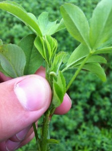
I have also had the opportunity to do some scouting in my first couple weeks of working with ACS. I began by scouting for alfalfa weevil that is a main pest of established stands of alfalfa, which can be detrimental if found in high enough numbers before the first cutting is done. Alfalfa weevil overwinters in NY as an adult and the larval stages starts to appear in fields around early May. They leave shotgun like holes in on the upper leaves of the alfalfa. When scouting for alfalfa weevil we walk through the field and examine five stems in ten different locations within the field looking for damage or larvae. It is also important to note the size of the larvae and the stage of the alfalfa. Once you have sampled in your ten locations you then divide your number of damaged stems by the number of stems you checked, which in the end would be fifty. So if I walked through a field and counted sixteen damaged stems then I would divide sixteen by fifty to determine my percent damage which would be thirty two percent in this example. The threshold for controlling alfalfa weevil in an established stand is forty percent, however just by cutting the alfalfa you can eliminate about eighty percent of the alfalfa weevil present in the field but that should not be assumed and scouting may need to be done again after first cutting to double check the situation.

