The National Hurricane Center issued a warning at 5PM EST of catastrophic damage from 20 ft storm surges along the Gulf Coast as much as 40 miles inland. US States within the NEWA area will also be impacted in coming days.
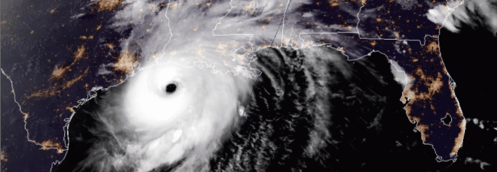
NOAA/NESDIS/STAR GOES-East color satellite image of Hurricane Laura taken 26 Aug 2020 8:21PM EST.
Hurricane Laura is expected to make landfall Wednesday evening with ‘inescapable’ 20+ ft. storm surges moving up to 40 miles inland, catastrophic hurricane force winds that extending across eastern Texas and western Louisiana and up to 10 inches of rain.
Northern Louisiana and Arkansas can expect sustained winds of 39-73 mph beginning Thursday afternoon to early Friday morning with projected rainfall totals of 6 to 10 inches in western LA. Similar wind conditions with 2 to 6 inches of rain are expected in eastern LA an the entirety of AR during that same time period.

5-day projected path of Hurricane Laura. Map provided by the National Hurricane Center.
Laura is projected to reach southeast Missouri, western Tennessee and western Kentucky Friday afternoon with diminished winds of less than 39 mph and projected rainfall totals between 1 and 4 inches.
Eastern KY and TN, along with extreme western regions of North Carolina, Virginia and West Virginia will see sustained wind speeds of less than 39 mph and accumulated rain totals between 1 and 4 inches moving into Saturday morning.
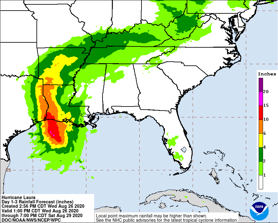
5-day projected rainfall totals from Hurricane Laura. Map provided by the National Hurricane Center.
Laura is projected to move eastward into the mid-Atlantic states sometime Saturday afternoon with diminished winds and rainfall but is likely to regain strength as it moves out over the Chesapeake Bay into the Atlantic.
Regular daily updates will be posted to the NEWA blog to and growers and producers in the path of Hurricane Laura as they mitigate the adverse impacts of this storm.
Hurricane forecast data provided by the National Hurricane Center which is part of the National Weather Service at the National Oceanic and Atmospheric Administration.
This report is posted by the Network for Environment and Weather Applications (NEWA) which is part of the New York State Integrated Pest Management Program in the College of Agriculture and Life Sciences at Cornell University.