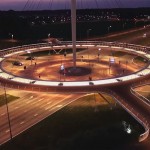
The Hovenring at night. Source: Flickr.
For decades, the dominant transportation paradigm in the United States and indeed, most of the world, has been that of the automobile. The vast majority of funding goes towards automobile infrastructure, and the world is full of novel planning and engineering solutions for increasing car traffic flow and safety.[i] (McCann 2013) However, there are many other alternative modes of transit. Isn’t it time that we give pedestrians, bicyclists, and transit users impressive solutions of their own? Luckily, there is no shortage of examples that fit this description. Here are some of the most impressive and novel alternative examples of transportation infrastructure around the world.
#1: The Hovenring, Eindhoven, Netherlands

Hovenring from street level. Source: Wikimedia Commons.
Cycling is very popular in the Netherlands. 31.2% of Dutch people list the bike as their principal mode of transportation,[ii] (BBC News 2013) and bicycling trips make up 27% of all trips nationwide.[iii] (Ministry of Transport 2009) As a result, the Dutch government has implemented many policies supporting cyclists and has built large-scale infrastructure intended to be principally used by cyclists, including special intersections (with traffic lights!), intercity bicycle paths, completely separated streets, and bicycle parking garages. A recently announced project in Amsterdam plans to construct an underwater garage with 7,000 spaces for bicycles.[iv] (O’Sullivan 2015) Very impressive, but in terms of striking infrastructure nothing compares to the Hovenring, an elevated bicycle roundabout constructed in a neighborhood of the Dutch city of Eindhoven. Built to relieve traffic on the automobile roundabout (later converted to an intersection), the choice of an elevated bicycle route allowed the complete separation of cycle and car traffic.[v] (Hovenring 2012) The project serves as reminder that transportation solutions must consider the aesthetic as well as the practical. The Hovenring is impressive both physically and in its impact on traffic flow.
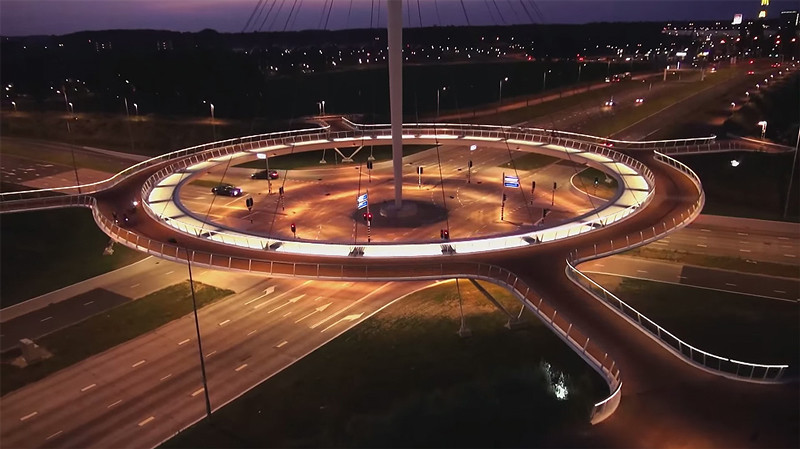
#2: Pedestrian Roundabout, Shanghai, China
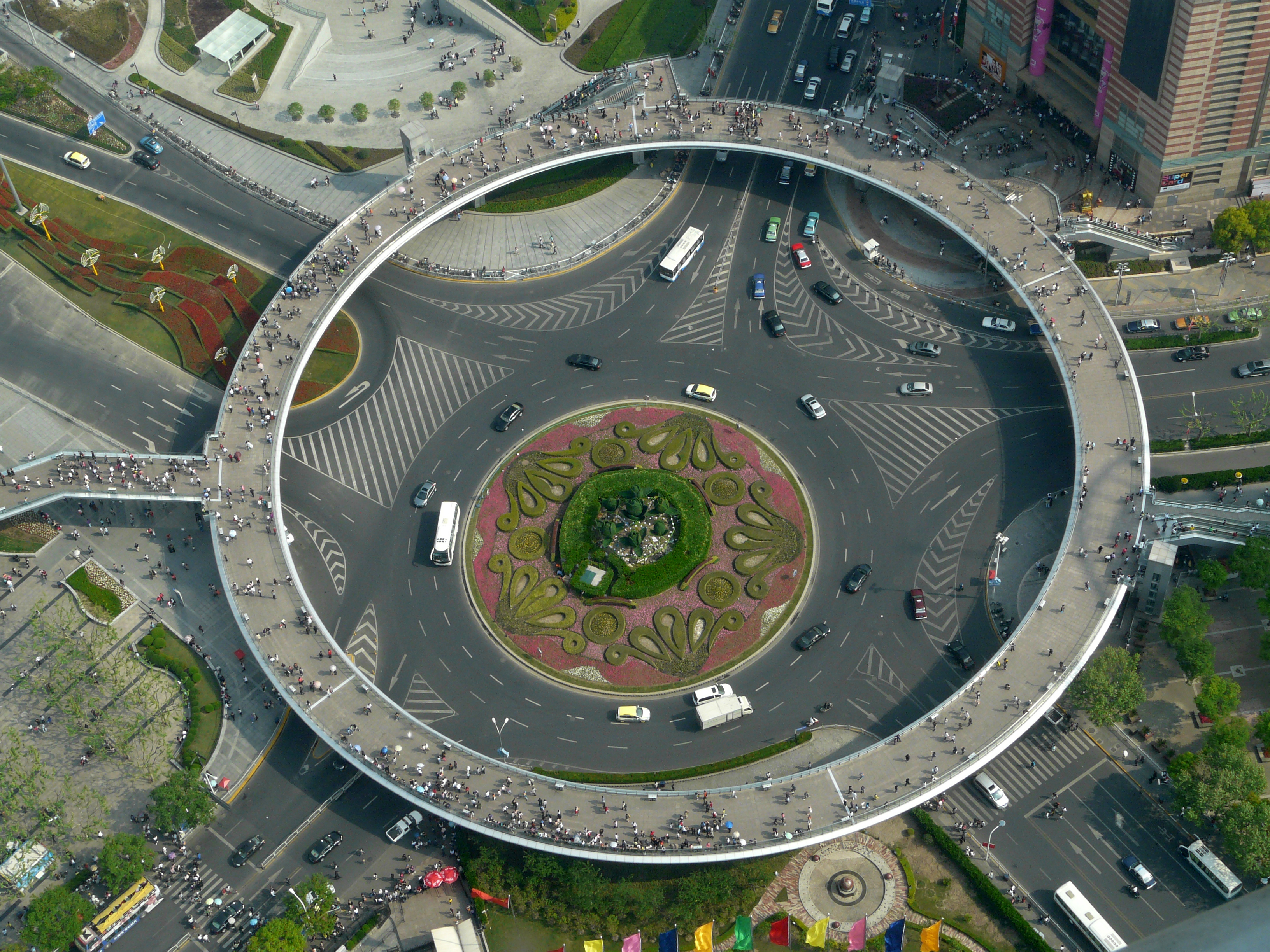
Pedestrian roundabout from above. Source: Wikimedia Commons.
We are all pedestrians. Everyone must walk during the day (or the equivalent, for those physically unable to walk). However, pedestrians are often neglected by transportation planners, both in terms of infrastructure and safety. In urban areas, crosswalks are dangerous zones for those on foot. At very busy intersections, it is a struggle to balance pedestrian safety and maintaining traffic flow. At this large roundabout in the posh business district of Lujiazui, engineers and planners had a strike a balance in access for both pedestrians and drivers, and reached a similar conclusion as the designers of the Hovenring: turn one roundabout into two. Now, pedestrians are able to move about the intersection unhindered, and without danger from car traffic.
#3: Furness Drive, Austin, Texas

Bridge seen from south. Source: Nathan Wilkes.
The previous two examples were large-scale and eye-catching, but it’s important not to underestimate the importance of small changes. A long-planned pedestrian bridge in the Heritage Hills neighborhood of Austin, Texas linked two residential neighborhoods and connected to Furness Drive, the street where the local elementary school was located. However, students struggled to ride their bikes to school as the approach and departure from the bridge were both on busy streets, unsuitable for young riders.[vi] (Andersen 2014) The solution proposed and executed was to fully separate a bike lane from the main road, allowing for an uninterrupted trip to school even for kids in neighborhoods further away from the school. Bike lanes are fairly common and growing even more so in cities all around the nation. Even these basic infrastructure changes can make great strides in increasing the modal share of cycling. A study done by the City of Austin found that only 17% of citizens were “enthused” about using regular bicycle lanes, while 39% were “interested but confident.”[vii] (City of Austin 2014) Protected bicycle lanes could be the push that that 39% needs to start using their bicycles for more trips, so the City is pushing ahead with adding more to city streets. In fact, Austin’s bicycle plan details a scheme to build feeder bikeways leading to transit routes, allowing cyclists to exchange onto bus rapid transit and light rail lines for trips around the city.[viii] (City of Austin 2014)
#4: Target Field Station, Minneapolis, Minnesota
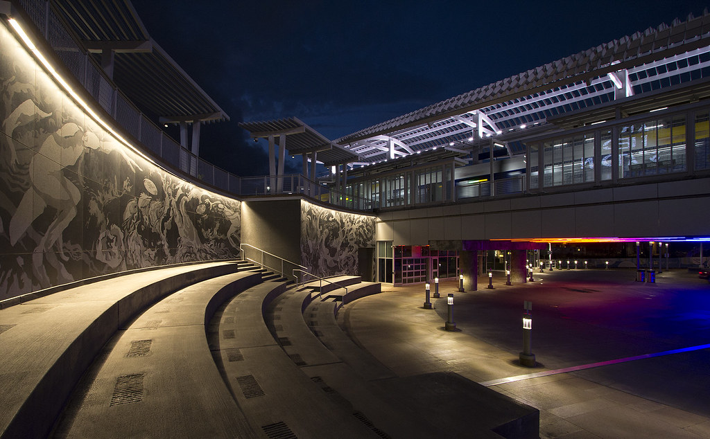
Public amphitheater at Target Field Station. Source: Flickr.
What makes for a good transit station? Is it a good location, with multiple amenities nearby? Is it cultural flair and environmental sustainability? Is it connections to other forms of transportation, enabling easy switching to get to your destination? What about all three? The Target Field Station, operated by the Twin Cities’ Metro Transit, has been added onto continuously since construction to evolve with the desires of the community. The station gets its name from Target Field, the Major League Baseball stadium right next door. In addition to the stadium, the station is meant to be convenient to area shops and offices. On the community end, the station grounds include a large lawn intended to be a park as well as an amphitheater available for public events.[ix] (Hennepin County) The amphitheater is decorated with murals from community artists. Environmentally, the lawn acts as a green roof and rain collector for the platform underneath, and the sidewalks are heated for chemical-free snow removal.[x] (Hennepin County) But perhaps the station’s most impressive feature is its embracement of intermodal transit. The station currently acts as a stop on a commuter rail line, two or the region’s three currently operating light rail lines, as well as the bus system. Future plans see both light rail lines be extended to serve more areas, and both a proposed bus rapid transit line and a proposed high speed rail corridor terminating at the station. The station also lies along a bike trail and is a hub for the city’s bikeshare system. It is designed to be as friendly as possible to bicyclists wishing to take advantage of the community hubs or the rail connections. For transit users still tied to the traditional modes of city transportation, the station also has a parking garage for park-and-rides. There is no mode left unconnected in the Twin Cities area. The station hasn’t gone unnoticed – it won a 2015 Institute Honor Award for Regional and Urban Design from the American Institute of Architects.[xi] (Star Tribune 2015)
#5: Transport Troy, Troy, NY
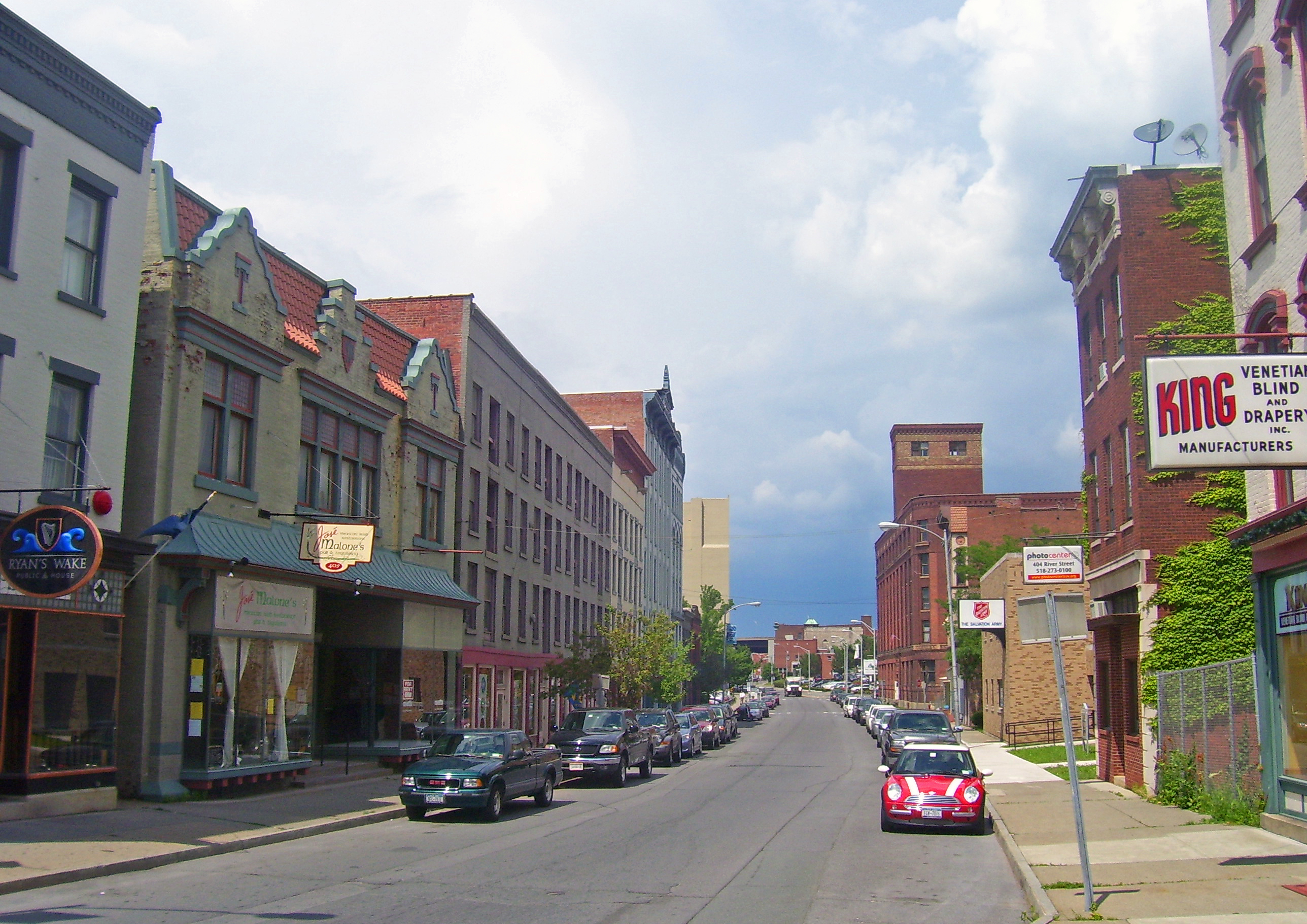
Northern River Street in Troy. Source: Wikimedia Commons.
This one (and the next entry as well) is cheating a bit, because it isn’t actually constructed, or indeed one single example of infrastructure. However, when completed it should shine as an example of overall city planning for alternative transportation. Troy, New York is home to over 50,000 people. 11.8% of workers in Troy do not own a car, and 12.1% walk to work.[xii] (Transport Troy 2014) These numbers are higher than the national age, but citizens were not content to rest with them. A volunteer citizen group, called Transport Troy, was commissioned to write a report complying with the Complete Streets Act of 2011. The report is currently under consideration by city officials and can be read in full online.
The question is, what is a complete street? As defined by Smart Growth America, a group that is on the frontlines of supporting them, complete streets are designed to give equal access to all users regardless of their transportation mode. To this end, the Troy report focuses heavily on increasing safety and access for pedestrians and cyclists. Walkability is listed as a desired outcome, with the proprietary rating system Walkscore used as the metric.
Walkscore ranks form 0 to 100 the feasibility of completing daily tasks by walking, such as going to parks, shopping, and getting to jobs. The report quotes a George Mason University researcher whose preliminary results show that Americans are willing to pay $850 more on a house for each additional Walkscore point.[xiii] (Market Urbanism 2013) Other quoted statistics put the return on investment in cycling and walking infrastructure at $11.80 for every $1 invested, and that significant investment in walkability can increase property values by up to 300 percent.[xiv] (Transport Troy 2014) With this kind of incentive, it’s no wonder Troy is rushing to upgrade its walking trails and sidewalks.
Most improvements in the plan for Troy focus on protecting pedestrians and reinforcing their right of way. As the report says, “pedestrians are the slowest common denominator.” By easing accessibility for walkers, the city also become more accessible for the disabled. On the bicycling end, Troy’s “interested but concerned” population makes up 60% of the total, with only 8% “enthused.”[xv] (Ibid.) Several connector routes running through the city are suggested to allow the city to open up to cyclists, and allow trips between popular destinations.
In addition to the physical requirements for improving the city’s access for those not using cars, the report also addresses the second important part of completing the streets: education. It is imperative that citizens are made aware of the new opportunities available in transportation, not just because they may want to use them but also so they know and respect that others will as well. When streets are shifted off of auto-centrism, it is crucial that drivers know they are sharing the road. The Troy plan has attracted praise from complete streets advocates – the aforementioned Smart Growth America ranked it #2 on its list of best policies in 2014.[xvi] (SGA 2014)
#6: Ogdensburg Waterfront, Ogdensburg, NY

Map of Ogdensburg waterfront. Source: Ogdensburg Waterfront website.
So, which city was ranked #1? In case you hadn’t already guessed from the title, that city was Ogdensburg, New York, a city of over 11,000 on the bank of the St. Lawrence River.[xvii] (Ibid.) Ogdensburg has also pledged to complete their streets, with a citizen Complete Streets Active Living Task Force established and goals set. The city has also moved to improve their brownfield waterfront properties, with four distinct districts recognized. Plans for these districts include a historic fort restoration, walking paths, biking trails, connections to the city’s other transportation, retail shops, senior living centers, and lots of park space, among other things. Ogdensburg has had a Local Waterfront Revitalization Plan since 1986, with an update in 1999 and another planned to be completed soon. It was the first city in New York State to have one. On the topic of complete streets, the city has fully committed to constructing them – as the award-winning ordinance states, “All City-owned transportation facilities in the public right-of-way including, but not limited to, streets, bridges and all other connecting pathways shall be designed, constructed, operated, and maintained so that users of all ages and abilities can travel safely and independently.”[xviii] (City of Ogdensburg 2015) This is clarified to also extend to privately-constructed streets as well. To keep track of the City’s progress in implementation, the ordinance uses miles of bike lanes, feet of sidewalks, curb ramps, and improved intersections. The “active living” in the task force’s name refers to the other benefit of encouraging cycling and walking, after reducing congestion and emissions – these activities are better for citizens’ health.[xix] (Kelley-Schwartz 2006) A study from GFK Research shows that Americans recognize the benefits of walking and wish to do it more – but feel that they lack the motivation to do so.[xx] (Kaiser Permanente 2013) If they could get to work or errands by walking, surely that could provide motivation? Overall, more and more cities are implementing complete street policies and cities like Ogdensburg and Troy can serve as models – just as long as they can actually fulfill their promises.
The Theory behind Complete Streets
One of the seminal works in detailing contemporary complete streets is Barbara McCann’s Completing Our Streets, completed in 2013. The book celebrates strides and successes from currently active complete streets policies while detailing the difficulties in the past and in the future. McCann lists some considerations in completing streets as engaging and educating the public both before and after the project is started and has ended, setting priorities for usage on the road (equal access is not always completely achievable), dealing with existing residents on the road in question, and deciding how much to change at once.[xxi] (McCann 2013) The input and participation of citizen groups can be a significant factor in implementation – support or dissent is crucial for getting things done. While transportation planners used to call their relationship with the public “design and defend,”[xxii] (McCann 2013, 110) and even may still find that at work when trying to pitch complete streets, they can now hope for and encourage a mutually beneficial relationship with those they are employed to serve.
McCann cites a nationwide poll that found 59 percent of Americans want transportation options other than driving, and 63 percent favor increasing access to mass transit and pedestrians to fight traffic congestion.[xxiii] (McCann 2013, 112) Eighty percent of Charlotte residents support complete street improvements. In addition to citizens, city administrators, planners, and engineers must all be on board. Only when all of a city’s groups are on the same page can complete streets truly flourish.
Why Care?
There are some theorized drawbacks to complete streets. The focus on using the streets as paths for those in transit takes away from the alternative usage of streets as public space.[xxiv] (Mehta 2013) This removal of public space can disproportionately harm economically disadvantaged citizens.[xxv] (Ehrenfeucht 2014) Can there be other benefits to complete streets to offset this?
The benefits of complete streets in terms of health, safety, environment, and access have already been discussed.[xxvi] (Frank 2006) But is there money in complete streets? Can the expense of implementation can be financially justified? McCann says yes.[xxvii] (McCann 2013) Safety can be monetized – the fewer pedestrian fatalities and injuries, the better. Citizens will walk if they have no choice – and those with no choice are often those on the worse end of economic trouble. By increasing access and safety for those people, all people live as equal citizens with as much ability to access the city as those with cars. What about the argument that cyclists, pedestrians, and transit users don’t pay gasoline taxes and thus don’t pay for roads as much as drivers? Well, setting aside the fact that gas taxes don’t come close to fully covering the cost of American roads, every citizens pays the sales and property taxes that fund local communities. The health benefits from walking and cycling cut down on healthcare costs relating to obesity. Finally, complete streets spur economic activity on the roads they are constructed on, bringing in many new customers and allowing employees to more easily reach work.
Conclusion and Alternatives
“Wait,” you say. “I picked up this article to look at cool infrastructure and ended up with a lecture on something that isn’t even fully implemented in most cities. If complete streets are so great, what was the point of the first four examples in this paper?” Well, all of the examples encouraged the idea of equal access for transportation modes. The Hovenring takes something that is usually reserved for cars and opens it up to bikes. The pedestrian roundabout does the same thing for pedestrians, and keeps them safe over city streets. The Furness Drive bike lanes is a step towards complete streets. And Target Field Station has access open to every mode conceivable. However, you have a point, reader. Complete streets are not everything. Access is they key concept to be taken away here. Cars and roads have been associated for so long that it can be hard to imagine other modes being given priority or creativity in their solutions. A shakeup in the paradigm of transportation thought is what is needed, and complete streets are only one facet of the revolution. The walker, the cyclist, the driver, and the transit rider – each is just a person who wants to move from Point A to Point B. How will they achieve that?
PHOTO CREDITS:
Hovenring at Night: https://c2.staticflickr.com/4/3871/14324945260_c18bebc988_b.jpg
Hovenring from Below: http://upload.wikimedia.org/wikipedia/commons/e/e9/Hovenring_Eindhoven.jpg
Pedestrian Roundabout: https://upload.wikimedia.org/wikipedia/commons/b/b8/View2FromPearlTower.jpg
Furness Drive: http://b.3cdn.net/bikes/4506d58698910e95da_97m6ivzpe.png
Target Field Station: https://c2.staticflickr.com/4/3926/14962749500_5e7bdeba6d_b.jpg
Troy: https://upload.wikimedia.org/wikipedia/commons/4/42/Northern_River_Street,_Troy,_NY.jpg
Ogdensburg Waterfront: http://www.ogdensburgwaterfront.com/wp-content/uploads/2012/09/OgdensburgDistrictWebRoads.jpg
[i] McCann, Barbara. Completing Our Streets: The Transition to Safe and Inclusive Transportation Networks. Washington, District of Columbia: Island Press, 2013, Chapter 1.
[ii] “Why Is Cycling so Popular in the Netherlands? – BBC News.” BBC News. August 7, 2013. Accessed November 8, 2015. http://www.bbc.com/news/magazine-23587916.
[iii] “Cycling in the Netherlands” (Press release). The Netherlands: Ministry of Transport, Public Works and Water Management. Fietsberaad (Expertise Centre for Cycling Policy). 2009. Accessed November 8, 2015.
[iv] O’Sullivan, Feargus. “Amsterdam Has Officially Run Out of Spaces to Park Its Bicycles.” Citylab. February 24, 2015. Accessed November 8, 2015. http://www.citylab.com/commute/2015/02/amsterdam-has-officially-run-out-of-spaces-to-park-its-bicycles/385867/.
[v] “Design.” Hovenring. October 12, 2012. Accessed November 8, 2015. http://hovenring.com/design-2/.
[vi] Andersen, Michael. “In Austin, Posts and Paint Bring a New Bike Bridge From Good to Great.” Streetsblog USA. August 29, 2014. Accessed November 8, 2015. http://usa.streetsblog.org/2014/08/29/in-austin-posts-and-paint-bring-a-new-bike-bridge-from-good-to-great/.
[vii] “City of Austin 2014 Bike Plan Update.” March 21, 2014. Accessed November 8, 2015. http://b.3cdn.net/bikes/5844b4fc9967a883c5_326m66kq1.pdf.
[viii] Ibid.
[ix] “Target Field Station.” Hennepin County, Minnesota. Accessed November 8, 2015. http://www.hennepin.us/targetfieldstation.
[x] Ibid.
[xi] “Target Field Station Wins Award; Architectural Group Praised Its Urban, People-Friendly Design.” Star Tribune, January 11, 2015. Accessed November 8, 2015. http://www.highbeam.com/doc/1G1-397089526.html?
[xii] “Sustainable Transportation for Troy, New York: Accessible, Safe, Healthy, Complete Streets.” April 24, 2014. Accessed November 8, 2015. https://dl.dropboxusercontent.com/u/192930/TroyNY Complete Streets 2014.pdf.
[xiii] “The Value of Walkability.” Market Urbanism. October 17, 2013. Accessed November 8, 2015. http://marketurbanism.com/2013/10/17/the-value-of-walkability/.
[xiv] Transport Troy.
[xv] Ibid.
[xvi] “The Best Complete Streets Policies of 2014.” Smart Growth America. Accessed November 8, 2015. http://www.smartgrowthamerica.org/complete-streets-2014-analysis.
[xvii] Ibid.
[xviii] “ORDINANCE AMENDING CHAPTER 189 ENTITLED “STREETS AND SIDEWALKS” OF THE CITY OF OGDENSBURG MUNICIPAL CODE.” February 13, 2014. Accessed November 8, 2015. http://www.smartgrowthamerica.org/documents/cs/policy/cs-ny-ogdensburg-ordinance.pdf.
[xix] Alexia Kelley-Schwartz, Schlossberg Marc, and Stockard Jean. “Active Community Environments and Health.” American Planning Association. Journal of the American Planning Association 72, no. 1 (2006): 19-31. Accessed November 8, 2015. Proquest.
[xx] “Americans View Walking as Good for Health But Many Aren’t Walking Enough to Realize Health Benefits: Survey.” Kaiser Permanente. October 2, 2013. Accessed November 8, 2015. http://share.kaiserpermanente.org/article/americans-view-walking-as-good-for-health-but-many-arent-walking-enough-to-realize-health-benefits-survey/.
[xxi] McCann.
[xxii] Ibid, 110.
[xxiii] Ibid, 112.
[xxiv] Mehta, Vikas. “The Street as Ecology.” In The Street: A Quintessential Social Public Space. London: Routledge, 2013.
[xxv] “The Irreconcilable Tension between Dwelling in Public and the Regulatory State.” In The Informal American City: Beyond Taco Trucks and Day Labor, edited by Vinit Mukhija, by Renia Ehrenfeucht and Anastasia Loukaitou-Sideris. MIT Press, 2014.
[xxvi] Frank, Lawrence D., James F. Sallis, Terry L. Conway, James E. Chapman, Brian E. Saelens, and William Bachman. “Many Pathways from Land Use to Health: Associations between Neighborhood Walkability and Active Transportation, Body Mass Index, and Air Quality.” Journal of the American Planning Association, 2006, 75-87. doi:10.1080/01944360608976725.
[xxvii] McCann, Chapter 7.