
Contributed by NOAA Northeast Regional Climate Center, Cornell University
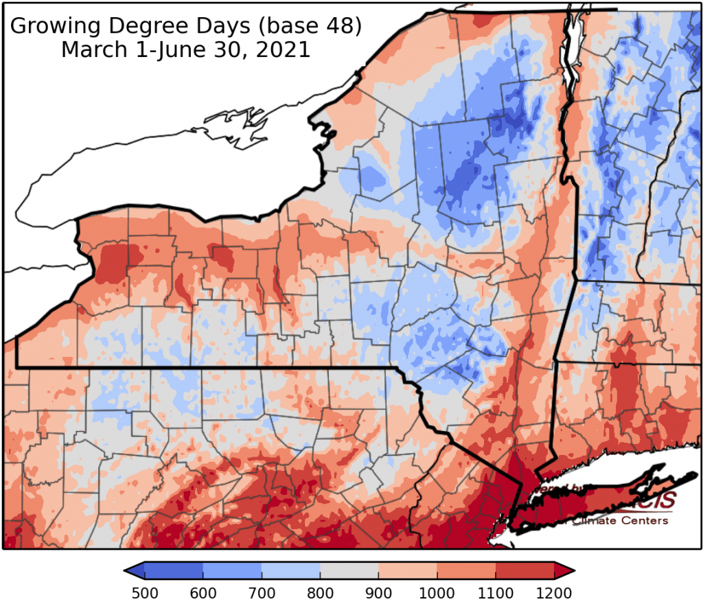
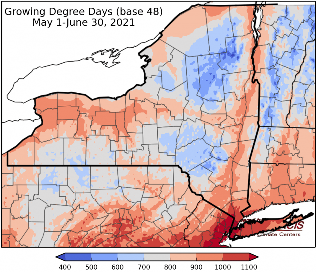
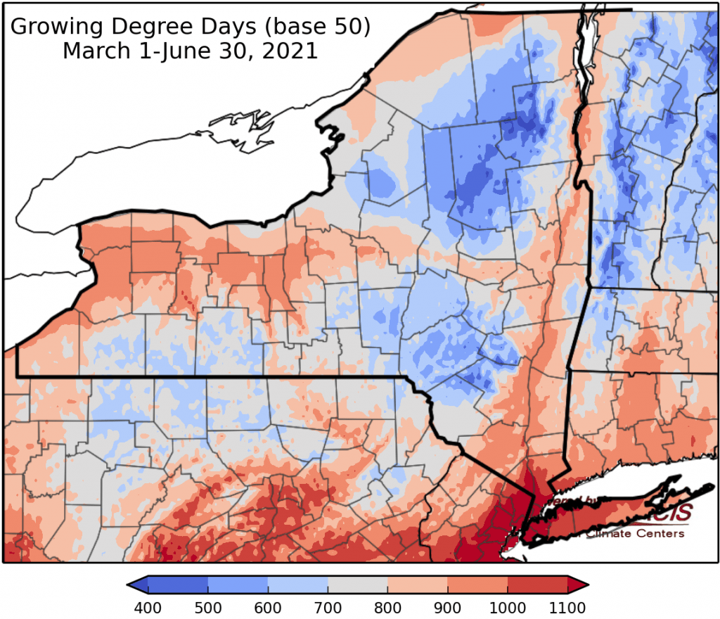
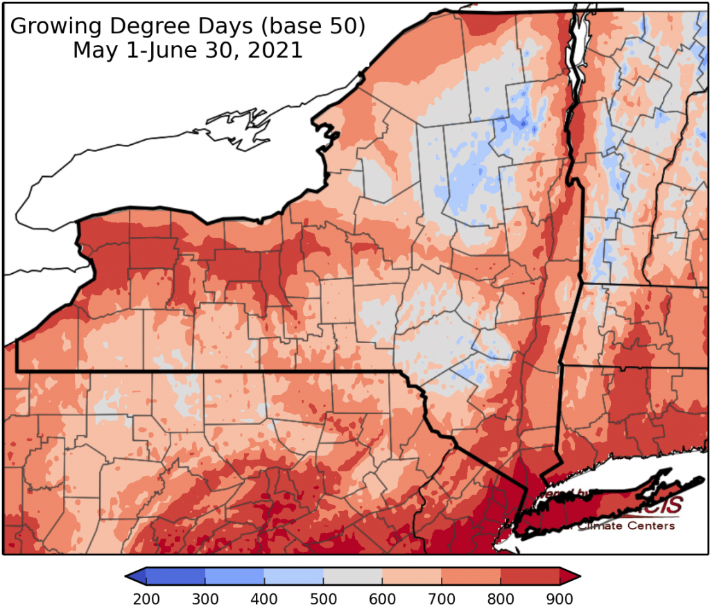
Last week temperatures were 2 to 8 degrees above normal. Precipitation has ranged from less than a quarter of an inch to 2 inches. Base 50 growing degree-days ranged from 90 to over 150.
Today will be cloudy & unsettled with temperatures in the 70s, much cooler than the first half of the week. Morning thunderstorms are occurring in western NY. Afternoon thunderstorms will occur, and central NY could see isolated flash flooding of urban and low-lying areas. Overnight lows will be in the mid 50s to low 60s.
Friday temperatures will be in the 70s again with widespread rain beginning in western NY in the morning and moving east across the state. Overnight temperatures will be in the 50s and low 60s.
Saturday temperatures will be in the 60s to mid 70s with scattered showers. Overnight temperatures will be in the mid 50s to low 60s.
Sunday temperatures will warm into the 70s and low 80s; showers and thunderstorms are possible. Overnight temperatures will be in the mid 50s to low 60s.
Monday temperatures will in the 80s and low 90s with more humidity; afternoon showers are possible. Overnight temperatures will be in the 60s.
Tuesday highs will be in the 80s and low 90s with humid conditions. A cold front is expected to pass late in the day, bringing showers and thunderstorms. Overnight temperatures will be in the 60s.
Wednesday highs will be in the 80s with afternoon showers and thunderstorms. Overnight temperatures will be in the 60s.
The seven-day precipitation amounts will range from half an inch to one and three quarters of an inch.
The 8-14 day outlook (July 8-14) favors above-normal temperatures with high probability. The outlook slightly favors above-normal precipitation for western, central, and southeast NY; northern parts of the state are favored for near-normal precipitation.
Maps of 8-14 day outlooks:
http://www.cpc.ncep.noaa.gov/products/predictions/814day/index.php
National Weather Service watch/warnings map:
http://www.weather.gov/erh/
US Drought Monitor
http://droughtmonitor.unl.edu/
CLIMOD2 (NRCC data interface):
http://climod2.nrcc.cornell.edu
