
Contributed by NOAA Northeast Regional Climate Center, Cornell University
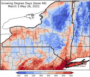
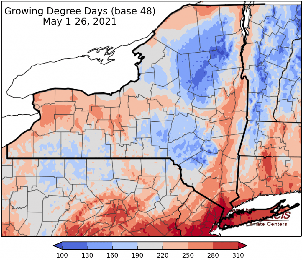
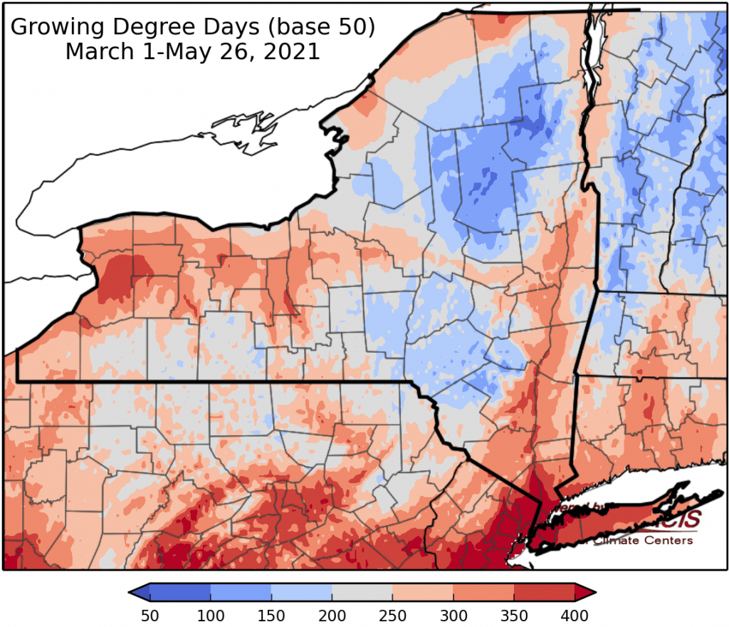
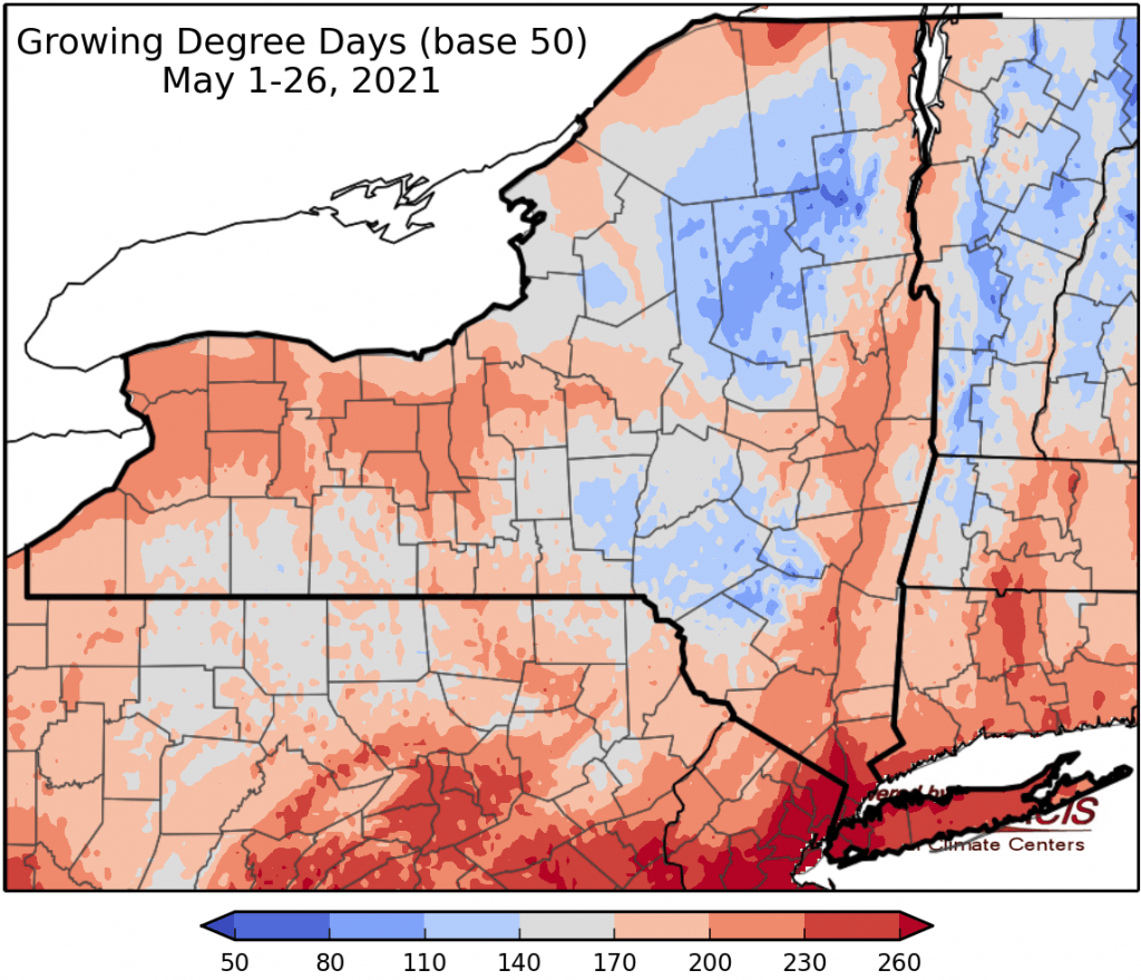
Last week temperatures ranged from 6 to 12 degrees above normal. Precipitation has ranged from a hundredth of an inch to half an inch. Base 50 growing degree-days ranged from 60 to 160.
Today will be cooler with temperatures in the 60s to near 70. Overnight lows will be in the low 40s to near 50 with a few overnight showers, northern areas will dip to near freezing with frost advisories for tonight till 8am Friday.
Friday will be rainy and chilly; temperatures will be in the mid 40s to upper 50s with widespread afternoon showers excluding northern NY who may see little rain. Overnight temperatures will be in the 40s with some lingering rain.
Saturday be partly sunny with temperatures in the mid 50s to mid 60s. Overnight temperatures will be in the low to mid 40s.
Sunday highs will be in the 60s with isolated showers. Overnight temperatures will be in the 40s.
Monday temperatures will in the 60s to mid 70 with a mix of sunshine and scattered showers. Overnight temperatures will be in the mid 40s to mid 50s.
Tuesday highs will be in the 70s. Overnight temperatures will be in the upper 40s to mid 50s.
Wednesday highs will be in the 70s to near 80. Overnight temperatures will be in the 50s.
The seven-day precipitation amounts will range from a hundredth of an inch in northern NY to two inches in southeast NY.
The 8-14 day outlook (June 3-5) favors above-normal temperatures (with high probability) and slightly favors below-normal precipitation.
Maps of 8-14 day outlooks:
http://www.cpc.ncep.noaa.gov/products/predictions/814day/index.php
National Weather Service watch/warnings map:
http://www.weather.gov/erh/
US Drought Monitor
http://droughtmonitor.unl.edu/
CLIMOD2 (NRCC data interface):
http://climod2.nrcc.cornell.edu
