
Contributed by NOAA Northeast Regional Climate Center, Cornell University
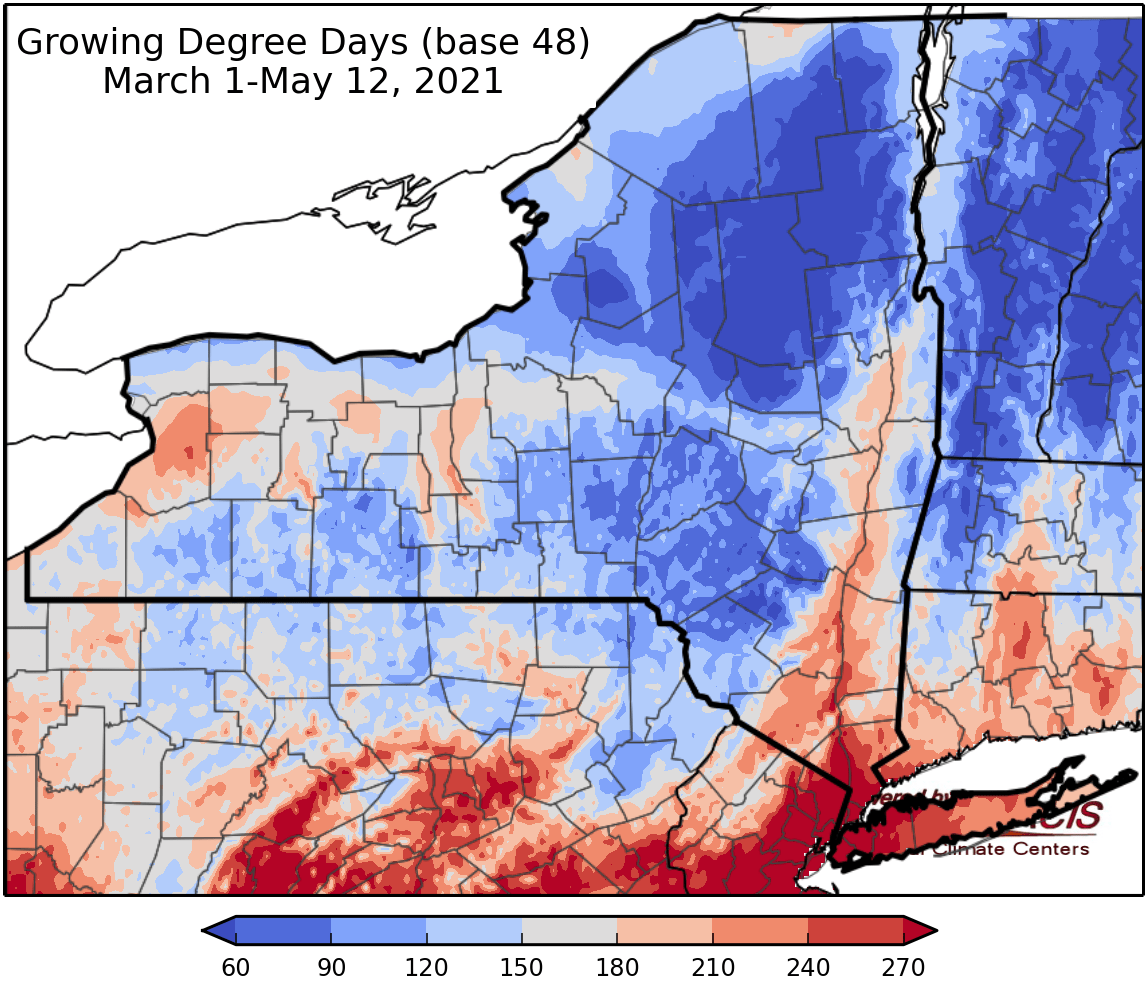
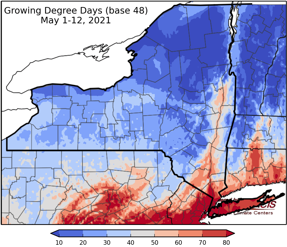
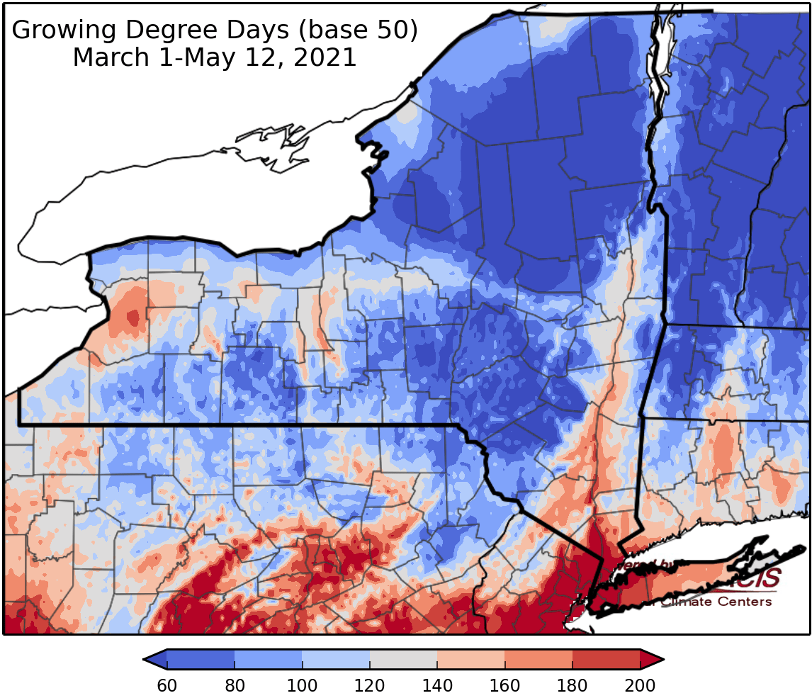
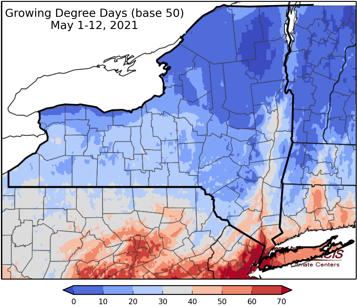
Last week temperatures ranged from 4 to 12 degrees below normal. Precipitation has ranged from a hundredth of an inch to over 2 inches. Base 50 growing degree-days ranged from 0 to 20.
Today will be mostly sunny with some scattered clouds isolated showers possible. Temperatures will be in the 60s. Overnight lows will be in the 30s to low 40s with patchy frost possible.
Friday temperatures will be in the mid 60s to mid 70s with light afternoon showers possible. Overnight temperatures will be in the mid 30s to mid 40s.
Saturday temperatures will be in the 60s to mid 70s with afternoon showers possible, slight chance for a thunderstorm. Overnight temperatures will be in the 40s.
Sunday highs will be in the 60s to mid 70s with isolated showers possible, slight chance for a thunderstorm. Overnight temperatures will be in the 40s.
Monday temperatures will be in the mid 60s to mid 70s with scattered showers. Overnight temperatures will be in 40s to low 50s.
Tuesday highs will be in the 60s to mid 70s with scattered showers. Overnight temperatures will be in the mid 40s to mid 50s.
Wednesday highs will be in the 60s to mid 70s. Overnight temperatures will be in the 50s.
The seven-day precipitation amounts will range from a hundredth of an inch to near half an inch.
The 8-14 day outlook (May 20-26) favors above-normal temperatures and favors below-normal precipitation.
Maps of 8-14 day outlooks:
http://www.cpc.ncep.noaa.gov/products/predictions/814day/index.php
National Weather Service watch/warnings map:
http://www.weather.gov/erh/
US Drought Monitor
http://droughtmonitor.unl.edu/
CLIMOD2 (NRCC data interface):
http://climod2.nrcc.cornell.edu
