
Contributed by NOAA Northeast Regional Climate Center, Cornell University
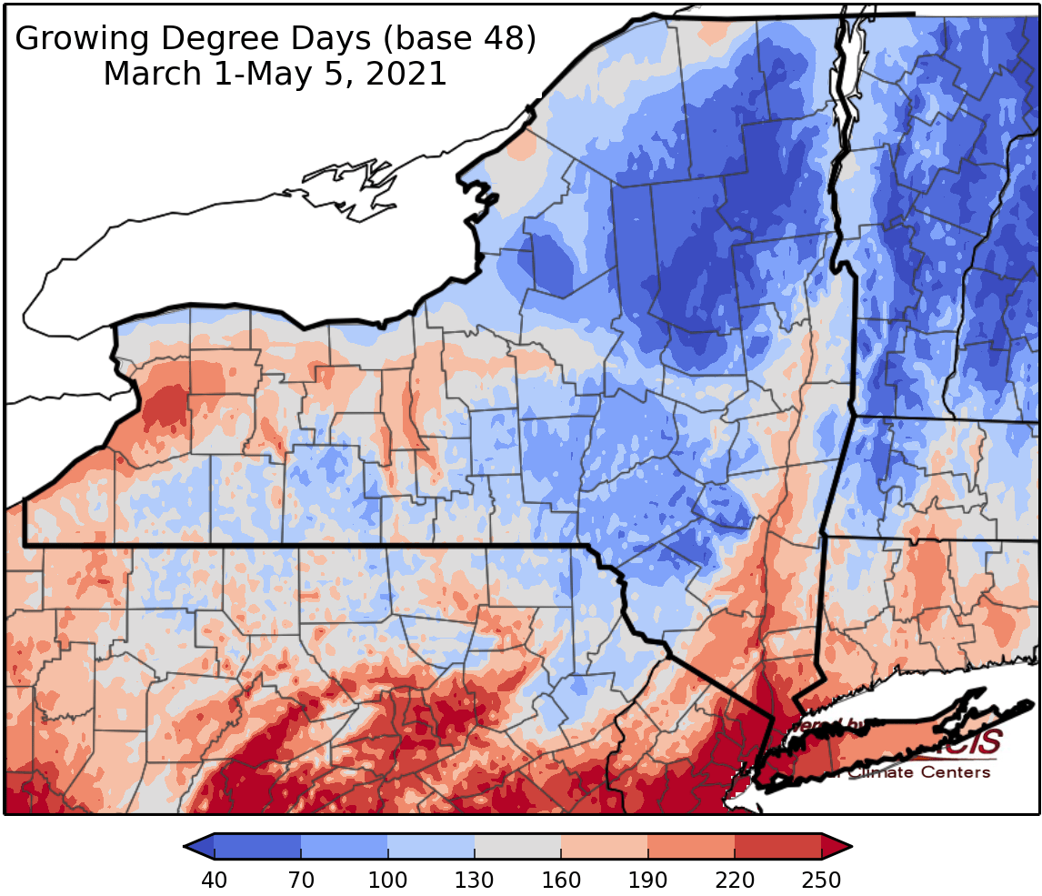
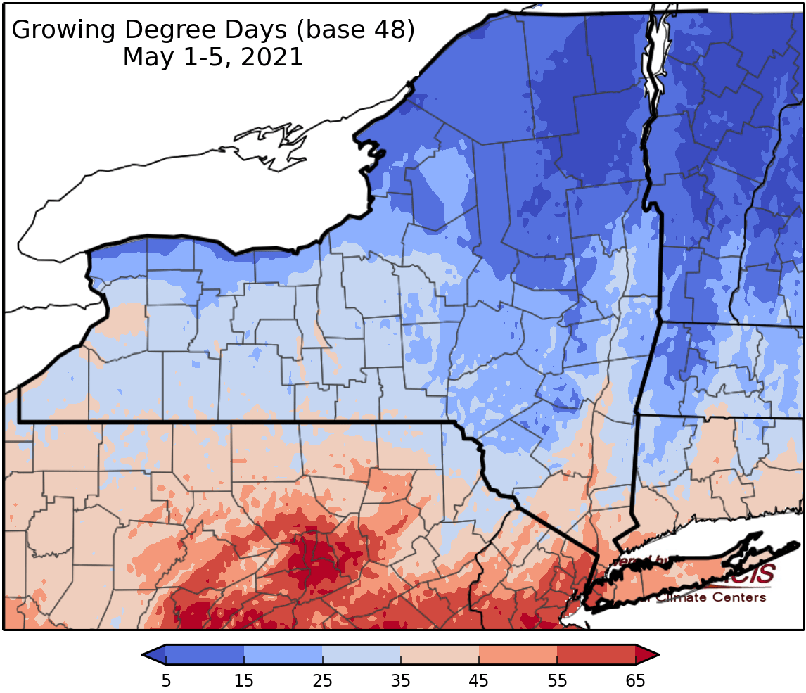
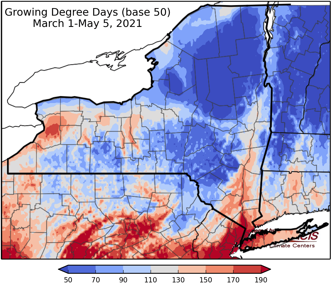
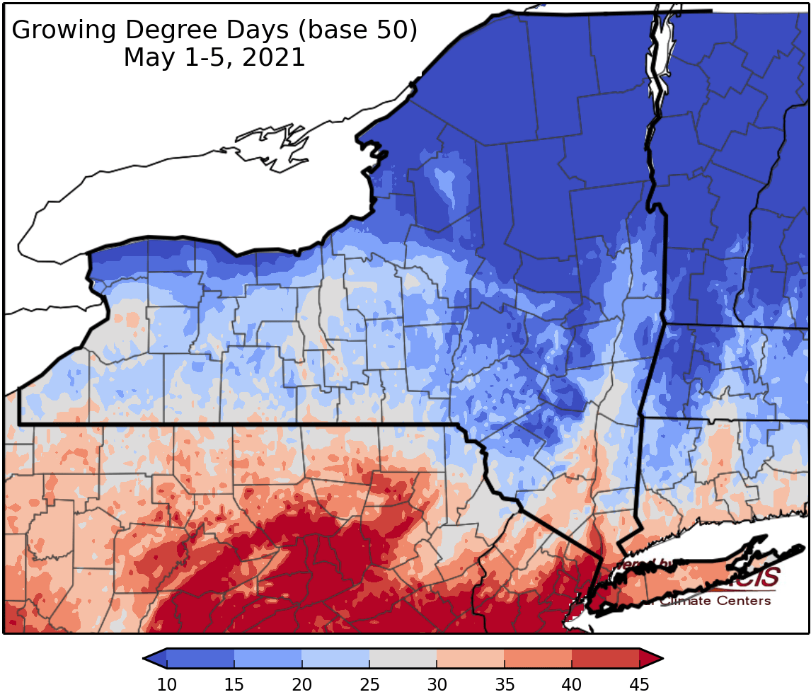
Last week temperatures ranged from 4 degrees below normal to 6 degrees above normal. Precipitation has ranged from a half an inch to 4 inches. Base 50 growing degree-days were less than 10 to 70.
Today temperatures will be in the 50s to low 60s with sunshine. Overnight lows will be in the 30s to near 40; rain showers will move into western NY late tonight. Frost advisories for early Friday morning.
Friday temperatures will be in the 40s to low 60s with rain slowly spreading from western NY eastward. Overnight temperatures will be in the 30s with some wet snow possible.
Saturday temperatures will be in the mid 40s to 50s with rain tapering off throughout the day; western areas will dry earlier. Overnight temperatures will be in the 30s with risk for frost.
Sunday highs will be in the 50s to low 60s with dry conditions. Overnight temperatures will be in the 30s to low 40s with rain spreading into the area.
Monday temperatures will be in the 40s and 50s with rain showers for some areas. Overnight temperatures will be in 30s.
Tuesday highs will be in the 50s to low 60swith a slight chance of rain. Overnight temperatures will be in the 30s.
Wednesday highs will be in the 50s to low 60s with dry and sunny conditions. Overnight temperatures will be in the.
The seven-day precipitation amounts will range from 0.10” to 1.25”.
The 8-14 day outlook (May 13-19) favors below-normal temperatures and slightly favors above-normal precipitation.
Maps of 8-14 day outlooks:
http://www.cpc.ncep.noaa.gov/products/predictions/814day/index.php
National Weather Service watch/warnings map:
http://www.weather.gov/erh/
US Drought Monitor
http://droughtmonitor.unl.edu/
CLIMOD2 (NRCC data interface):
http://climod2.nrcc.cornell.edu
