
NOAA Northeast Regional Climate Center, Cornell University
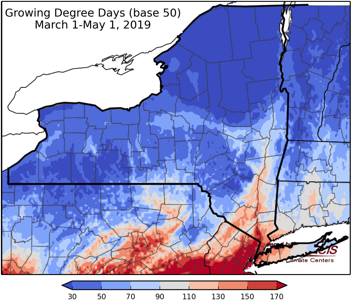
Last week temperatures 2-8 degrees below normal. Precipitation has ranged from ¼” – 2”. Base 50 growing degree-days ranged from were under 20.


An unsettled week ahead with mild temperatures but many days with rain possible. a cold front brings rain and isolated thunderstorms on Friday.
Friday will be in the mid 50s to 60s with, a cold front will bring rain and isolated thunderstorms, heavy rain is possible in some areas. Overnight temperatures will be in the low 40s to low 50s.
Saturday temperatures will be in the 60s to near 70 with rain moving in later in the day. Overnight temperatures will be in the 40s.
Sunday highs will be in the 50s and lower 60s with rain possible in southern areas. Overnight temperatures will be in the 40s.
Monday temperatures will be in the 60s with rain possible as another system moves through. Overnight temperatures will be in the 40s.
Tuesday highs will be in the 60s with rain possible from a cold front. Overnight temperatures will be in the 40s.
Wednesday highs will be in the upper 50s and lower 60s with rain possible. Overnight temperatures will be in the 50s and 50s.
The seven-day precipitation amounts will range from ¾” to 1.50”.
The 8-14 day outlook (May 9-15) favors below-normal temperatures and above-normal precipitation for the state.
Maps of 8-14 day outlooks:
http://www.cpc.ncep.noaa.gov/products/predictions/814day/index.php
National Weather Service watch/warnings map:
http://www.weather.gov/erh/
US Drought Monitor
http://droughtmonitor.unl.edu/Home.aspx
Drought Impact Reporter:
http://droughtreporter.unl.edu/map
