Living with Leopards: Implications of human-leopard interaction on food security and public health in the foothills of the Himalayas
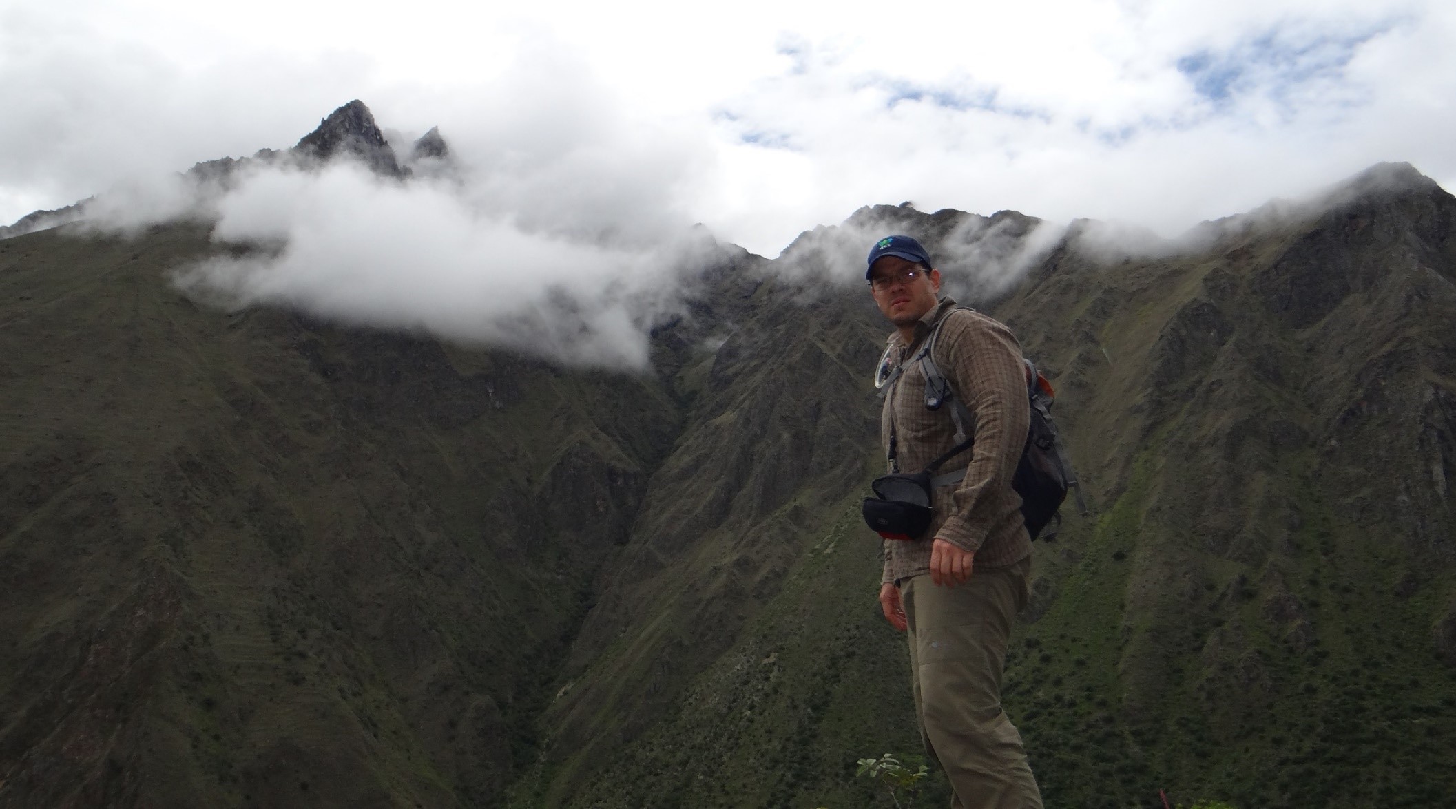
 In Nepal, human-leopard conflict threatens food security of local communities as a result of livestock loss and causes injuries and death to both humans and leopards. We aim to understand key drivers and impacts of human-leopard interactions across a rural-urban gradient and to generate well-informed policy-led interventions for sustainable conservation actions. We will conduct an analysis of leopard diet to better understand the extent to which leopards prey on livestock and feral species and we will develop a spatial conflict risk model that will help to manage or mitigate human-leopard interactions. In partnership with two national conservation champions, we seek to secure national policy commitment by developing a National Policy document to enable site-specific sustainable conflict management responses, and promote local stewardship for the survival of leopards in shared landscapes without compromising human well-being.
Collaborators: Dr. Martin Gilbert, College of Veterinary Medicine, Cornell University and Dr. Richard Stedman, Department of Natural Resources, Cornell University; Shashank Poudel, Cornell University
Conservation and management of Andean bears from regional to local scales: occupancy, density, connectivity, and threats
 The Andean bear is the only extant species of bear in South America and is considered threatened across its range due to habitat loss, fragmentation, and illegal hunting. Typically, Andean bear inhabit natural areas with little to no human presence/activity, occurring between 200-4700 m elevation. Nevertheless, in Colombia non-protected areas have historically had a high level of human presence/activity. Consequently, Andean bear populations are isolated, and exposed to a diverse degree of human related threats, including human-bear conflict in the form of retaliatory hunting. Monitoring changes in the Andean bear population, and understanding their relationship with threats and environmental variables is necessary for informing management decisions.

The objectives of this study are to 1) evaluate the relationship between real/perceived damage caused by Andean bears, farmers’ attitudes about bears, and bear killing; 2) Evaluate landscape factors and species threats that contribute to regional occupancy of Andean bears. 3) Estimate density and connectivity of Andean bears in priority conservation areas, and evaluate the relationship between density and occupancy.
Spatial Risk Mapping: A Tool to Plan and Implement Human- Andean Bear Conflict Mitigation in Ecuador
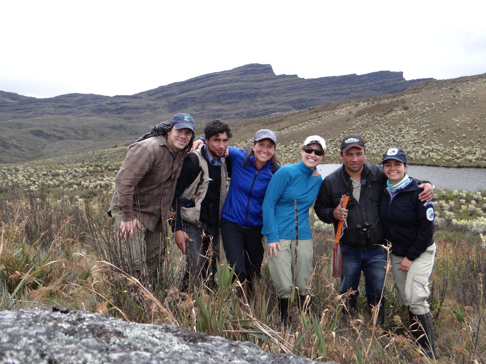
 The Chocó-Andean region of Ecuador lies at the convergence of two of the world’s top 25 biodiversity hotspots and is home to more endemic species than any other hotspot on Earth. Unfortunately, half of this region has been deforested and the expansion of agriculture, development, and recently granted mining concessions threatens remaining forest. Social-ecological systems are linked systems of people and nature, emphasizing that humans must be seen as a part of, not apart from, nature. We will use a socio-ecological system approach and generate alternative strategies to guide the design of public policies that can help communities to cope with the effects of environmental changes. Specific objectives include, 1) Assess the level of knowledge and perception of local communities about the state of their natural resources and the benefits that they obtain from them, 2) Identify strategies and preferences that local communities use for their subsistence (land uses: livestock, agriculture, ecotourism, recreation, ecotourism, conservation) 3) Assess the social capacity of communities to engage in conservation activities, 4) Understand the motivations that influence land use and development decisions, 5) Engage community members in the co-development of a tool to allow growing productive and sustainable agricultural crops in landscapes inhabited by Andean bears, and 6) Develop a spatial risk/benefit map that identifies areas with a high potential for agricultural crop damage by Andean bears. This will serve as a decision-making tool to preemptively avoid conflict with Andean bears and to identify areas for management interventions (e.g., sustainable crop management practices).
Collaborators: Dr. Richard Stedman, Department of Natural Resources, Cornell University; CONDESAN; Foundation Cambugan; Santiago Garcia, Cornell University
Carnivore Occupancy and Intraguild Interactions Across New York State
 The distribution and abundance of carnivore species can have significant impacts on ecological communities through top-down and cascading trophic effects. Several carnivore species occur in New York, and in addition to their ecological importance, they have economic and recreational value to humans as fur-bearing species. Understanding the factors that influence their spatial distribution can help managers ensure the maintenance of sustainable populations. These factors can include environmental variables that determine the suitability of habitat for a particular species or their main prey, as well as the potential for negative interspecific interactions arising from competition and intraguild predation in areas where they occur in sympatry. Occupancy models are a useful tool to determine the occurrence of species as a function of environmental covariates across the landscape, while accounting for imperfect detection. In addition, more recently developed multispecies occupancy models can elucidate the effects of interspecific interactions on species occupancy. From 2013-2015, we collaborated with the New York State Department of Environmental Conservation (NYSDEC) to conduct a non-invasive survey across western portions of New York. Results from the fisher survey resulted in the opening of conservative trapping seasons (6 days) in new wildlife management units (WMU) previously closed to trapping, based on a minimum threshold predicted occupancy level of 0.41. We are using the same fisher detection data, along with additional data on bobcats, coyotes, and red foxes in multispecies occupancy models to explore hypotheses regarding interspecific interactions and environmental correlates in determining species occupancy. These studies demonstrate the efficiency and value of large-scale camera-trapping surveys, which can detect multiple species at once. Both single-species and multispecies occupancy models can provide managers with useful information that can be used to guide decisions on harvest, conservation of habitat, and population management.
Collaborators: New York State Department of Environmental Conservation
Occupancy of dhole in Parsa and Chitwan National Park, Nepal
 The dhole (Cuon alpinus), or Asiatic wild dog, is endangered across its range in Nepal. Dholes are one of the top predators of South Asian tropical forests, yet they are the least studied carnivore species in the world and they receive very little attention in conservation. We aim to understand factors (i.e., landcover, anthropogenic features, prey availability) that influence the occurrence of dholes at the landscape scale. This understanding is important to identify sites for targeted conservation efforts of this endangered species.
Moose Health and Parasitic Threats
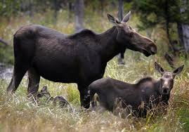 Populations at their range margins are increasingly susceptible to environmental and stochastic change. Moose (Alces alces) in the northern United States are at the southern limit of their range and have experienced population extirpations and fluctuations from a combination of factors including warming climate, predation, declining habitat quality and quantity, competition with conspecifics, and the deleterious effects of parasites. Populations in the northeast have experienced repeated declines from winter tick (Dermacentor albipictus) epizootics, meningeal worm (Parelaphostrongylus tenuis), and giant liver fluke (Fascioloides magna), and warming climate is predicted to increase the range and fitness of these parasites. Moose were extirpated from New York by the 1860s due to habitat alteration and unregulated harvest, but have since recolonized northern areas of the state and slowly increased in numbers. Despite this increase, the population has failed to grow as quickly as predicted considering amounts of suitable habitat, and the mechanisms behind this limited growth are unknown.
We will examine the effects of multiple parasites on moose individual and population health and assess factors limiting moose population growth within the Adirondack Park. Objectives of this project include 1) quantifying juvenile moose survival in the Adirondacks, identifying sources of mortality, and determining the influence of juvenile survival on population growth, 2) understanding parasite prevalence in moose and intermediate hosts, 3) investigating community dynamics of moose, deer, and their parasites, and 4) developing a risk map of parasitic threats to moose in New York. This information will directly contribute to the management and conservation of moose in New York and the region.
Collaborators: New York State Department of Environmental Conservation; Dr. Krysten Schuler, Cornell Department of Population Medicine and Diagnostic Sciences, Cornell University; Dr. Jacqueline Frair, Department of Environmental and Forest Biology, SUNY College of Environmental Science and Forestry; Jen Grauer, Cornell University
Bobcat Density Estimation
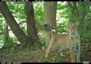 In 1977, the bobcat (Lynx rufus) was listed in Appendix II of CITES due to its similar appearance to the endangered Iberian lynx (Lynx pardinus), and thus its trade is currently managed by the federal government. This listing also granted the New York State Department of Environmental Conservation (NYSDEC) the authority to implement bobcat harvest seasons to control where and when harvest is allowed in New York. To manage bobcats for all stakeholders, NYSDEC must have a robust estimate of bobcat abundance in the state. Traditionally, these estimates have been based off harvest indices, which can susceptible to bias. Spatially explicit models based on resighting individual bobcats offers a more robust alternative to harvest indices.
Unlike bobcats in other parts of their range, bobcats in New York are not as easily individually identifiable through camera trapping alone. Therefore, we will estimate the density of bobcats across New York State using a Spatial-Mark-Resight (SMR) study design. To do this, we will collect occasion histories by deploying identifying ear tags on a subset of bobcats in the state and conducting multiple seasons of camera trapping. We will also deploy GPS collars on a subset of bobcats to collect movement behavior information for input in our SMR model. This information will yield robust estimates of bobcat density which will directly contribute to the management and conservation of bobcats in New York State.
Collaborators: New York State Department of Environmental Conservation; Haley Turner, Josh Twining, Cornell University