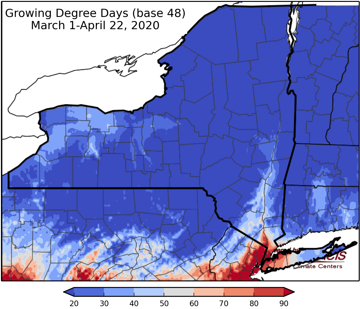
Contributed by NOAA Northeast Regional Climate Center, Cornell University
Last week temperatures ranged from 6 to 12 degrees below normal. Precipitation has ranged from a hundredth of an inch to one inch. Base 50 growing degree-days ranged from 0-6.
Today temperatures will be in the upper 30s to low 50s with showers likely for western and central NY early in the day and only light precipitation expected in eastern and northern areas. There should be a dry period later in the day before another round of precipitation tonight. Overnight lows will be in the 30s.
Friday temperatures will range from 30s to low 50s with light showers for southern parts of the state, depending on the track of the system. High elevation areas could see a wintry mix and/or freezing rain. Overnight temperatures will be in the 30s with clearing conditions.
Saturday temperatures will be in the 50s and low 60s (the warmest day of the week) with a mostly dry and partly sunny day. Overnight temperatures will be in the upper 20s to mid 30s with periods of rain through Sunday.
Sunday highs will be in the 40s with rain continuing. Rain may change to snow in some areas, with accumulating snow possible. Overnight temperatures will be in the 30s.
Monday temperatures will be in the 40s with additional rain/snow showers possible in the morning but conditions should clear to bring dry weather later in the day. Overnight temperatures will be in the 30s.
Tuesday highs will be in the 50s with dry conditions for most of the day; afternoon showers are possible. Overnight temperatures will be in the upper 20s to mid 30s.
Wednesday highs will be in the 50s and low 60s with unsettled conditions. Overnight temperatures will be in the 30s.
The seven-day precipitation amounts will range from half an inch to near three inches, with increasing amounts from north to south.
The 8-14 day outlook (April 30-May6) favors below-normal temperatures with high probability. Above-normal precipitation is slightly favored for most areas.
Maps of 8-14 day outlooks:
http://www.cpc.ncep.noaa.gov/products/predictions/814day/index.php
National Weather Service watch/warnings map:
http://www.weather.gov/erh/
US Drought Monitor
http://droughtmonitor.unl.edu/Home.aspx
CLIMOD2 (NRCC data interface):
http://climodtest.nrcc.cornell.edu


