From Jessica Spaccio, NOAA Northeast Regional Climate Center, Cornell University
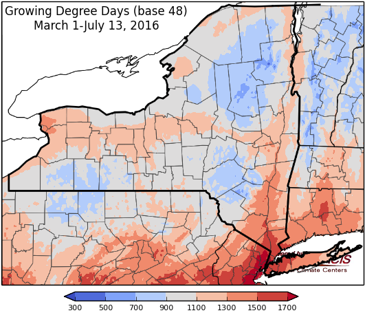
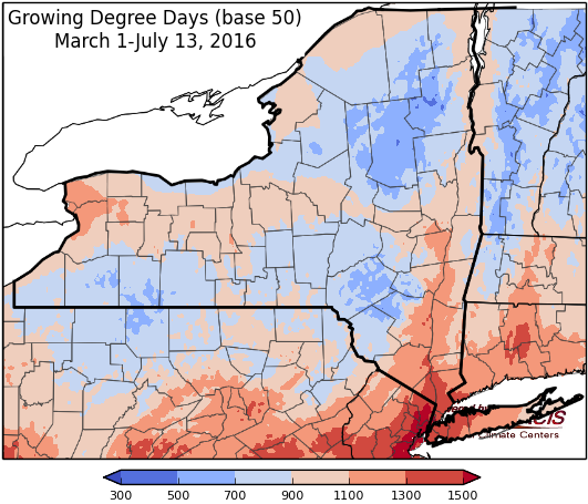
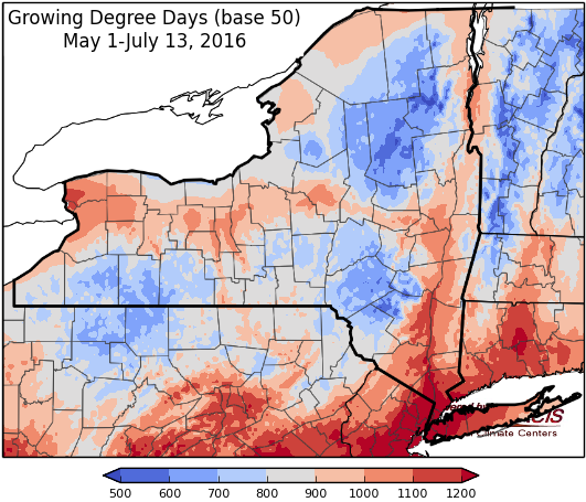
Last week temperatures ranged from normal to 6 degrees above normal, with the warmest temperatures south of Lake Ontario. Precipitation ranged from a tenth to 2 inches for most areas with isolated areas getting 2 to over 4 inches. Western NY continues to receive the least rain. Base 50 growing degree-days ranged from 90 to 190.
Hot & humid, sever weather possible Thursday, nice for the weekend…
Friday there will be a possibility of scattered showers and thunderstorms, with highs in the 80’s and some low 90’s and decreasing humidity. Lows will be in 50’s to low 60’s.
Saturday temperatures will be in the 70’s to low 80’s with mostly dry conditions, but isolated showers and thunderstorms are possible. Overnight temperatures will be in the 50’s to low 60’s.
Sunday will be dry with highs in the 80’s. Overnight temperatures will be in the mid 50’s to low 60’s.
Monday temperatures will be in the 80’s and a few 90’s with a chance of showers. Lows will be in the mid 50’s to low 60’s.
Tuesday temperatures will be in the mid 70’s to mid 80’s with a chance of showers. Lows will be in the upper 50’s and 60’s
Wednesday temperatures will be in the upper 70’s to 80’s with rain possible. Lows will be in the upper 50’s and 60’s.
The five-day precipitation amounts will range from ¼” to 2” , ranging from the lowest amounts in southeast NY and the highest amounts east of Lake Ontario.
The 8-14 day outlook (July 21-27) shows an increased chance (50-60%) for above normal temperatures. The NWS has issued an hazards outlook for the western part of the state for July 21-23 for a slight risk (20%) of much above normal temperatures. http://www.cpc.ncep.noaa.gov/products/predictions/threats/probhazards_d8_14_contours.png
Most of the state has equal chances for above or below normal precipitation. Southeast NY has an increased chance(33-40%) for below normal precipitation.
The Drought Monitor: Two new D2 areas (Severe Drought) were added in western New York and the Finger Lakes Region where the lowest indices and largest departures were found (90-day deficits of 4-6 inches). USGS 7-day average stream flows reached record low values on July 12 in western New York. In areas with locally heavy rain, some slight improvement was made (east-central New York, extreme northern parts of New York).
Maps of 8-14 day outlooks:
http://www.cpc.ncep.noaa.gov/products/predictions/814day/index.php
National Weather Service watch/warnings map:
http://www.weather.gov/erh/
US Drought Monitor:
http://droughtmonitor.unl.edu/Home.aspx
CLIMOD2 (NRCC data interface):
http://climodtest.nrcc.cornell.edu


