
Contributed by NOAA Northeast Regional Climate Center, Cornell University
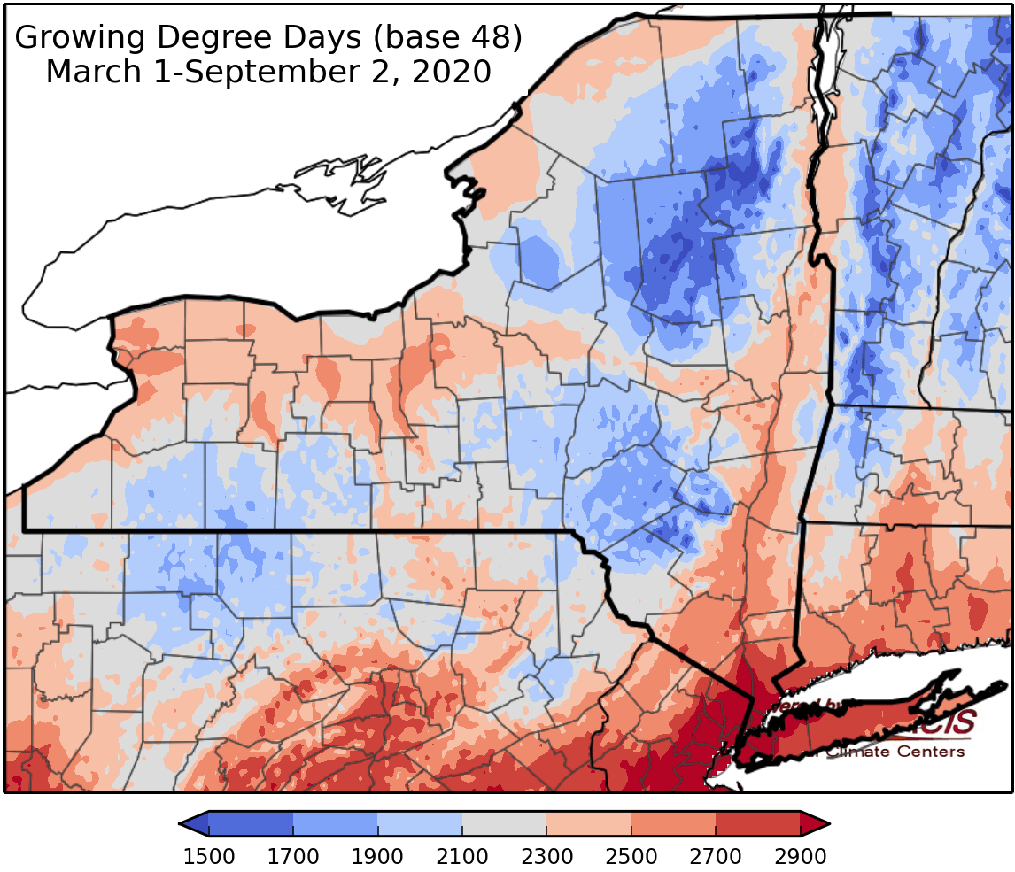
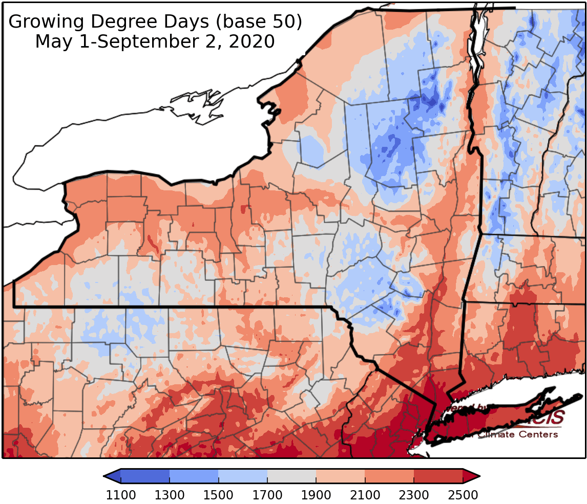
Last week temperatures ranged from 6 degrees below normal to 4 degrees above normal. Precipitation has ranged from less than a quarter of an inch to an isolated area of over 3 inches in isolated areas. Base 50 growing degree-days ranged from 40-140.


Today temperatures will warm into the mid 70s to mid 80s with a slight chance for afternoon showers and thunderstorms. Overnight lows will be in the mid 50s to mid 60s.
Friday temperatures will be in the upper 60s to upper 70s with high pressure bringing fair weather to most areas, northern NY could see some light rain; there will be gusty conditions in the afternoon. Overnight temperatures will be in the mid 40s to mid 50s with showers possible east of Lake Ontario.
Saturday temperatures will be in the upper 60s to upper 70s with sunny skies for along the southern border and increasing clouds northward with a few light rain shows possible in northern NY. Overnight temperatures will be in the mid 40s to mid 50s.
Sunday highs will be in the mid to upper 70s. Overnight temperatures will be in the 50s to low 60s with a slight chance of showers.
Monday temperatures will be in the 70s with showers possible. Overnight temperatures will be in the 50s to low 60s.
Tuesday highs will be in the upper 70s to mid 80s with humid conditions. Overnight temperatures will be in the 50s to low 60s.
Wednesday highs will be in the upper 70s to mid 80s. Heavy rain and thunderstorms are possible; there is a lot of uncertainty of when and if this will happen. Overnight temperatures will be in the 50s to low 60s.
The seven-day precipitation amounts will range from 0” to over 0.25” inches.
The 8-14 day outlook (September 10-16) favors near- to above-normal temperatures and favors above-normal precipitation.
Maps of 8-14 day outlooks:
http://www.cpc.ncep.noaa.gov/products/predictions/814day/index.php
National Weather Service watch/warnings map:
http://www.weather.gov/erh/
US Drought Monitor
http://droughtmonitor.unl.edu/
CLIMOD2 (NRCC data interface):
http://climod2.nrcc.cornell.edu
