
Contributed by NOAA Northeast Regional Climate Center, Cornell University
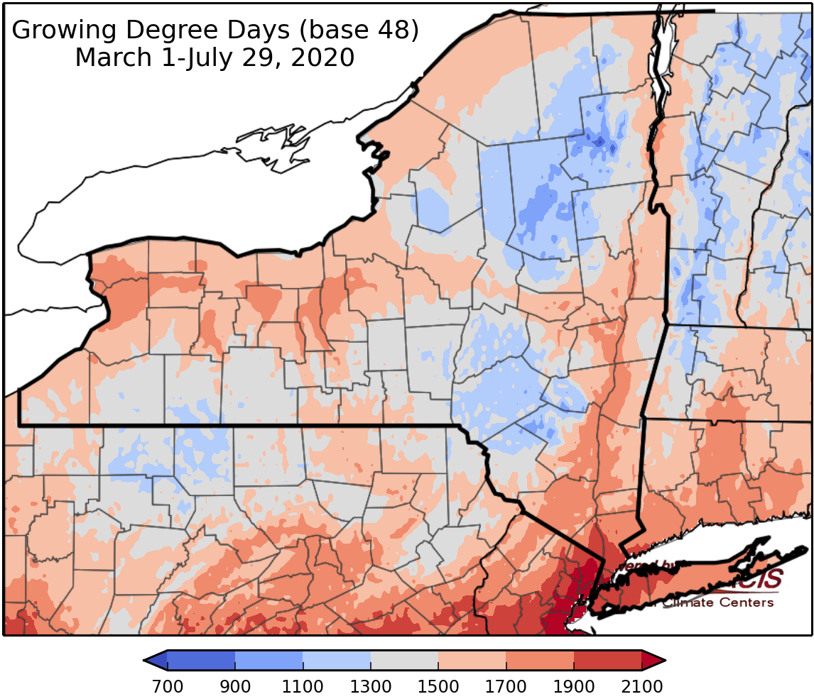
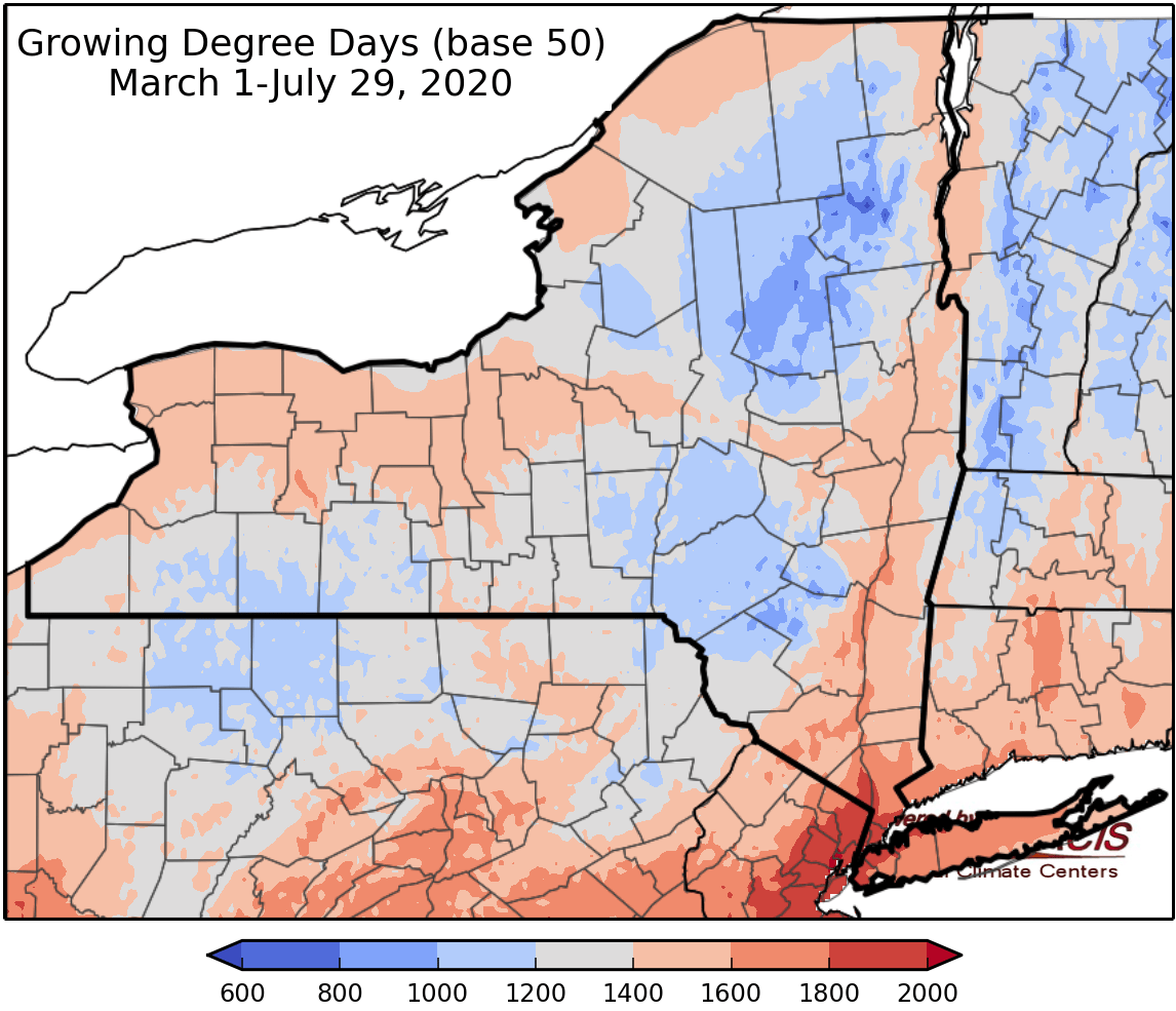
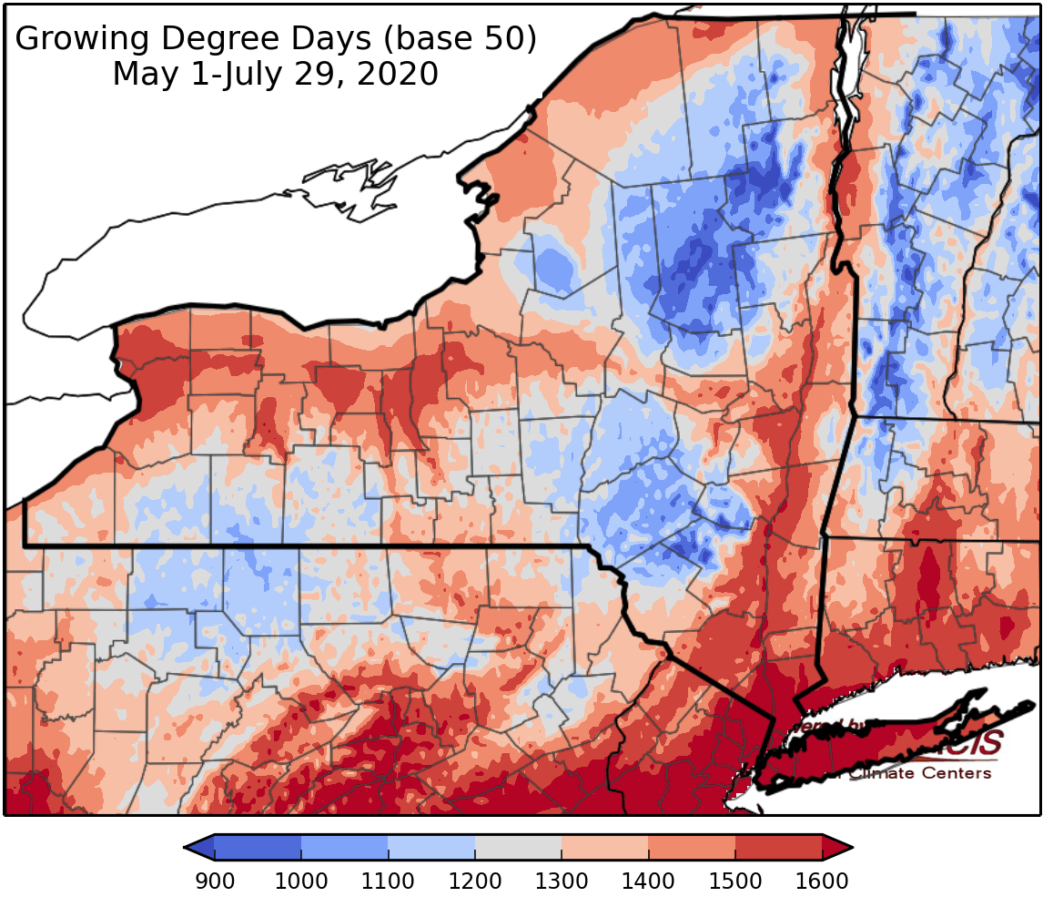
Last week temperatures ranged from 2 to 8 degrees above normal. Precipitation has ranged from a hundredth of an inch to over 4 inches. Base 50 growing degree-days ranged from 110-210.

Today temperatures will in the mid 70s to upper 80s with a chance for scattered showers and thunderstorms. Overnight lows will be in the mid 50s to low 60s.
Friday temperatures will be in the uppers 70s to mid 80s with mostly sunny skies, isolated showers and thunderstorms are possible. Overnight temperatures will be in the mid 50s to low 60s.
Saturday temperatures will be in the upper 70s to 80s with gradually increasing clouds and slight chance for afternoon showers and thunderstorms. Overnight temperatures will be in the low to mid 60s.
Sunday will be with highs in the upper 70s to mid 80s with showers and thunderstorms likely; heavy downpours are possible. Overnight temperatures will be in the mid 60s with rain continuing.
Monday temperatures will be in the upper 70s to mid 80s with on and off scattered showers. Track of Tropical Storm Isaias could bring heavy rainfall to parts of NY, lots of uncertainty at this time. Overnight temperatures will be in the 60s.
Tuesday highs will be in the mid 70s to low 80s with on and off scattered showers. Overnight temperatures will be in the 60s.
Wednesday highs will be in the mid 70s to low 80s with slight chance for showers. Overnight temperatures will be in the 60s.
The seven-day precipitation amounts will range from 0.75 inch to over 3inches. There is the potential for higher totals depending on the track of moisture from Tropical Storm Isaias.
The 8-14 day outlook (August 6-12) slightly favors above-normal temperatures and slightly favors below-normal precipitation for all but western to central NY.
Maps of 8-14 day outlooks:
http://www.cpc.ncep.noaa.gov/products/predictions/814day/index.php
National Weather Service watch/warnings map:
http://www.weather.gov/erh/
US Drought Monitor
http://droughtmonitor.unl.edu/
CLIMOD2 (NRCC data interface):
http://climod2.nrcc.cornell.edu
