
NOAA Northeast Regional Climate Center, Cornell University
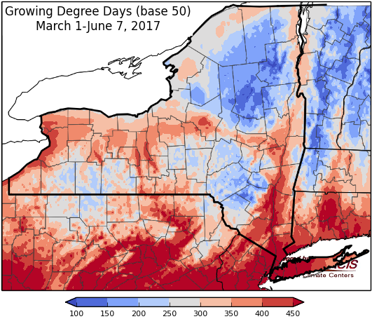
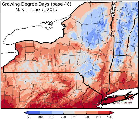
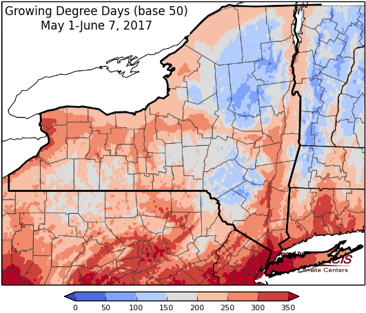
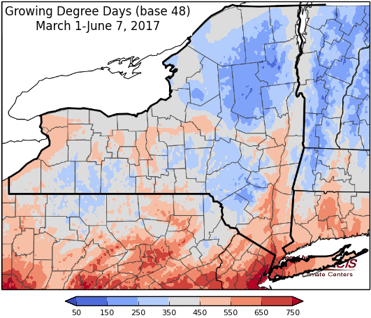
Last week temperatures ranged from near normal to 8 degrees below normal. Precipitation ranged from a ¼ inch to 3 inches. Base 50 growing degree-days ranged from 10 to 110.\
Unsettled weather through Saturday, then heating up Sunday and into next week…
Today temperatures will be in the low 60’s and low 70’s with partly to mostly cloudy skies. Overnight lows will be in the mid 40s to mid 50’s for most areas.
Thursday & Friday highs will be in the 70’s with a slight chance of showers and thunderstorms. Lows will be in the upper 40’s to mid 50’s.
Saturday, temperatures will be in the low 70’s to low 80s with a chance of showers and thunderstorms. Overnight temperatures will be in the mid 50’s to low 60’s.
Sunday, highs will be in the upper 70s to upper 80s with partly cloudy skies. There’s a slight chance of showers and thunderstorms in northern New York. Overnight temperatures will be in the 60s.
Monday’s highs will range from the low 80s to low 90s with mostly sunny to partly cloudy conditions. Lows will be in the 60s.
Tuesday, temperatures will be in the 80’s with partly cloudy skies.
The five-day precipitation amounts from today through next Wednesday (June 7-14) will range from less than 1/10” to 3/4 ”, with the greatest amounts in northern New York.
The 8-14 day outlook (June 14-20) shows increased chances for above-normal temperatures for the entire state. Above-normal precipitation is slightly favored for all NY except Long Island and the New York City area.
Maps of 8-14 day outlooks:
http://www.cpc.ncep.noaa.gov/products/predictions/814day/index.php
National Weather Service watch/warnings map:
http://www.weather.gov/erh/
US Drought Monitor:
http://droughtmonitor.unl.edu/Home.aspx
CLIMOD2 (NRCC data interface):
http://climodtest.nrcc.cornell.edu
