
NOAA Northeast Regional Climate Center, Cornell University
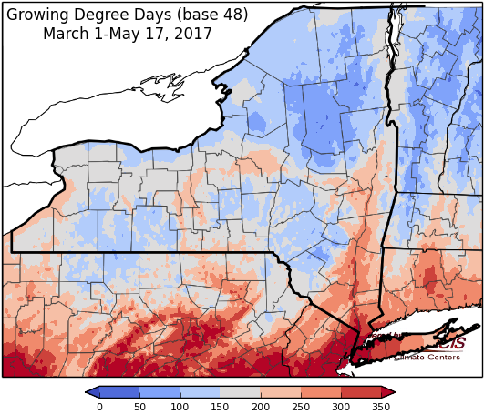
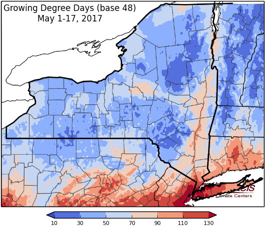
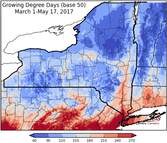
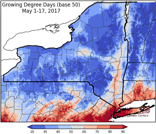
Last week temperatures ranged from near-normal to 6 degrees below normal. Precipitation ranged from a trace to 2 inches. Base 50 growing degree-days ranged from 0 to 30.
Hot Thursday, then near-normal…
Wind Advisories & Hazardous Weather Outlook for Thursday.
Today will be another very warm day with temperatures in the mid 80’s to low 90’s. Showers and thunderstorms associated with an approaching cold front could bring severe weather in the afternoon; primary threats are damaging wind and small hail. Overnight lows will be range from the mid 50’s to mid 60’s.
Friday’s highs will range widely from low 60’s in western and northern NY to mid 80’s in southeast NY. There is a slight chance of lingering scattered showers. Lows will be in the 40’s.
Saturday will be sunny with highs in the 60’s to low 70’s. Overnight temperatures will be in the 40’s to low 50’s with showers possible in western NY.
Sunday, highs will be in the upper 60’s and 70’s with chance of scattered showers, most likely in western NY. Overnight temperatures will be in the 50’s.
Monday’s highs will be in the mid 50’s to mid 70’s with scattered showers possible from a passing cold front. Lows will be in the 50’s.
Tuesday will have temperatures in mid 60’s to low 70’s. Lows will be in the 50’s.
Wednesday, temperatures will be in the mid 60’s to mid 70’s. Lows will be in the upper 40’s to mid 50’s.
The five-day precipitation amounts will range from ¾ “ in southeast NY to near 2.3” in central to northern NY.
The 8-14 day outlook (May 25-31) shows increased chances for below-normal temperatures and above-normal precipitation.
Maps of 8-14 day outlooks:
http://www.cpc.ncep.noaa.gov/products/predictions/814day/index.php
National Weather Service watch/warnings map:
http://www.weather.gov/erh/
US Drought Monitor
http://droughtmonitor.unl.edu/Home.aspx
CLIMOD2 (NRCC data interface):
http://climodtest.nrcc.cornell.edu
