From Jessica Spaccio, NOAA Northeast Regional Climate Center, Cornell University
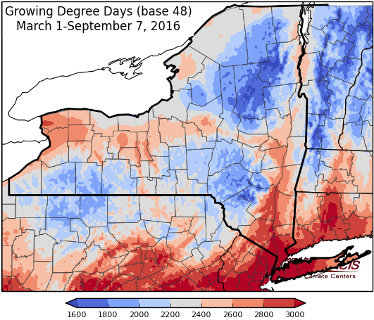
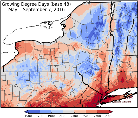
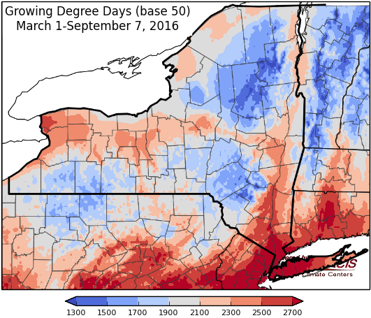
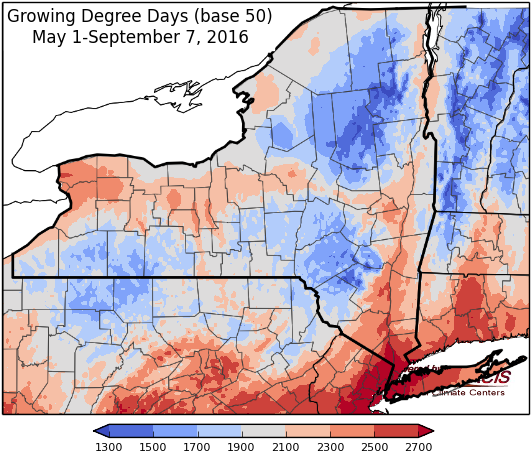
Last week temperatures ranged from 2 degrees below normal to 4 degrees above normal. Precipitation ranged from a trace to 1 inch for most areas, isolated areas of 1 to 2 inches. Base 50 growing degree-days ranged from 70 to 130.
Hot, humid & windy before returning to seasonable weather the latter half of the weekend. Some severe storm potential …
Today will be hot and humid with scattered afternoon and evening showers and thunderstorms ahead of a week cold front. Areas in central NY will see gusty winds and isolated severe storms. Temperatures will be in the mid 80’s to near 90. Overnight lows will be in the mid to upper 60’s.
Friday will be sunny, less humid, and slightly cooler with highs in the upper 70’s to mid 80’s. Areas in eastern NY will still approach 90. Lows will be in the mid 50’s to low 60’s, with a few showers possible in western NY.
Saturday temperatures will heat up again to the mid to upper 80’s with scattered showers and thunderstorms possible. Possibility exists for some severe storms and windy conditions. Overnight temperatures will be in the 60’s.
Sunday high pressure dries things out after a few lingering showers in the morning, highs will be in the 70’s. Overnight temperatures will be in the 40’s and low 50’s.
Monday highs will be in the 70’s. Lows will be in the upper 40’s to mid 50’s.
Tuesday temperatures will be in the mid 70’s to mid 80. Lows will be in the upper 40’s to mid 50’s.
Wednesday temperatures will be in the 70’s with a chance for precipitation. Lows will be in the mid 50’s to low 60’s.
The five-day precipitation amounts will range from a ¼” to ½” in eastern NY, and ½” to 1 ½” in the rest of the state.
The 8-14 day outlook (September 8-14) shows increased chances for above-normal temperatures and below-normal precipitation for all of the state.
The Drought Monitor: On this week’s map, short-term precipitation deficits (30–60 day), low streamflows, and dry soils led to the expansion of areas of Extreme Drought (D3) in the Finger Lakes District of New York.
Maps of 8-14 day outlooks:
http://www.cpc.ncep.noaa.gov/products/predictions/814day/index.php
National Weather Service watch/warnings map:
http://www.weather.gov/erh/
US Drought Monitor:
http://droughtmonitor.unl.edu/Home.aspx
CLIMOD2 (NRCC data interface):
http://climodtest.nrcc.cornell.edu


