From Jessica Spaccio, NOAA Northeast Regional Climate Center, Cornell University
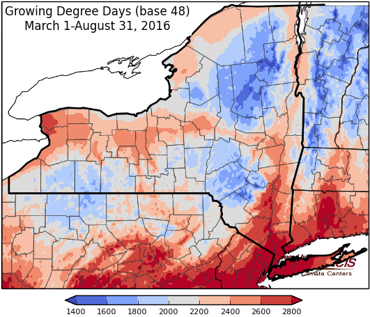
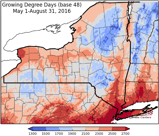
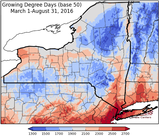
Last week temperatures ranged from 2 to 8 degrees above normal. Precipitation ranged from 1/10 inch to 2 inches. Base 50 growing degree-days ranged from 90 to 170.
Cooler temperatures into the weekend then warming up again, dry into next week for most of the state …
Today will be cool behind the cold front, with a few lingering showers in eastern NY. Temperatures will be in the upper 60’s to mid 70’s, warming to low 80’s in eastern NY. Overnight lows will be in the 50’s and low 60’s, 40’s in northern areas.
Friday will be sunny with highs in the upper 60’s and 70’s. Lows will be in the mid 40’s to upper 50’s.
Saturday temperatures will be in the mid 60’s to 70’s again with sunny conditions. Overnight temperatures will be in the mid 40’s to 50’s.
Sunday highs will be in the mid 70’s to low 80’s. Overnight temperatures will be in the 50’s. Moisture from Tropical Storm Hermine (will then be post tropical) will bring rain, possibly heavy, for southeastern NY.
Monday highs will range from the mid 70’s to mid 80’s. Lows will be in the 50’s to low 60’s.
Tuesday temperatures will be in the mid 70’s to a few 90’s possible. Lows will be in the mid 50’s to low 60’s.
Wednesday temperatures will be in the 80’s, with isolated 90’s possible again. Showers and thunderstorms are possible, along with increasing humidity. Lows will be in the 60’s.
The five-day precipitation amounts will range from a trace to 1” in southeastern NY, the rest of the state will be dry.
The 8-14 day outlook (September 8-14) shows increased chances for above normal temperatures and above normal precipitation for all of the state.
The September outlook shows increased chances for above normal temperatures and no indication for precipitation for most of the state..
The September/October/November outlook show increased chances for above normal temperatures. There is no indication for precipitation.
The Drought Monitor: Overall the Northeast was drier than normal for the USDM period. The rain event that occurred during the first part of the USDM week dropped 1.5 inches at the Buffalo airport and over an inch at several nearby co-op stations. Although the long-term factors (such as groundwater) are low but stable, near term factors such as creek flows have recovered considerably and it was reported that lawns and foliage have greened up in the Buffalo metro area. This resulted in D3 being trimmed back in the area.
D2, severe drought, expanded to cover most of Jefferson County. St Lawrence, Franklin, and part of Clinton counties are now in D1, moderate drought.
Maps of 8-14 day outlooks:
http://www.cpc.ncep.noaa.gov/products/predictions/814day/index.php
National Weather Service watch/warnings map:
http://www.weather.gov/erh/
US Drought Monitor:
http://droughtmonitor.unl.edu/Home.aspx
CLIMOD2 (NRCC data interface):
http://climodtest.nrcc.cornell.edu


