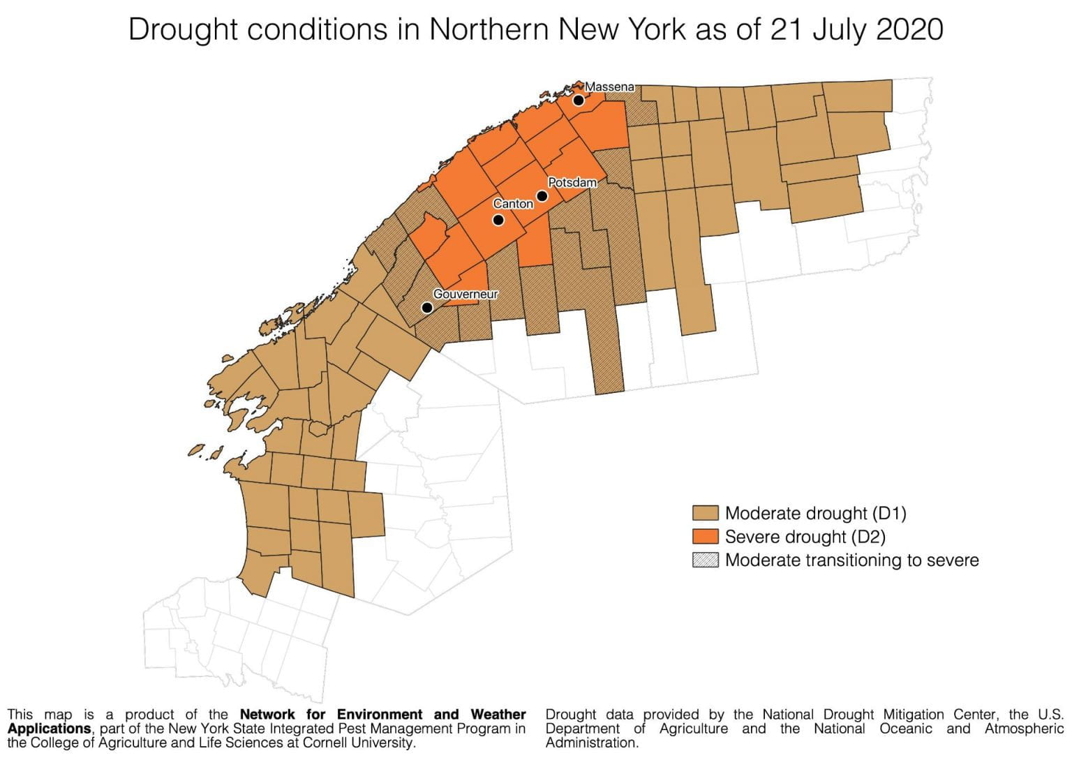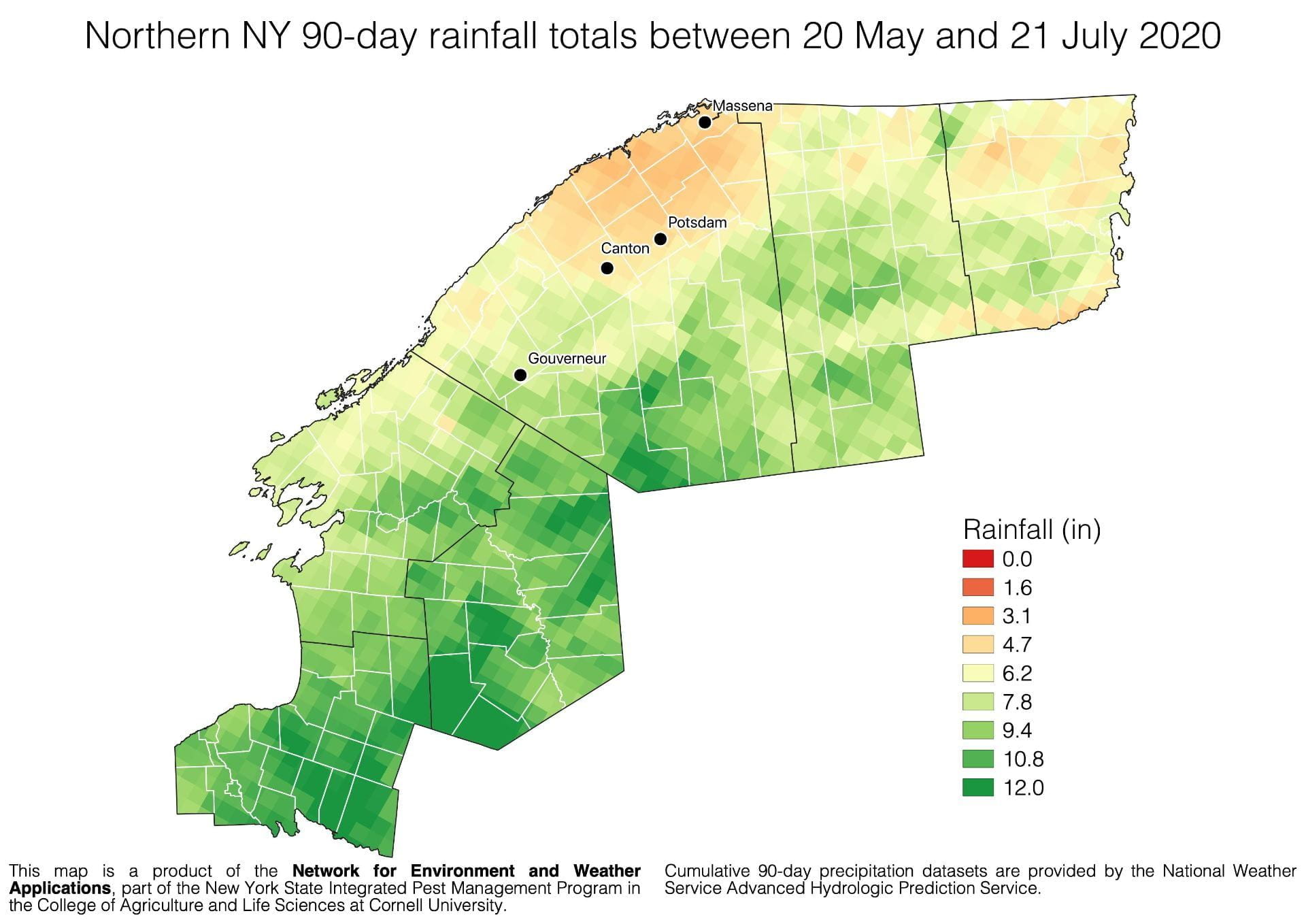

Dan Olmstead from the NYS IPM program and Cornell’s Network for Environment and Weather Applications (NEWA) shared this town-level drought map and an update from the National Drought Mitigation Center this morning. He developed a map of rainfall for the past 90 days, showing the least fortuitous areas are in St. Lawrence County to the N and W of Canton and Potsdam. Clinton County, areas around Ellenburg, Chazy and Beekmantown have also missed a lot of rain this season. These maps seem consistent with observations of crop stress on the ground.