
(adapted, expanded and updated from “Nasbeh, Tell en-” by J. R. Zorn in The New Encyclopedia of Archaeological Excavations in the Holy Land, edited by E. Stern, vol. 3, 1098-1102. Jerusalem: Carta, 1993. Many of the topic mentioned here are addressed in more detail in the Tell en-Nasbeh bibliography of this site. Unless otherwise noted, all illustrations are courtesy of the Badè Musuem, Berkeley, CA. Many of the illustrations can be found in the 1947 site report volumes edited by C. C. McCown and J. C. Wampler)
Identification
Located 12 kilometers (8 miles) northwest of Jerusalem, Tell en-Nasbeh (M.R. 1706-1436; below) is probably to be identified with Biblical Mizpah of Benjamin (Joshua 18:26). In the past it has also been identified with Beeroth or Gibeon. Beeroth and Gibeon, however, were occupied in the Late Bronze age, which Tell en-Nasbeh was not. Ataroth-Addar was another possible identification because a village named ‘Attara was located at the southern foot of the tell. Ataroth-Addar, however, is mentioned only in the boundary descriptions in Joshua, and so was apparently a place of little importance, not at all in keeping with the remains uncovered on the tell. Those who maintain this latter identification suggest that Ataroth-Addar was the site’s original name, and that when Asa fortified the town its name was changed to Mizpah. The only other candidate for biblical Mizpah is Nebi Samwil, but that site has produced no remains from either the Iron I or Babylonian periods when Mizpah should have been occupied.

Mizpah in the Bible
Tell en-Nasbeh was occupied in the Late Chalcolithic and Early Bronze I periods, when it was a relatively small village. After this time the site was virtually abandoned until the beginning of the Iron Age. If one accepts the identification with Mizpah, the Biblical text records that the Israelite tribes gathered at Mizpah before their battle against Gibeah (Judg. 20:1, 3; 21:1, 5, 8), and later against the Philistines (I Sam. 7:5-12). Saul was appointed king at Mizpah (I Sam. 10:17). Along with Gilgal and Bethel, Mizpah was one of the towns visited by the prophet Samuel on his circuit (I Sam. 7:15-17). When Baasha, the king of Israel, encroached on the territory of Judah, Asa of Judah bribed the king of Damascus to invade northern Israel. Asa then called up the people of Judah for corvee labor and fortified Mizpah and Geba with the materials Baasha had brought to fortify Ramah. (I Kings 15:22; II Chr. 16:6). Asa is also said to have constructed a great cistern at Mizpah (Jer. 41:9). During the Iron Age Mizpah may have been home to some form of cultic establishment (I Sam. 7:9; Hosea 5:1; I Macc. 3:46). After the fall of Jerusalem to Nebuchadnezzar, the Babylonians appointed Gedaliah, the son of Ahikam, over what remained of the area of Judah. He made Mizpah his capital, and along with many of his entourage, was murdered there by anti-Babylonian conspirators (II Kings 25:22,25; Jer. 40:6-10, 13, 15; 41:6, 9-10, 14-15 ). How long Mizpah remained the capital is uncertain, possibly until the time Jerusalem was refortified by Nehemiah in the mid-5th century. It was still the capital of its own district when the walls of Jerusalem were rebuilt (Neh. 3:7, 15, 19). Pottery, coins and other small finds indicate some settlement at the site into the Hellenistic period. It was at this time that Judas Maccabee gathered his army at Mizpah to confront the Seleucid army (I Macc. 3:46). During this and the subsequent Roman period the tell was probably an agricultural estate, occupied by a watch tower, kilns, a few buildings and fields. The tell does not seem to have been occupied in later times, though Byzantine tombs were found in the extra-mural cemeteries and the floor of a Byzantine church near the west cemetery was uncovered.
Geographic Setting
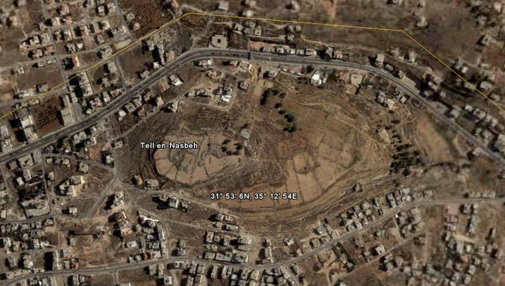
Tell en-Nasbeh (left) sits on a low cenomanian limestone plateau which forms a wide terrace suitable for farming and grazing, as well as extra-mural dwellings. The terrace drops off quickly on the east and is lacking on the north. A shallow saddle connects the tell with the hills to the north. The fortified Iron Age settlement is a bit over 200 meters north to south and about half that in width. The north-south road connecting Jerusalem with the northern hill country ran past the tell in wadis either on the east or the west. The site derives its principal importance from its location on this main road. The hills to the east and north could produce olives or grapes, while grains could have been cultivated on the rolling land to the west and south.
The site’s cemeteries are in the low ridges to the north, northeast and west of the tell.
Its major importance in Biblical times was as Judah’s northern-most border fortress. Early researchers, arguing over the site’s identification with Mizpah, were troubled that the town gate was located in the northeast corner of the wall’s circuit; they felt that a Judean fort must face south, rather than north, toward Israel. This overlooked the fact the northeastern section was the site’s most defensible area. A gate on the south, facing the wide expanse of table land there, would have been quite vulnerable.
History of Excavation and Analysis

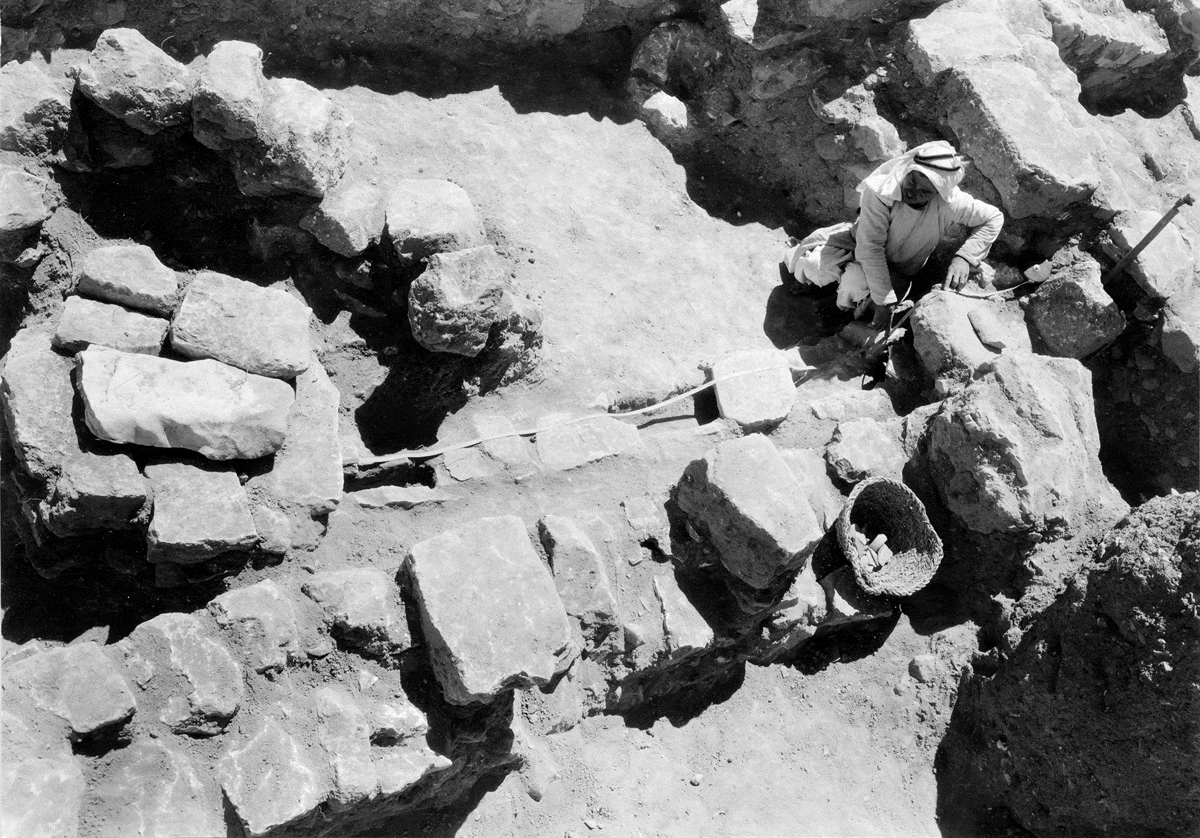
William F. Badè of Pacific School of Religion in Berkeley, California (right), excavated the site in lengthy excavation campaigns during the years 1926, 1927, 1929, 1932 and 1935, clearing about two-thirds of the site’s 32 dunams (3.2 hectares or 8 acres). Much of the central area of the tell was severely eroded, while areas down slope against the city wall preserved several layers of architecture. The excavation methods in use at the time, and the site’s denuded nature, made untangling its stratigraphy difficult. This was made doubly so by Badè’s death in 1936, the year after the final season. Badè’s chief assistant J.C. Wampler, and Badè’s colleague from the seminary, C.C. McCown, were responsible for the two volume final report published in 1947. Besides the death of Badè other problems plagued the production of this report. McCown was a New Testament scholar whose excavation experience was limited to Classical era sites; he had little empathy for the rough fieldstone construction of a predominantly Iron Age site. Moreover, he had only visited the site once briefly. Labib Sorial, the excavation’s draftsman and architect, the individual most familiar with the site’s architecture, and the only staff member present during all five seasons besides Badè, left the field of archaeology soon after Badè’s death and played almost no part in the site’s final analysis. Thus the post excavation staff, though competent enough in their respective areas of expertise, were not up to the challenge of untangling the stratigraphy of an Iron Age site.
Financial difficulties also plagued the publication process. The last years of the Tell en-Nasbeh excavations and the first years of post-excavation analysis were conducted during the Great Depression. Funds for a luxury such as publishing an archaeological excavation were scarce. In addition, the last years of analysis and preparation for publication were undertaken during the equally dark days of World War II. Wampler himself was called away for military service and had to rush to finish his contributions. D. Bothmer, who published the Greek pottery, was also called into the military. No doubt one of the reasons for the unsatisfactory presentation of the artifacts was the lack of proper funding and the hurried stages of the final writing.
Finally, when Tell en-Nasbeh was being excavated many of the architectural forms now taken for granted were new phenomena. For example, the first four-room house was thought by some to be a temple; rock-cut installations now seen to be wine presses were unrecognizable as anything; olive presses were though to be dying installations; the concept of well-fortified sites possessing inner-outer gate complexes was only attested for Megiddo and Lachish. Once an individual becomes familiar with these basic forms, which are now well known from many sites, the plan of Tell en-Nasbeh becomes much easier to interpret.
Relatively little direct work was done on the Tell en-Nasbeh materials since the publication of the 1947 report until the late 1980s. At that time J.R. Zorn began his efforts to compile a complete computer readable and searchable database of the site’s records, along with a thorough reanalysis of this material. These new studies form the basis for the following historical and material cultural reconstruction. From the 1990s to the present there has been a renewed interest in the site and it has been the subjects of a significant number of new studies.
Excavation Results
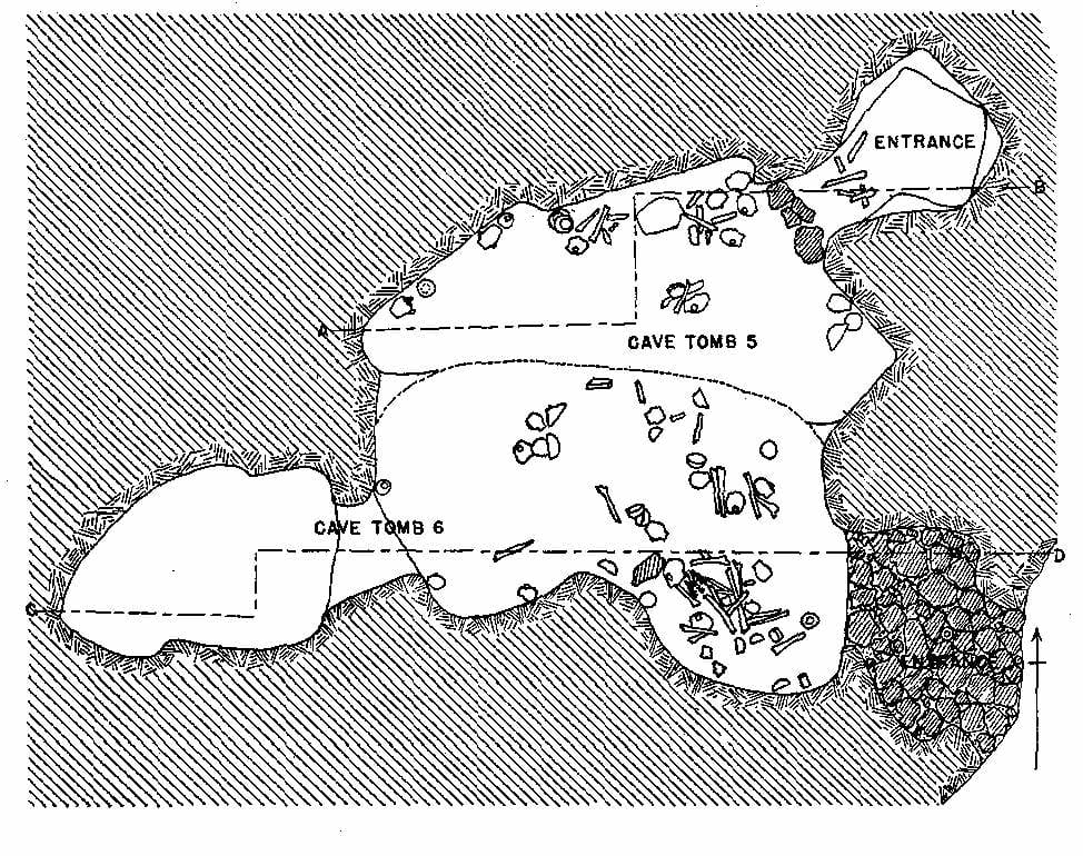
Stratum 5: Late Chalcolithic – Early Bronze I – The earliest materials come from Cave Room 68, in the North Cemetery, which seems to contain material mainly from the Late Chalcolithic period. Early Bronze remains on the tell are represented by two categories of evidence, and are assigned to stratum 5. First are the Cave Tombs 5 and 6 (and probably 7, though records for this tomb were apparently lost) found in the southeast corner of the tell (left). Pottery and skeletal remains came from both tombs; in addition a few beads came from 6. The ceramics associated with these adjoining tombs is in the main Early Bronze I. Cave 193, located just outside the town wall, not far from Cave Tombs 5 and 6, also yielded fragmentary Early Bronze remains below an Iron Age floor.
Second, the distribution of Early Bronze pottery sherds (right) recovered during excavation shows a definite pattern. Approximately eighty percent of them come from the northwest corner of the site, suggesting that the village of this period was probably concentrated in that area. This includes pottery found in cavities in the bedrock. A rock cut installation on the west side of the tell recorded as Silo 315, which seems too small to be a dwelling and is more likely a tomb, contained only EB I ceramics, and fragmentary walls in its vicinity may be connected with it. There is no other architecture on the tell which can be assigned to this period. Whether it was obliterated by later Iron Age building activities, or the Early Bronze I settlement was confined to tents and other perishable structures, is impossible to say.
Most other Early Bronze material comes from the tombs and caves across the valley from the northwest corner of the tell. Some of these rock-cut features were used only in the Early Bronze period (Tomb 67), while others also contain material as late as the Byzantine period (Tombs 9-11). Some of these caves were used as dwellings, or tombs, or both. There is no evidence to explain the site’s abandonment, evidently at the end of Early Bronze I or beginning of Early Bronze II. Many small settlements throughout ancient Israel were abandoned at about the same period, their populations swelling the citizenry of the first urban centers to appear in this region.

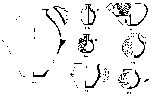
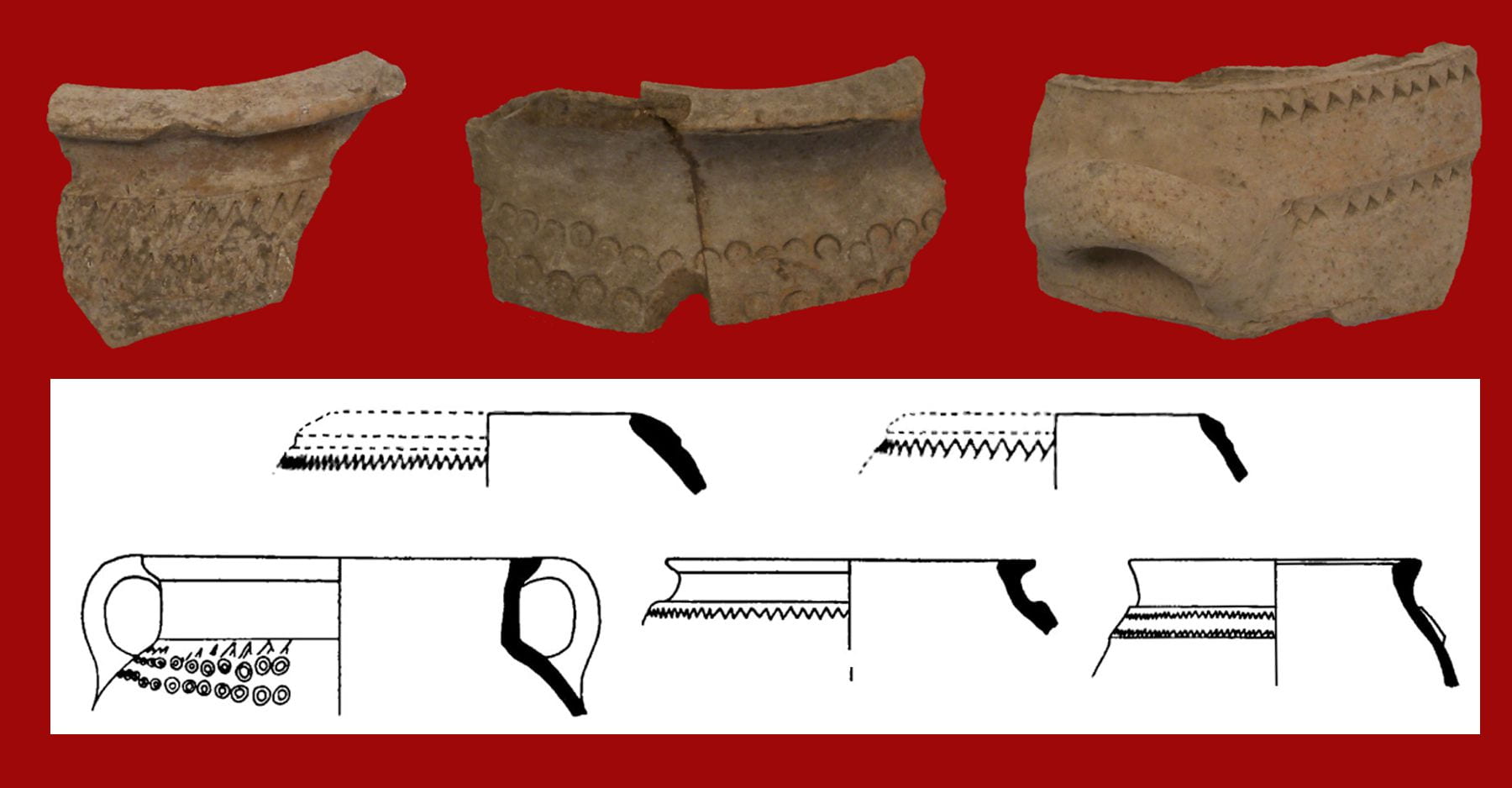
Stratum 4: Iron Age I – The site was abandoned for over fifteen hundred years, but was resettled in the Iron I period (Stratum 4), perhaps in the later twelfth century, as attested by the recovery of more than fifty fragments of Philistine pottery (left), and early local forms, such as collar-rim storage jars and cooking pots (right). Architecture clearly belonging to this period is difficult to discern. Many of the scores of rock-cut installations such as cisterns and silos found at both ends of the tell, and a winepress, silos,
a cave and cup-marks, found in the north (below), were probably dug at this time and attest to a variety of agricultural activities. Some of these continued in use throughout the Iron age, but many are clearly cut by later walls, and a few contain only Iron I pottery, providing a sounder basis for attributing them to Iron I.
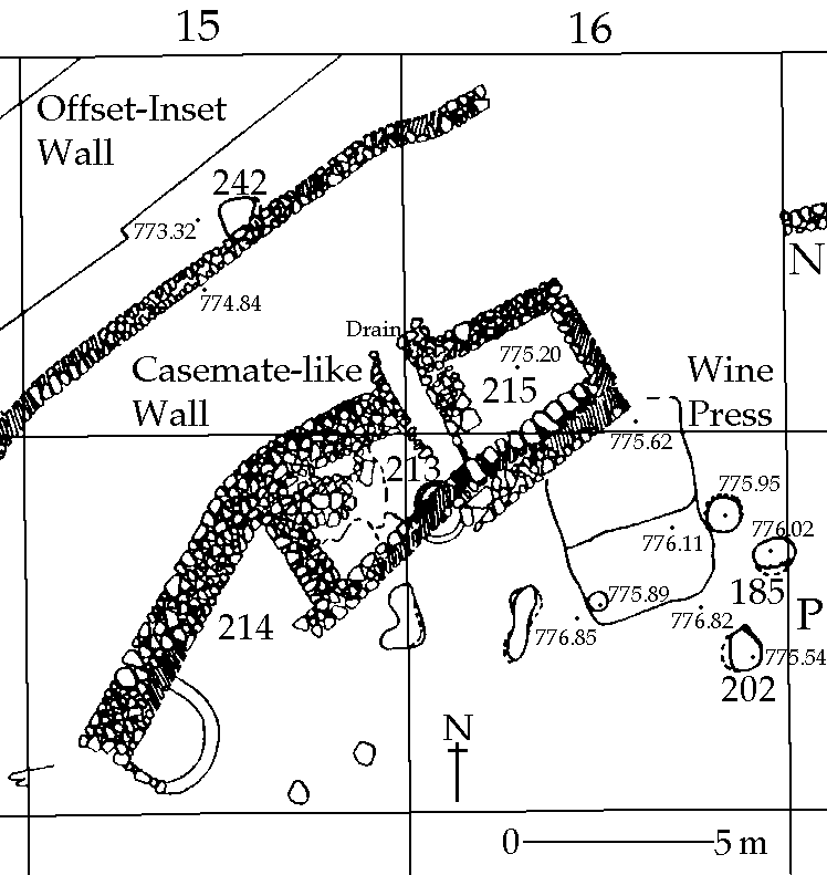
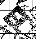
Stratum 3: Iron Age II – Town Plan: To Stratum 3 belongs about half of the architecture on the site plan (below). The deepest soundings on the west side of the mound uncovered a wall approximately two meters thick, against which were built the rear rooms of three- and four-room houses. There is no indication of a gateway for this casemate-like wall. This initial phase of construction is Stratum 3C and is followed by 3B, the construction of the offset-inset wall, and 3A, later modifications to the original buildings. It is important to note that for a period of at least four hundred years the town was never destroyed. This means that the overall plan of the site changed little during the Iron Age II and there are no destruction deposits to help date different phases in the settlement’s development. This plan, which is characteristic of many other Israelite settlements, follows basically a ring-road arrangement: a town wall often with houses or other structures built up against it in a casemate manner, a street, and another belt of buildings. At intervals other streets cut across the inner band of structures. Major public edifices, lacing at Tell en-Nasbeh, are usually near the gate or in the inner band.

Early Defenses: Two towers (below) were erected outside the casemate-like wall, one on the west and the other on the northwest, as reinforcements to the town’s defenses before the offset-inset wall was built. Both contain two narrow chambers. The western tower is better constructed, being of rough ashlars laid in regular courses.
Dwellings: The houses (left) of this period were initially built with walls one stone thick; in later phases the walls of rebuildings, additions and new constructions were usually wider and two stones thick (Strata 3B-3A). The general plan was to have two rooms (or a courtyard and a room) parallel along their lengths, with a shorter room across the back (a three-room house). Larger dwellings have three long chambers, and one in back (a four-room house). There are also a few irregular structures. Since the closest spring was at the southern end of the terrace on which the town was built most homes probably had their own cisterns. Some of the houses had second stories, as witnessed by stairs in several structures. Olive presses and storage facilities in six buildings show that this type of structure was used for industrial purposes, not only for dwellings. Based on the number of buildings recovered, there were likely around 200 mostly three-room houses at the site, with a population of possibly 900-1000. Whether Iron Age houses had open courtyards and complete second stories is a much debated topic. Likely some houses did have courtyards and probably not all houses had completely built up second stories.
Town Wall: The major addition to the town plan was the massive new wall (right) and gate complex, which is associated by some with Asa’s fortification of Mizpah. The
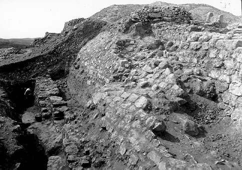
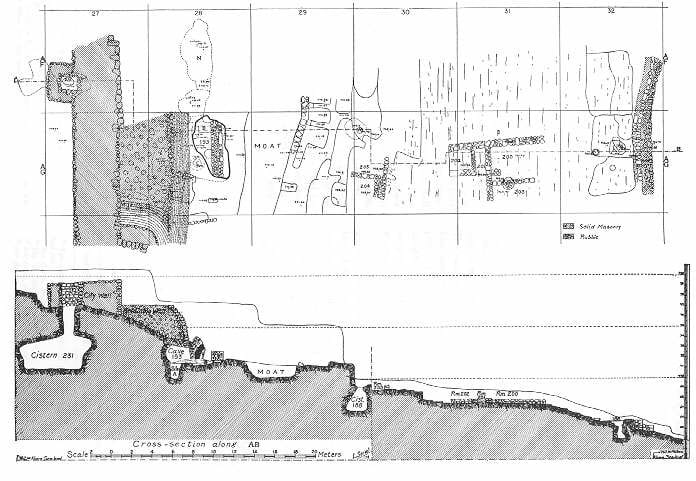
wall was uncovered for its entire 660 meters. It is estimated to have stood 12 to 14 meters above bedrock, and at least the lower half of this was covered with hard mud plaster. The wall averaged about 4.4 meters thick. Eleven towers dotted the wall; these ranged between 6 and 9 meters in thickness, including the wall. Most of the stones used in the wall were unhewn, laid in mud mortar, with smaller stones used for chinking. In some sections, especially in the towers, ashlars were used as facing or to strengthen corners. The wall was built in an offset-inset fashion. The manner of construction is not uniform, and some segments are not bonded into those on either side, which led the excavators to suggest that each section was built by a different band of corvée laborers. The towers were further protected by a stone revetment, and long sections of the wall itself on the western and eastern sides were so protected. Retaining walls were found along one part of the eastern glacis and one section of the northern wall. Three sections of a dry moat were excavated along the perimeter of the defenses; it is not certain if this feature is continuous, for no example of it was found outside the wall on the south and the moats have have resulted from quarry rock for the wall construction.
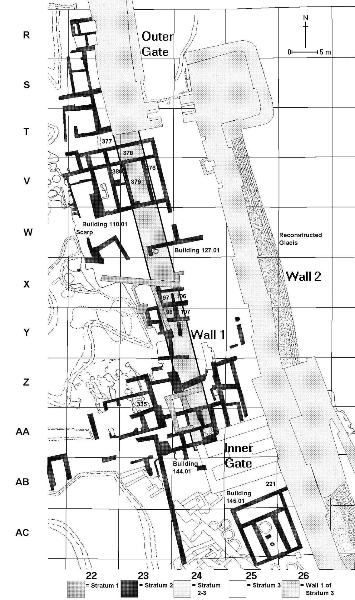
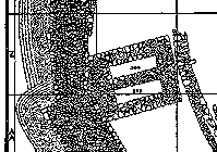
Gate Complex (left): Entrance to the 3B town was through a monumental inner-outer gate complex. The inner gate was not recognized as such by the excavators because of a lack of comparanda at that time. They preferred to think of it as either an earlier gate which had gone out of use, or a gate which had never been completed. It is clear, however, that a wall as massive as the town wall originally connected these two gate houses, linking them into a single complex.
Inner Gate: The inner gate was ca. 12 by 14 meters, with walls about 2.2 meters thick. It contained two pairs of chambers. Since it is only preserved at its foundations it is difficult to be certain if it had a bent-axis entrance, as suggested by the excavators, or was a direct-axis type. There may have been a plaza in front of this gate.
Outer Gate: The outer gate is formed by a section of the city wall from the south overlapping to its east another wall segment approaching from the north. This eastern overlap takes the form of a tower about 12 meters square, not including its glacis. Two pairs of stone piers ca. 1.5 meters wide formed the entryway; the guard chambers between the piers were 2.3 meters wide and lined with stone benches, as was the plaza outside the gate. The width of the entrance was 4.25 meters. Ashlars were used more frequently in this gate than any other part of the fortifications. The threshold, a gate stop, two sockets for the gate posts, a slot in the eastern pier along which the gate bar ran and the slot in the western pier into which it fit when the gate was closed were also found. There is no indication how the gate was roofed. A covered channel drained the gate area. At some point the entrance was deliberately narrowed, perhaps in the face of the Babylonian invasions.
This inner and outer gate complex (right), which is an integral part of the wall system attributed by some to king Asa of Judah in the early 9th century, would be one of the earliest examples of its kind. It would be also one of the strongest defensive systems in the country at the time, more massive than Megiddo, for example. The reason for the great length of the passage which connects the two gates is the topography on the northeastern part of the site. A rock scarp which stretches from just inside the outer gate to a point some 45 meters to the southeast; the builders of this great complex had to extend the inner gate past the point where the scarp leveled off. In Stratum 2 the inner gate went out of use and other structures were built over and adjoining it. The wall which connected the two gates was razed to its foundations and a variety of dwellings and other structures were built over it. The most likely period for this would be in the aftermath of the Babylonian conquest, when Mizpah was made the capital of the region.
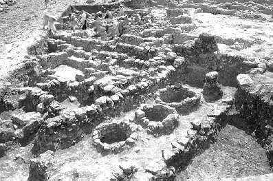
Agricultural Installations: In the steeply sloping area between the original city wall and the massive new wall a large fill was poured to provide a level surface. In the southern half of this intramural zone a band of stone-lined storage pits was dug (left). These bins, northern drainage channels (discussed below) and new defenses seem to be part of a single well thought-out royal construction project designed to increase the storage capability of the site. The pits were likely used to store grain used to feed those employed by the administration and as a food reserve in times of famine or siege. Six olive pressing installations (below) were found in the southwest part of the site (marked by grey oval in the schematic plan above). These installations may have belonged to extended families that clustered around the buildings in which the presses were found.
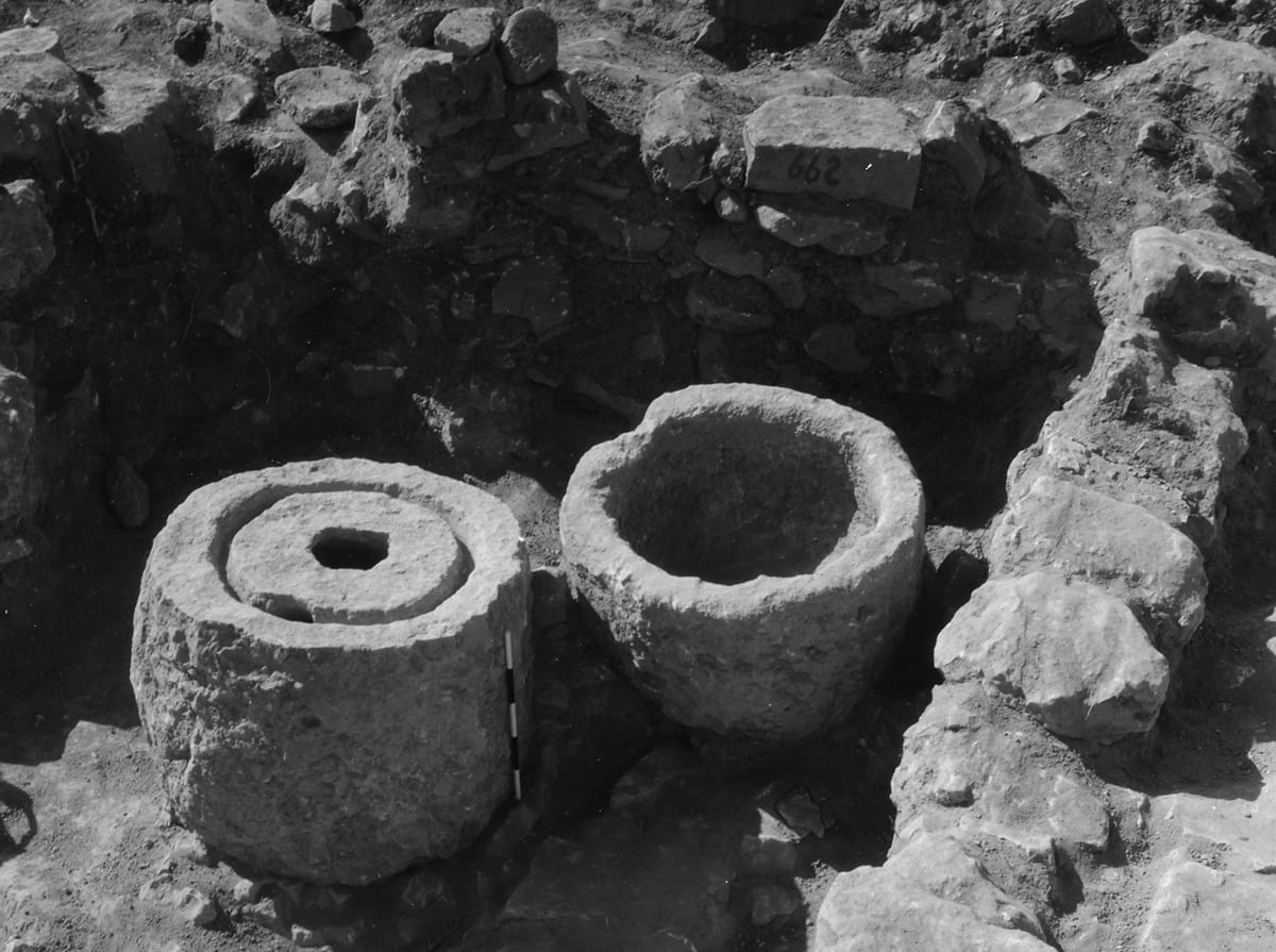
Water Installations: The intra-mural area of the town on the north and west contains eight drain channels (right). The general slope of the site is from south to north. Water which collected in this intra-mural area would have accumulated at its northern end and had to be channeled through the great wall. It was probably for this reason that no storage bins were constructed here. Not only did the inhabitants of the town channel unwanted water out of the town, but they also directed it to cisterns inside the town (below). Scores of such cisterns, some lined with plaster, were found scattered across the site. These cisterns were sometimes fed by water runoff from adjacent streets, and also from rainfall that fell on house roofs. An estimation of the capacity of a sample of these cisterns indicated an approximate average volume of ca. 18 cubic meters, though this could vary widely. Cistern 159 in Square AJ20 had a capacity of over 76 cubic meters. Most cisterns had a capacity far beyond the needs of a nuclear family and probably indicate a sharing of water resources across a larger family unit.
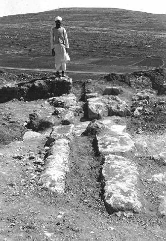
Suburbs: There was not only settlement within the town walls at this time, but also without. A trench cut down the eastern slope of the site (below), and a probe outside the walls on the southwest, revealed the walls of dwellings and agricultural installations (a wine press?). In calculating the populations of ancient towns these sort of suburbs are seldom taken into account.
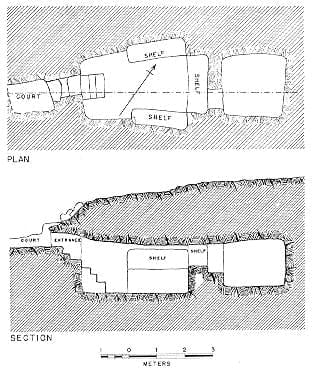
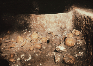
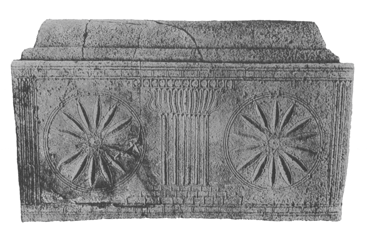
Tombs: Tell en-Nasbeh’s cemeteries contained a number of Iron Age tombs. Four were especially rich (Tombs 5, 29, 32, 54), and yielded almost sixteen hundred objects. Of the four Tomb 5 (below) was the only one with a regular plan, consisting of a court, entrance stairwell, rectangular main chamber with three burial shelves and a back chamber for funerary deposits. Such tombs came into use in the 8th c. B.C.E. The others are oval chambers.
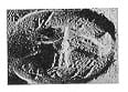
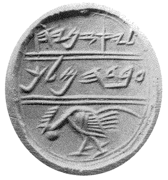
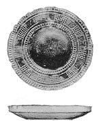
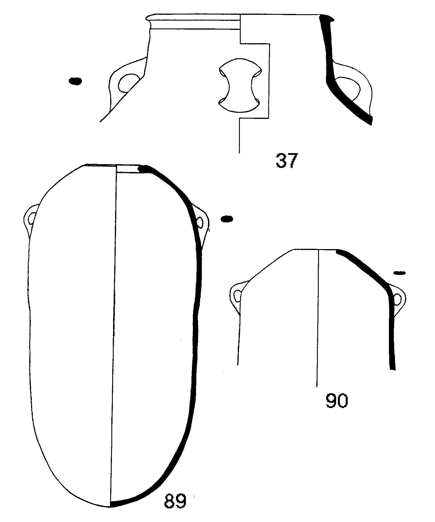
Small Finds: Epigraphic finds include inscribed ostraca, weights, scarabs, a cylinder seal, and seal impressions, including eighty-eight of the LMLK variety (left). The prize in this category was the seal of Jaazaniah (below), which is possibly to be attributed to the officer of the same name who reported to Gedaliah at Mizpah (II Kings 25:23). This seal bears the image of a cock in a fighting stance; this is one of the earliest representations of this bird ever recovered from ancient Israel.
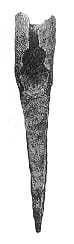
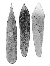
Tools, such as plows points (left), mattocks, knives and sickles were generally made of iron, though many flint blades and mortars, pestles and querns were also found, attesting to the use of stone
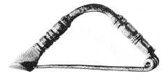
technology even in the Iron Age. Enigmatic bone “spatulas” (right) were also found in abundance. Spear and arrow heads were of bronze as often as they were of iron. Evidence of weaving is apparent from the many loom weights and spindle whorls which were uncovered. Items used for adornment were also frequent: kohl sticks for applying make-up, decorated stone mortars (below) for grinding and mixing cosmetics, straight pins and fibulae (below) for fastening garments and all manner of earrings, anklets and bracelets. The religious life of the people is demonstrated by the dozens of pillar base female figurines uncovered, as well as by fragments of altars and stands.
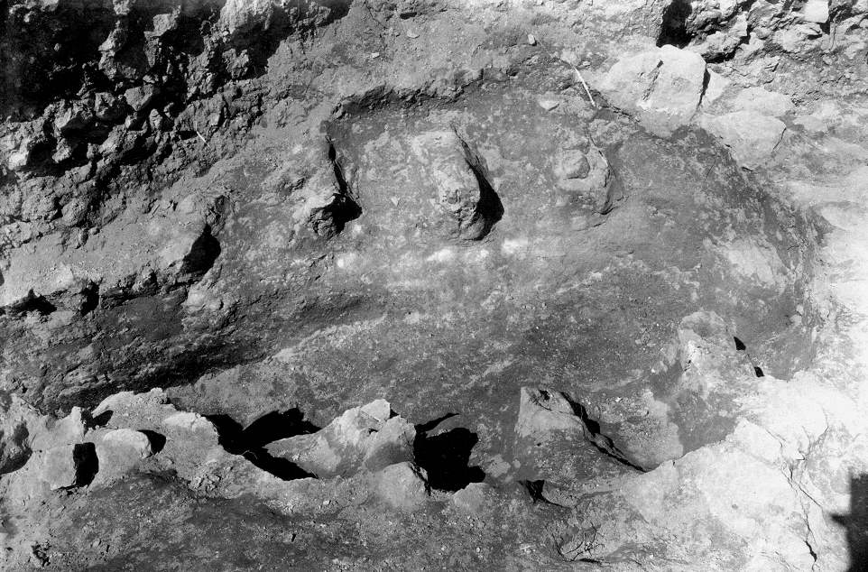
Pottery production (below) is attested by a large kiln found in the southwest corner of the tell (below), partially cut by the offset-inset wall.
Stratum 2: The Babylonian to Persian Period If the identification of Tell en-Nasbeh with Mizpah is accepted, it is natural to expect to find remains associated with Babylonian period since this was the era of the site’s greatest importance. The excavators, however, failed to distinguish the buildings of this period. Such remains do exist and belong to Stratum 2 (below). Since the site’s function changed from that of a border fortress to being a provincial capital some change in its plan is expected. Almost no in situ finds, and those mostly heavy stone objects, were discovered in Stratum 3, suggesting that the settlement was peacefully abandoned, torn down and leveled out for the construction of Stratum 2.
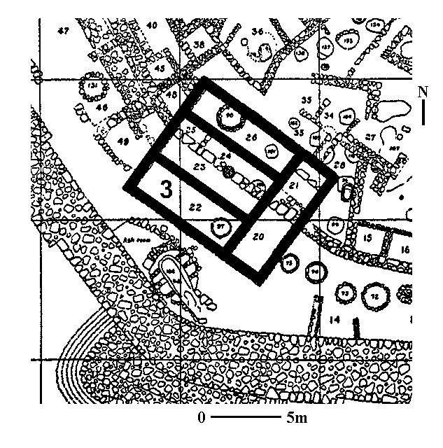
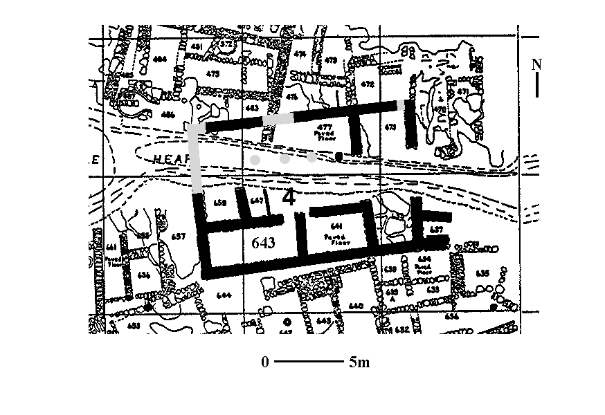
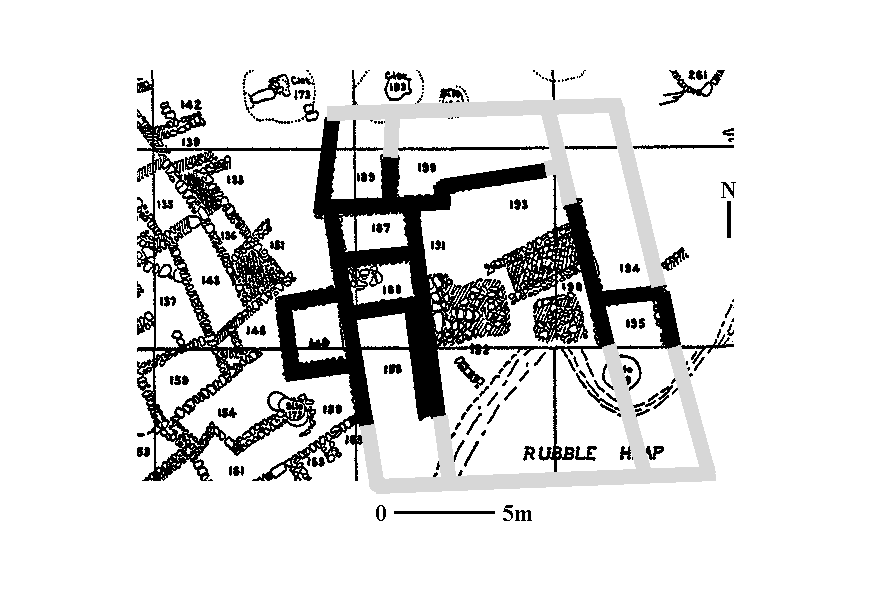
Houses: The excavators uncovered three 4-room house remarkably similar size and of finer construction than any other dwellings on the site: the first (Building 110.01) next to the outer gate, the second (Building 145.02) adjacent to the inner gate and the third (Building 194.01) in the southwest corner of the site. These were all of the same constructional technique and dimensions. They are all later than the Iron II period. The one near the outer gate is built over the remains of the wall which connected the two gate houses (see plan of inner-outer gate complex above), the second is built only two meters in front of the exit of the inner gate, the third is built over remains of houses associated with the Iron II period. All these dwellings are at a different orientation to the town’s original ring-road plan. Three further 4-room houses can be added to this list: the fourth (Building 125.01) a little north of the center of town and built over Iron II houses, a fifth (Building 127.03) northeast of the inner gate and a sixth (Building 93.03) built up against the city wall to the east of the gate. These houses are all of the same basic style and size as the others previously recounted.

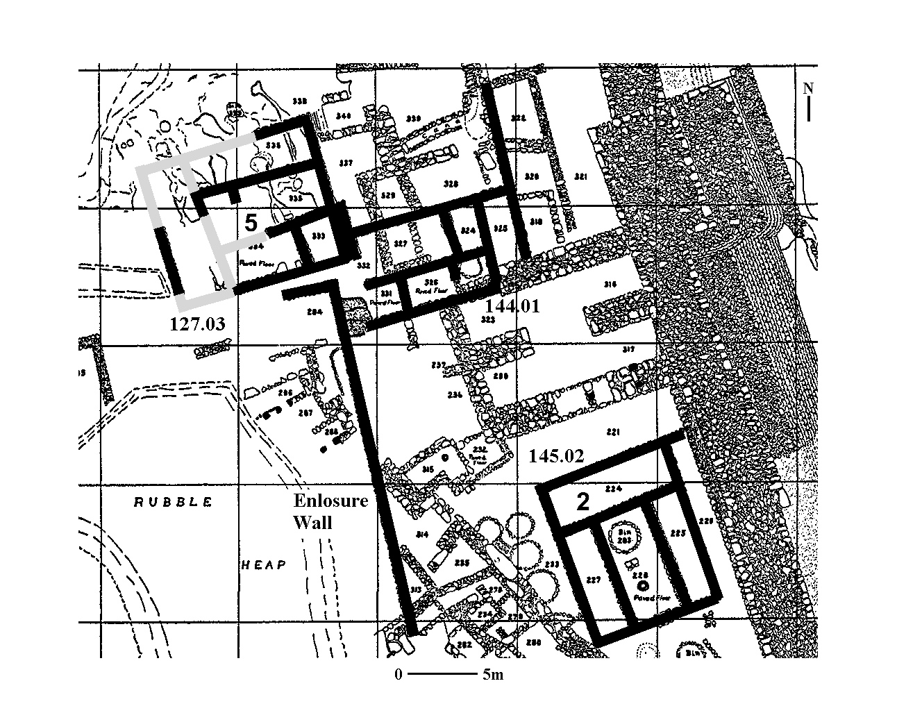
Palace or Residency (?): In the northern part of the site two areas of stone pavement were found above wall stubs of the Iron II. Bounding these patches of paving on the west, north and east are stone walls thicker than any others in that part of the tell. The area to the south was not excavated. Some of these walls form connected chambers, others are too fragmentary to make restoration possible. The extant remains are indicative of a structure far larger than any other found, and is certainly more than a private dwelling (Building 74.01).
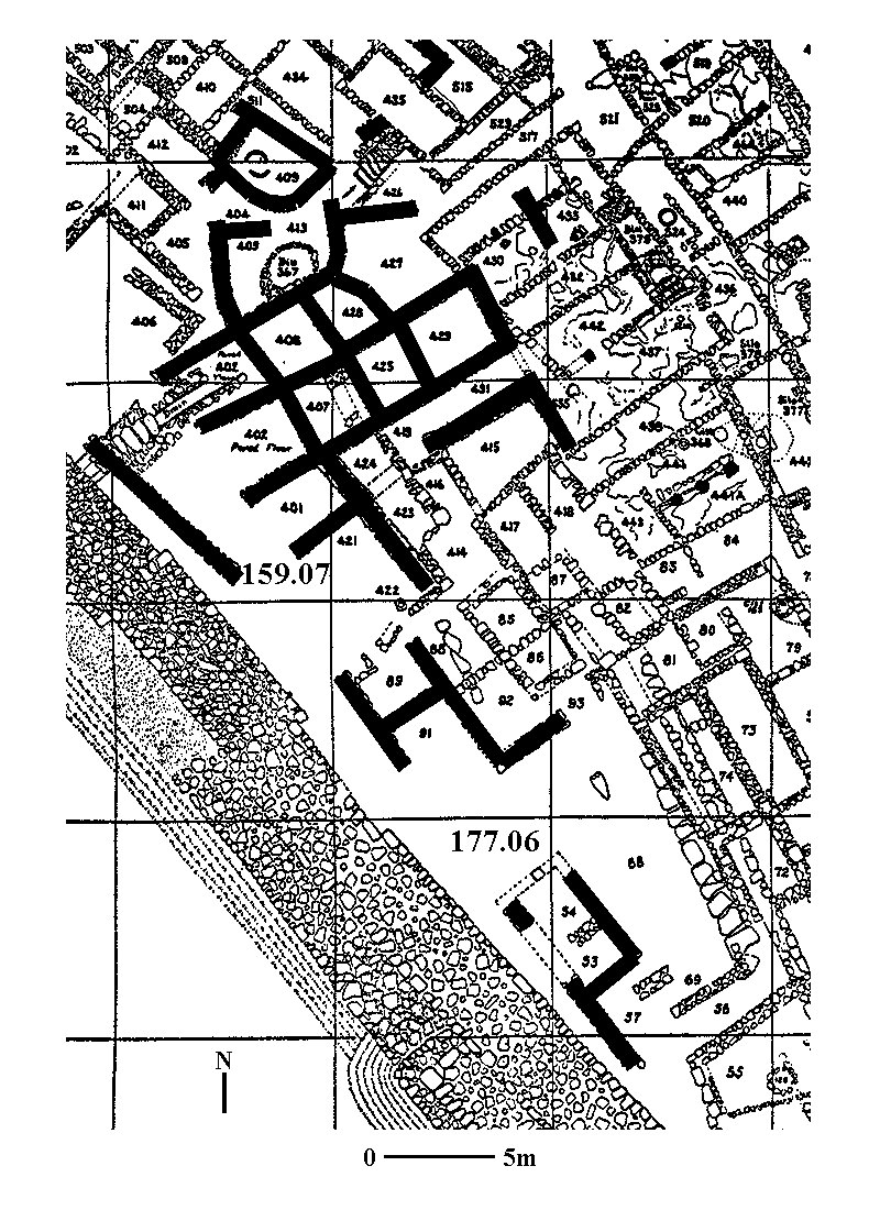
Store Houses: In the south central part of the tell fragments of two long chambers (Building 160.10) were found which were built over the remains of the Iron II town. No cross walls are evident in these rooms, though it is possible that only their foundations survive. Such long structures are often indicative of store rooms, and such would be expected on the site of a provincial capital. To the east of these chambers are very fragmentary remains of other large, well constructed rooms which seem to be later than the Iron II dwellings.
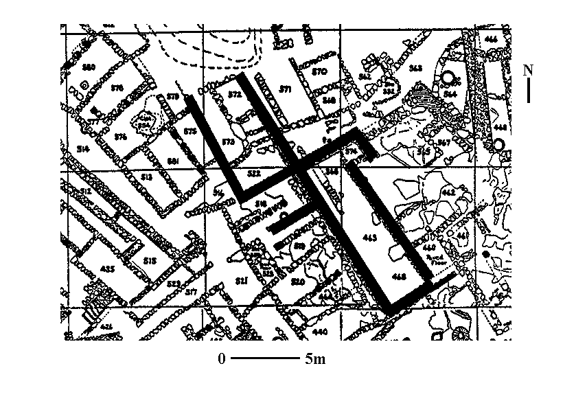
A mass of similar fragmentary walls are to be found to the southwest, evidence perhaps of another monumental building, or buildings (Building 159.07 and 177.06).
Intra-Gate Area: In the area between the two gates, and built over the wall which connected them, are another series of fragmentary walls, including remains of a three-room house and perhaps another four-room house. (see Stratum 2 plan above) These walls are in turn cut by walls apparently from the Persian period, or later.
Long Wall: To the west of the inner gate is a 25 meter stretch of wall. Only its northern corner was uncovered (see above, west of inner gate and south of Building 127.03). This wall cuts buildings of the Iron II town. Because of its fragmentary character nothing can be said of its purpose.
Town Plan: These remains show a marked difference from the town of the Iron II period. The structures, and individual chambers, are larger than their counterparts in the Iron II town, they are at a completely different orientation, and are usually built over the Iron II dwellings. Further, their construction put the old inner gate house out of use, and also the wall which connected it to the outer gate. The most likely period for such defenses to go out of use, and such substantial new construction to take place, would be the Babylonian period.
Small Finds: Certainly many of the classes of objects described under the Iron II period could fit here as well since Iron Age material culture did not simply cease to exist after the Babylonian

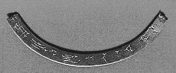
destruction of Jerusalem in 586 B.C.E. Various items likely belonging to Stratum 2 are worth noting. First are the inscriptions. Very interesting is a fragment of a bronze circlet (left) bearing a cuneiform dedicatory inscription, in a script which is probably Neo-Babylonian. A similarly intriguing piece is an ostracon on which was written a Babylonian name in Hebrew characters; it reads “[S]on of Mar-sharri-utsur” Next come stamp impressions. The earlier group of inscriptions read: M(W)SH (below), most likely a reference to the town of Mozah west of Jerusalem. Of the 43 known examples of this impression, 30 come from Tell en-Nasbeh. While these impressions have often been attributed to the Persian period, their geographic distribution conforms very closely to the area of the tribe of Benjamin (from Jericho on the east to Suba on the west; from Tell en-Nasbeh on the north to Ramat Rahel on the south), which was likely the heart of the Babylonian sub-province. The inscriptions possibly indicate products from a royal estate at Mozah that were primarily shipped to the provincial center at Mizpah. From the Persian period, mainly its latter half, come the Yehud stamp impressions (below), which are markers of the imperial Persian administration.
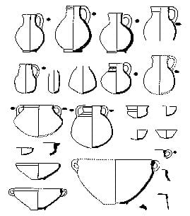
Second are fragments of Mesopotamian-style bathtub-shaped coffins. Normal Judean practice was to bury the dead outside the settlement; in Mesopotamia, however, the dead were usually interred below the
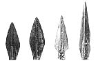
floor of their dwelling. The Nasbeh coffins were found on the tell, indicating that the Mesopotamian practice was in use. Twenty-nine fragments of Greek pottery, dated mainly in the late 6th to 5th centuries, such as a rare Clazomenian amphora , were recovered. Wedge-and-circled impressed vessels (below), mainly storage jars and kraters, were found in great amounts at Tell en-Nasbeh and also date to this period. Four of the trilobate so-called “Skythian” arrowheads (below) were also found.
The appearance of the circlet, ostracon and coffins at a Neo-Babylonian provincial capital is quite understandable, but otherwise hard to explain.
Dating of Stratum 2: The beginning date of Stratum 2 is based on the large sack shaped pithoi found in situ in Building 125.01. Such large pithoi, once set in their final position, may have very long lives,
a century and more. These pithoi are paralleled by specimens found in Babylonian destruction deposits in Jerusalem and Lachish. The destruction of the stratum is assigned to approximately the end of the 5th century BC on the base of storage jars found in Building 110.01 which are dated by parallels to examples found at Tel Michal. This late 5th century dating tends to be confirmed by the lack of imported Greek pottery after that date. Because of the data that shows that Tell en-Nasbeh was inhabited at the beginning of the 6th century, and at the end of the 5th century it was likely

Stratum 1: Later Periods The site seems to have been abandoned from the end of the 5th century until the 3rd or 2nd century B.C. From the Hellenistic into into the Roman period the site may have been an agricultural
estate. Fragments of walls built over the Stratum 2 walls, and over the town wall and outer gate, belong to this phase, as does a thick-walled chamber in the north central part of the tell, the remains of a watch tower (left), with an associated wine press. What seems to be another wine press, which cuts the remains of the Iron II period, was found in the northern half of the town. It may also belong to this phase. Two small kilns found outside and later than the outer gate may have provided jars for the wine produced on the tell. Coins of the Ptolemies, Seleucids, Hasmoneans, Romans and Byzantines were found. Quantities of late period ribbed pottery also occur. Given the eroded state of the surface of the tell it is impossible to say when in the Roman period occupation actually ceased on the site.
There are no clear remains from the Byzantine period on the tell, though a Byzantine church was found southwest of the site, and Byzantine tombs were found in the surrounding cemeteries. Scattered remains into the Ottoman period were also found on the tell and in its vicinity.
Summary: The remains from Tell en-Nasbeh tally very well with the history of Biblical Mizpah. It was a moderate size town in Iron I, which could have been visited by Samuel if the tradition connecting him with Mizpah is correct. In the early part of Iron II the site was invested with a massive new fortification system and new storage bins, which would tie in with Asa’s need to fortify his northern-most town. In the sixth century the town’s plan changed completely as parts of the fortifications were dismantled and spacious new dwelling were constructed. This fits well with Gedaliah’s need to establish a provincial capital in Mizpah and demonstrates the towns importance from the 6th into the 5th centuries B.C.E.