Mega regions are not a new idea of course, as Dr. Richard Florida (of Atlantic Cities), Tim Gulden, and Charlotta Melander explain in their 2008 paper “The rise of the Mega-Region”:
…the past two or three decades have seen the rise of a new economic unit—the mega-region. At the time when the great classical economists were framing economic theory, nations truly were the space over which labour and capital were reallocated by the economic process. International investment and travel existed, but they were burdensome and not nearly as common as they have become. Nations were thus natural units of macroeconomic analysis and these nations were productively conceived as being composed of cities and hinterlands. In the 21st Century, however, the emergence of globalization makes national boundaries mean a lot less. Capital can now be allocated freely around the globe—seeking maximum return wherever that may be. Even labour, particularly highly creative and productive labour, can be reallocated globally in a way that would once have been impractical.
From Florida, Richard, Tim Gulden, and Charlotta Mellander. “The rise of the mega-region.” Cambridge Journal of Regions, Economy and Society 1, no. 3 (2008): 459-476.
This paper, and Florida’s website Who’s Your City? show other megaregions of the world:
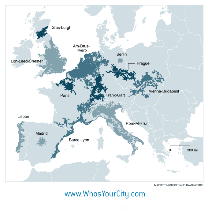
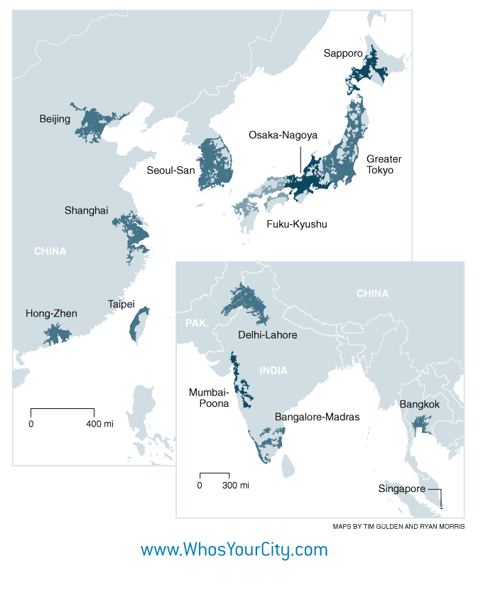
Data for these maps comes from light emissions as an indicator of economic activity, referred to as Light-based Regional Product (LRP). The authors explain that although the correlation is imperfect, there is a reasonably reliable relationship between large economic areas and light output. Noticeably absent from the data sets are mega regions in Eurasia, Africa, South America, or Australia, however the authors clarify that their coverage is imperfect and
“…our method, dependent as it is on light emission patterns, does not account for…historical, cultural, political or social context.”
Regardless, this is an interesting concept that seems better suited to the economic realities of the present. What might also be interesting to uncover is how people in these economic corridors identify themselves—do pan-megaregion identities exist? Are they stronger than national identities? And what does this means for future governments and governance?