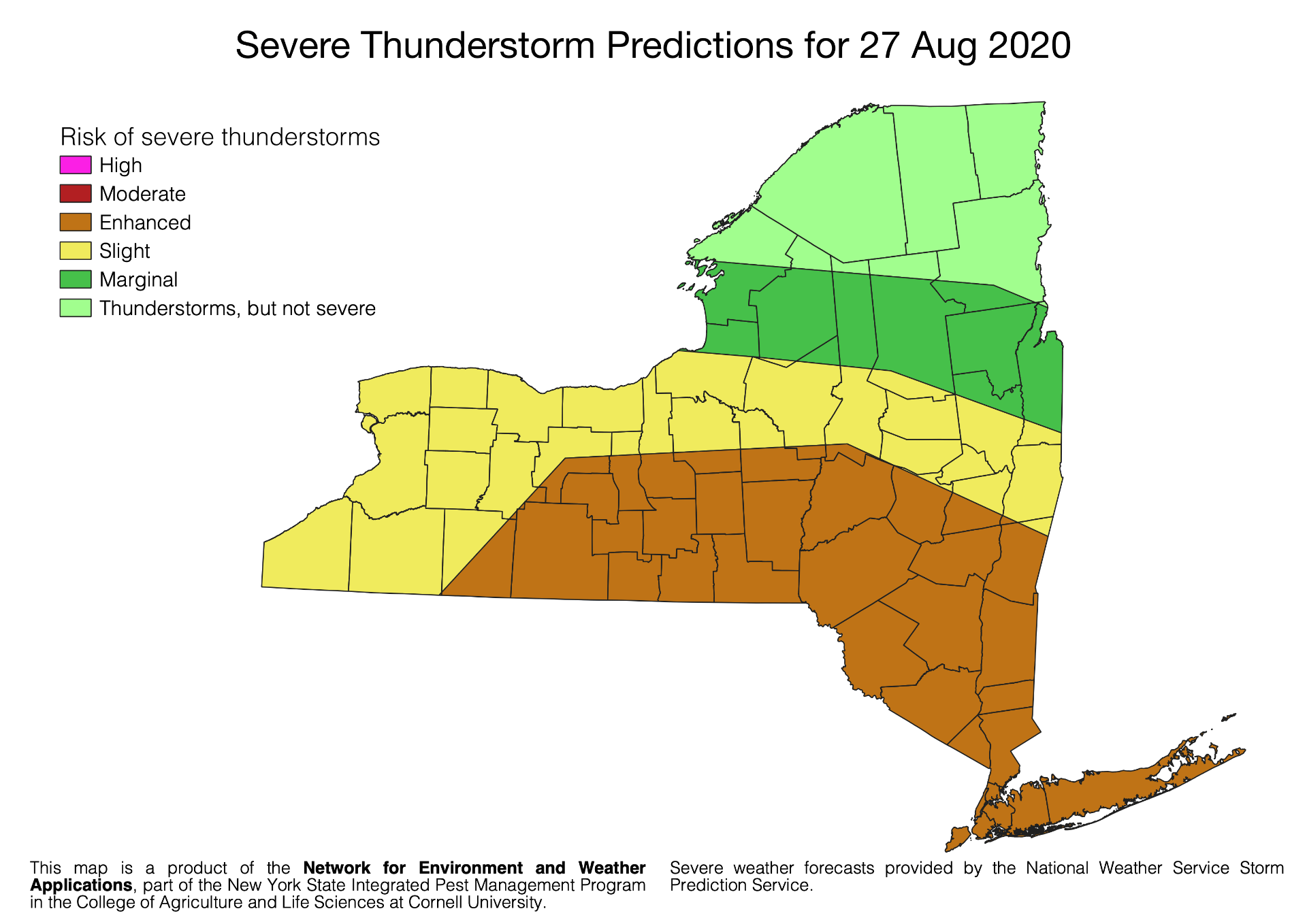
The National Weather Service predicts slight to enhanced risk of severe thunderstorms across large portions of New York State for Thursday 27 Aug 2020.
Central and eastern NY south of the Thruway, the Catskills, Hudson Valley and downstate regions have been placed at an ‘Enhanced’ risk level of severe thunderstorms by NWS, with a possibility of damaging winds and 5-15% chance of damaging hail in these regions.
If severe or dangerous weather develops in your area, NWS will use the Wireless Emergency Alert (WEA) system to push urgent text messages to your mobile device.
Follow your local NWS office on Twitter for regular updates in your region of NY.
| NWS Office | Twitter handle |
|---|---|
| Albany, NY | @NWSAlbany |
| Buffalo, NY | @NWSBUFFALO |
| Binghamton, NY | @NWSBinghamton |
| Burlington, VT | @NWSBurlington |
| New York, NY |
Thunderstorm prediction data provided by the National Weather Service Storm Prediction Center.
This report was provided by the Network for Environment and Weather Applications (NEWA) which is part of the New York State Integrated Pest Management Program in the College of Agriculture and Life Sciences at Cornell University.