
Contributed by NOAA Northeast Regional Climate Center, Cornell University
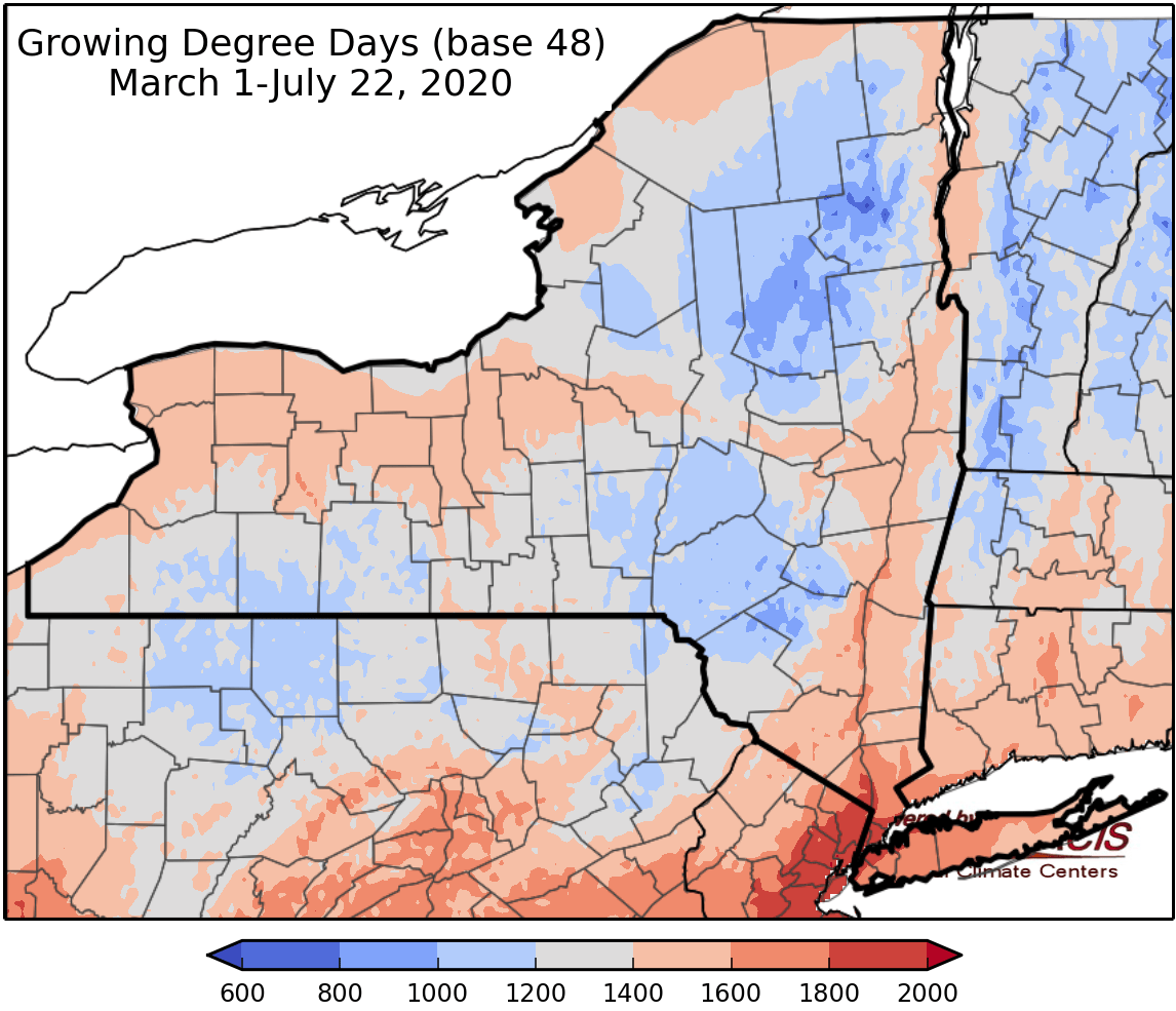
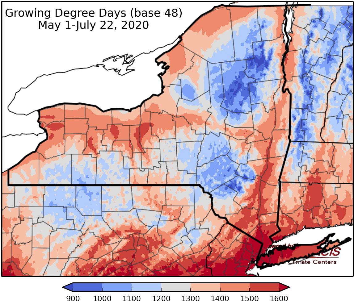
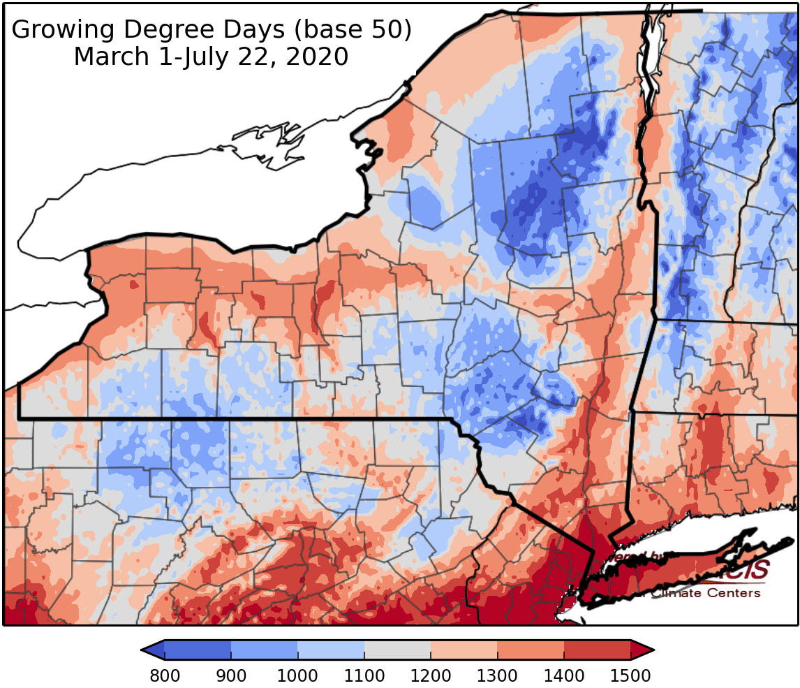
Last week temperatures ranged from 2 to 6 degrees above normal. Precipitation has ranged from a hundredth of an inch to near 4 inches. Base 50 growing degree-days ranged from 110-210.

Today temperatures will in the 80s with humid conditions. Scattered showers and thunderstorms are expected, some could reach severe stage with isolated damaging winds, hail, and localized heavy rainfall. Overnight lows will be in the upper 50s to upper 60s.
Friday temperatures will be in the mid 70s to mid 80s with clearing conditions. Overnight temperatures will be in the mid 50s to mid 60s.
Saturday temperatures will be in upper 70s to low 90s with increased humidity. Overnight temperatures will be in the mid 50s to mid 60s.
Sunday will be with highs in the 80s to low 90s with increased humidity. Overnight temperatures will be in the 60s to low 70s with showers possible.
Monday temperatures will be in the 80s to low 90s. A cold front will bring showers and thunderstorms. Overnight temperatures will be in the 60s.
Tuesday highs will be in the 80s with scattered showers and thunderstorms. Overnight temperatures will be in the mid 50s to mid 60s.
Wednesday highs will be in the 70s and 80s with scattered showers and thunderstorms. Overnight temperatures will be in the mid 50s to mid 60s.
The seven-day precipitation amounts will range from 0.5 inch to 1.75 inches.
The 8-14 day outlook (July 30-August 5) slightly favors above-normal temperatures and slightly favors below-normal precipitation.
Maps of 8-14 day outlooks:
http://www.cpc.ncep.noaa.gov/products/predictions/814day/index.php
National Weather Service watch/warnings map:
http://www.weather.gov/erh/
US Drought Monitor
http://droughtmonitor.unl.edu/
CLIMOD2 (NRCC data interface):
http://climod2.nrcc.cornell.edu
