
Contributed by NOAA Northeast Regional Climate Center, Cornell University
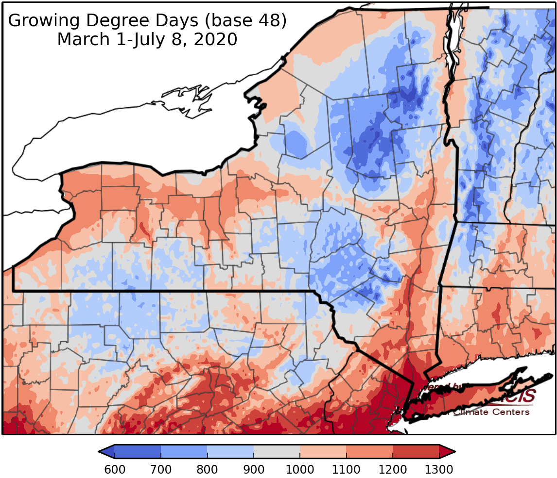
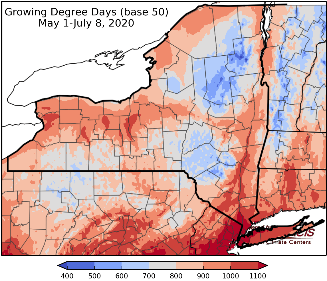
Last week temperatures ranged from 2 degrees below normal to 4 degrees above normal. Precipitation has ranged from a trace to 2 inches. Base 50 growing degree-days ranged from 110-190.


Today will be hot & humid with temperatures in the mid 80s to mid 90s and isolated showers and thunderstorms; some storms will be capable of producing heavy downpours. Overnight lows will be in mid 60s to mid 70s.
Friday will be another hot & humid day with temperatures in the 90s. A coastal low will bring cloud cover and increased chances for showers and thunderstorms, most likely for eastern areas. There is a risk for flash flooding. Overnight temperatures will be in the 70s.
Saturday temperatures will be in the 80s. Some areas will have morning rain continuing from Friday night and more widespread afternoon showers and thunderstorms are likely. Overnight temperatures will be in the mid to upper 60s.
Sunday will have afternoon showers and thunderstorms, with highs in the mid low to 80s. Overnight temperatures will be in the mid to upper 60s.
Monday temperatures will be in the low 80s with scattered thunderstorms. Overnight temperatures will be in the mid to upper 60s.
Tuesday highs will be in the 80 with scattered afternoon showers and thunderstorms. Overnight temperatures will be in the mid to upper 60s.
Wednesday highs will be in the mid 80s to low 90s. Overnight temperatures will be in the mid to upper 60s.
The seven-day precipitation amounts will range from half an inch to two and a half inches.
The 8-14 day outlook (July 16-22) favors above-normal temperatures with high probability. The precipitation outlook favors near- to slightly below-normal amounts.
Maps of 8-14 day outlooks:
http://www.cpc.ncep.noaa.gov/products/predictions/814day/index.php
National Weather Service watch/warnings map:
http://www.weather.gov/erh/
US Drought Monitor
http://droughtmonitor.unl.edu/
CLIMOD2 (NRCC data interface):
http://climodtest.nrcc.cornell.edu
