
Contributed by NOAA Northeast Regional Climate Center, Cornell University
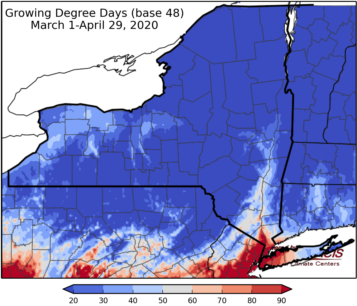
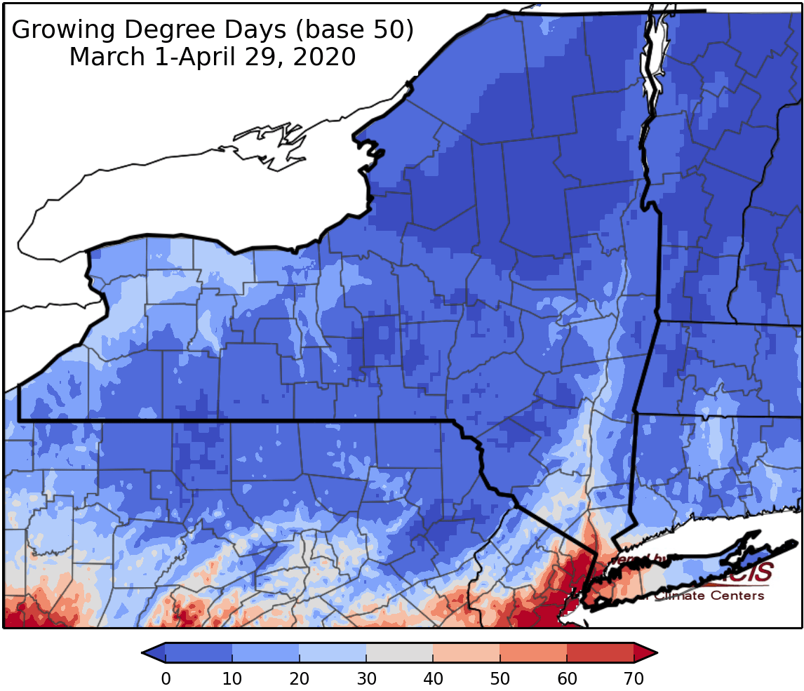
Last week temperatures ranged from 2 to 10 degrees below normal. Precipitation has ranged from a hundredth of an inch to two inches. Base 50 growing degree-days ranged from 0-10.
Today temperatures will be in the mid 50s to mid 60s with heavy rain in central NY; some thunderstorms are possible. Flood & Flash Flood Watches have been issued for parts of NY. Overnight lows will be in the upper 40s and lower 50s.
Friday temperatures will be in the 50s to mid 60s with lingering showers and possibly a thunderstorm. Overnight temperatures will be in the 40s.
Saturday temperatures will be in the mid 50s to upper 60s (around 70 in eastern areas) with gusty conditions and light morning showers likely for central NY, otherwise there will be clearing conditions Saturday through Sunday morning. Overnight temperatures will be in the mid 30s to mid 40s.
Sunday highs will be in the 60s with afternoon/evening showers and isolated thunderstorms possible. Overnight temperatures will be in the 40s.
Monday will be cooler with temperatures in the 50s with another heavy rainfall possible. Overnight temperatures will be in the 30s with clearing conditions.
Tuesday highs will be in the 40s and 50s. Overnight temperatures will be in the 30s.
Wednesday highs will be in the 50s. Overnight temperatures will be in the 30s.
The seven-day precipitation amounts will range from a tenth of an inch to 3 inches.
The 8-14 day outlook (May7-13) favors below-normal temperatures with high probability. Near- to below-normal precipitation is favored.
Maps of 8-14 day outlooks:
http://www.cpc.ncep.noaa.gov/products/predictions/814day/index.php
National Weather Service watch/warnings map:
http://www.weather.gov/erh/
US Drought Monitor
http://droughtmonitor.unl.edu/Home.aspx
CLIMOD2 (NRCC data interface):
http://climodtest.nrcc.cornell.edu
