Northeast Regional Climate Center (NRCC)
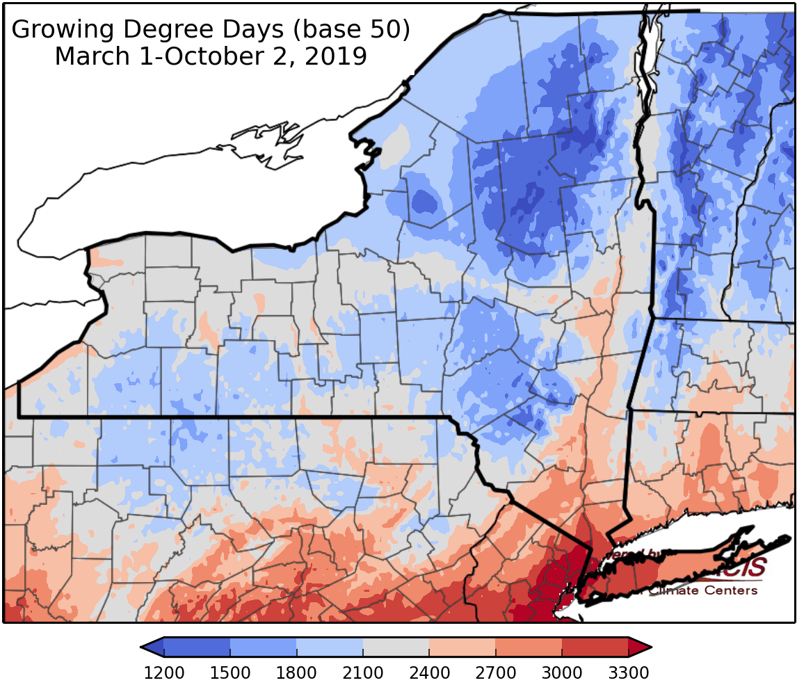
A much cooler week is in store compared to last week, with a good chance of a 1-2 inch rainfall event for upstate NY from late Sunday through Tuesday. After today’s rain, clear skies will reappear later Friday and particularly Saturday. This will lead to a widespread frost for much of northern and central NY Saturday morning. This is right on schedule as the average day of the first fall frost is October 4 in Ithaca. Saturday will be the coolest day of the week with highs only in the upper 50s to upper 60s across the state and lows from around 30 to the mid to upper 40s down near the city. After that temperatures should mainly be in the 60s from Sunday-Wednesday with lows in the mid 40-mid 50s most days. Normal highs for this time of year is low 60s upstate and upper 60s near the City with normal lows mainly in the low 40 to low 50s. For the period starting next Thursday (10/10). Temperatures should average slightly above normal and precipitation should be on the lighter side as the long range forecast models show a zonal (west to east) jet stream pattern, which typically does not bring extreme temperature variations or big storm systems.