
NOAA Northeast Regional Climate Center, Cornell University
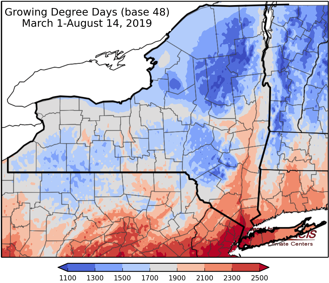
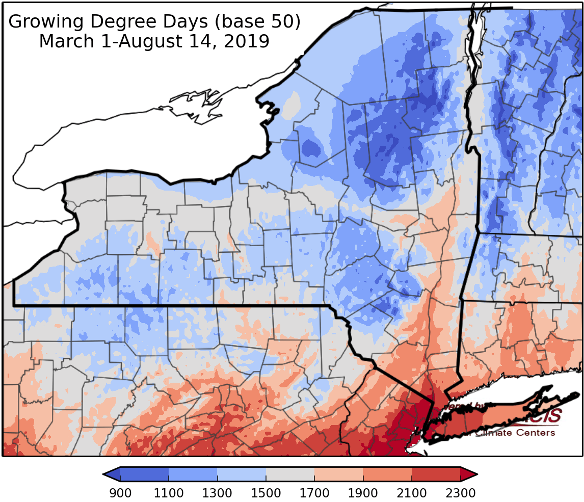
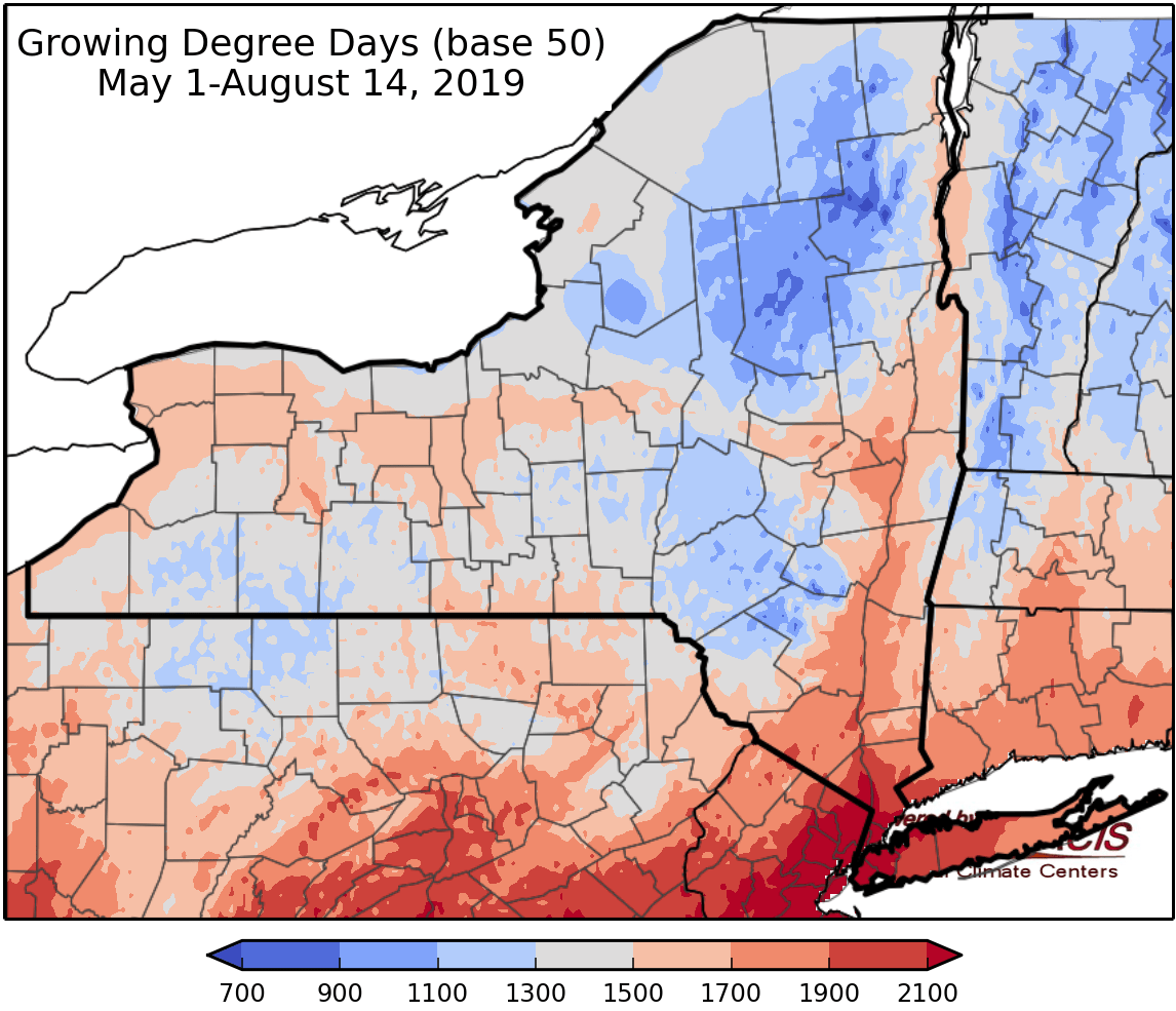
Last week temperatures ranged within 2 degrees of normal. Precipitation has ranged from a quarter inch to 3 inches. Base 50 growing degree-days ranged from 80 to 160.

An active weather pattern expected for the week. Temperatures and humidity will increase for the end of the weekend into next week.
Thursday a week frontal system will bring a chance for showers and thunderstorms, a few strong storms could develop with gusty winds, hail, & brief downpours; northern areas of the state will stay dry and sunny. Temperatures will be in the 70s to near 80. Overnight lows will be in the mid 50s to mid 60s with overnight showers and thunderstorms.
Friday scattered showers and thunderstorms will move through, with increased humidity and temperatures in the mid 70s to low 80s. Overnight temperatures will be in the mid 50s to mid 60s.
Saturday temperatures will be in the low to mid 80s with afternoon and evening showers and thunderstorms. Overnight temperatures will be in the upper 50s to mid 60s.
Sunday highs will be in the 80s to near 90 with increased chances for shows and thunderstorms with gusty winds. Overnight temperatures will be in the 60s.
Monday will be warm and humid with temperatures in the 80s to near 90. Showers and thunderstorms are possible. Overnight temperatures will be in the 60s.
Tuesday highs will be in the 80s. Overnight temperatures will be in the 60s.
Wednesday highs will be in the low to mid 80s. A cold front is expected to bring cooler temperatures and lower humidity. Overnight temperatures will be in the 60s.
The seven-day precipitation amounts will range from a quarter inch to one and a quarter inches.
The 8-14 day outlook (August 22-28) favors above-normal temperatures for the state, with high probability. The outlook slightly favors below-normal precipitation for northern and eastern areas and near-normal precipitation for the rest of the state.
Maps of 8-14 day outlooks:
http://www.cpc.ncep.noaa.gov/products/predictions/814day/index.php
National Weather Service watch/warnings map:
http://www.weather.gov/erh/
US Drought Monitor
http://droughtmonitor.unl.edu/Home.aspx
Drought Impact Reporter:
https://droughtreporter.unl.edu/map/
CLIMOD2 (NRCC data interface):
http://climodtest.nrcc.cornell.edu
