
NOAA Northeast Regional Climate Center, Cornell University
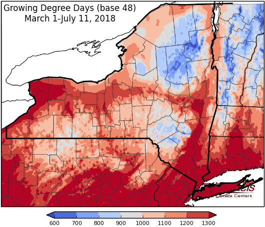
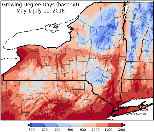
Last week temperatures were near-normal to 4 degrees above-normal. Precipitation has ranged from a trace to 2”. Base 50 growing degree-days ranged from 100-180. Abnormally dry conditions have been expanded for part of NY and moderate drought has been introduced in some areas.


Monday temperatures will be in the 80s to mid 90s with humid conditions and a chance for afternoon thunderstorms. Overnight temperatures will be in the 60s to low 70s.
Tuesday highs will be in the 80s to low 90s. A cold front will bring showers and thunderstorms, with heavy rainfall, flooding, and gusty winds possible for some areas. Overnight temperatures will be in the 60s.
Wednesday will be dry with highs will be in the 80s. Overnight temperatures will be in the 60s.
The seven-day precipitation amounts will range from one inch to one an three quarters of an inch.
The 8-14 day outlook (July 19-25) favors above-normal temperatures for all of the state. The precipitation outlook is split with extreme western to northern NY slightly favored for below-normal rainfall and extreme southeast NY slightly favored for above-normal rainfall.
Maps of 8-14 day outlooks:
http://www.cpc.ncep.noaa.gov/products/predictions/814day/index.php
National Weather Service watch/warnings map:
http://www.weather.gov/erh/
US Drought Monitor
http://droughtmonitor.unl.edu/Home.aspx
Drought Impact Reporter:
http://droughtreporter.unl.edu/map
CLIMOD2 (NRCC data interface):
http://climodtest.nrcc.cornell.edu
