
NOAA Northeast Regional Climate Center, Cornell University
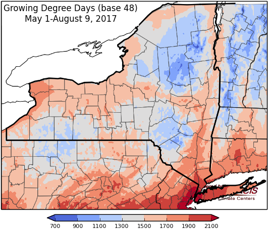
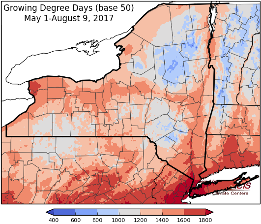
Last week temperatures ranged within 2 degrees of normal. Precipitation ranged from less than a quarter inch to over 4 inches in isolated ares. Base 50 growing degree-days ranged from 70 to 150.


A weak cold front will bring scattered showers and thunderstorm Thursday evening through Saturday. Sunday through Wednesday carry a chance for isolated showers but will be mostly dry.
Thursday temperatures will be in the upper 70’s to mid 80’s. Most areas will stay dry, but there is a slight chance for scattered showers and thunderstorms, more so for the northern Adirondacks and Champlain Valley. Overnight lows will be in the upper 50’s to low 60’s.
Friday temperatures will be in the mid 70’s to low 80’s, with scattered showers and thunderstorms possible. Overnight temperatures will be in the 60’s.
Saturday’s highs will be in the mid to upper 70’s with showers and thunderstorms possible and increasingly humid. Overnight temperatures will be in the low to mid 60’s.
Sunday highs will be in the mid 70’s to low 80’s with isolated scattered showers. Overnight temperatures will be in the mid 50’s to low 60’s.
Monday’s highs will be in the 70’s to low 80’s with isolated scattered showers. Lows will be in the mid 50’s to low 60’s.
Tuesday will have temperatures in the mid 70’s to low 80’s with isolated scattered showers. Lows will be in the mid 50’s to low 60’s.
Wednesday, temperatures will be in the mid 70’s to low 80’s with isolated scattered showers. Lows will be in the mid 50’s to low 60’s.
The seven-day precipitation amounts will range from ¼” to near 1”.
The 8-14 day outlook (Aug 17-23) slightly favors above-normal temperatures in far northern NY and slightly favors below-normal temperatures in southeast N, other areas can expect near-normal temperatures. The precipitation outlook slightly favors below-normal precipitation amounts for southeast NY and favors near-normal amounts for the rest of the state.
Maps of 8-14 day outlooks:
http://www.cpc.ncep.noaa.gov/products/predictions/814day/index.php
National Weather Service watch/warnings map:
http://www.weather.gov/erh/
US Drought Monitor
http://droughtmonitor.unl.edu/Home.aspx
CLIMOD2 (NRCC data interface):
http://climodtest.nrcc.cornell.edu
