
From Jessica Spaccio, NOAA Northeast Regional Climate Center, Cornell University
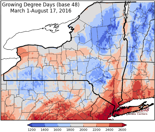
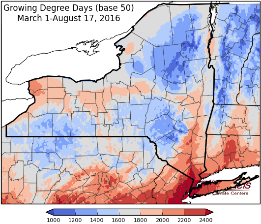
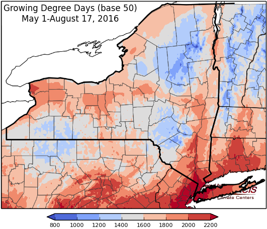
Last week temperatures ranged from 4 to 10 degrees above normal. Precipitation ranged from 1/2 inch to over 4 inches. Base 50 growing degree-days ranged from 140 to 220.

Warming up again through Sat, then a cold front brings chance for rain on Sunday and cooler temperatures…
Today will be a slight chance for showers and thunderstorms with temperatures in the mid 70’s to mid 80’s. Overnight lows will be in the mid 50’s to mid 60’s.
Friday will be dry and warm with highs will be in the 80’s and increasing humidity. Lows will be in the mid 50’s to mid 60’s.
Saturday temperatures will be in the mid 80’s to near 90 and humid with a slight chance for afternoon showers. Overnight temperatures will be in the 60’s.
Sunday highs will be in the mid 80’s to near 90 again, an afternoon/evening cold front will bring a chance for showers and thunderstorms. Overnight temperatures will be in the 60’s.
Monday highs will be cooler, in the upper 60’s and 70’s with a few lingering showers. Lows will be in the 50’s.
Tuesday temperatures will be in the upper 60’s and 70’s. Lows will be in the 50’s.
Wednesday temperatures will be in the 70’s. Lows will be in the 50’s.
The five-day precipitation amounts will range from ¾” to 1.5”.
The 8-14 day outlook (August 25-31) shows increased chances for above normal temperatures for all of the state. There is no indication for precipitation.
The September outlook shows no indication for above or below normal temperatures or precipitation.
The September/October/November outlook show increased chances for above normal temperatures. There is no indication for precipitation.
The Drought Monitor: Enough rain (more than 2 inches) fell for a one-category improvement in extreme southwestern and south-central New York. However, some portions missed out on the heavy rains (e.g. western New York) where less than 0.5 inches fell. Accordingly, conditions deteriorated there, two new D3 areas (Extreme Drought) in western New York, one along the I-90 corridor, and another in the southern Finger Lakes region.
Maps of 8-14 day outlooks:
http://www.cpc.ncep.noaa.gov/products/predictions/814day/index.php
National Weather Service watch/warnings map:
http://www.weather.gov/erh/
US Drought Monitor:
http://droughtmonitor.unl.edu/Home.aspx
CLIMOD2 (NRCC data interface):
http://climodtest.nrcc.cornell.edu
