
From Jessica Spaccio, NOAA Northeast Regional Climate Center, Cornell University
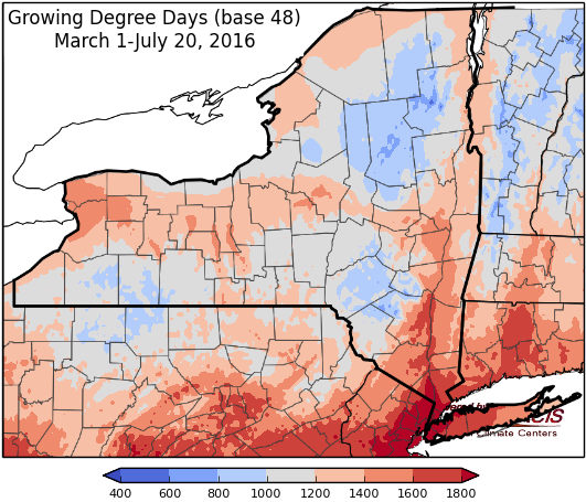
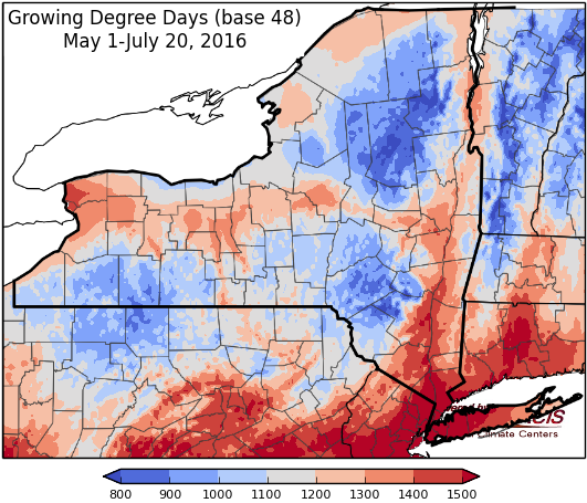
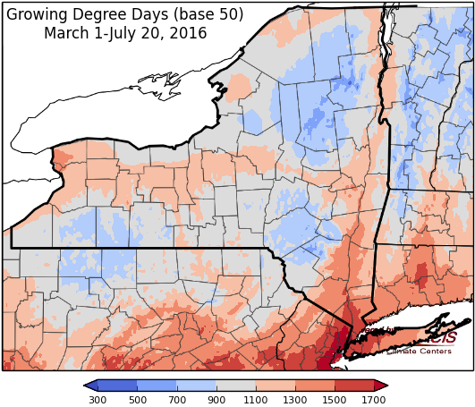
Last week temperatures ranged from normal to 4 degrees above normal. Precipitation ranged from a tenth to 2 inches. Base 50 growing degree-days ranged from 110 to 170.

Heat & humidity return…
Today will be sunny with temperatures warming into the 80’s and low 90’s. Overnight lows will be in the 60’s and low 70’s with strong thunderstorms possible (gusty winds).
Friday will be humid with highs in the mid 80’s to low 90’s with showers and thunderstorms likely with a passing cold front, some possibly severe (large hail, damaging winds possible). Lows will be in the 60’s to low 70’s.
Saturday high pressure will bring sunny, still humid conditions with temperatures in the 80’s and low 90’s. Overnight temperatures will be in the mid 60’s to low 70’s.
Sunday highs will be in the mid 80’s to low 90’s with continued high humidity. Overnight temperatures will be in the mid 60’s to low 70’s with a chance of showers and thunderstorms.
Monday the chance of showers and thunderstorms continues in the morning, highs will continue to be above normal in the mid 80’s to low 90’s. Lows will be in the mid 60’s to low 70’s.
Tuesday temperatures will be more seasonable in the 80’s. Lows will be in the 60’s.
Wednesday temperatures will be in the 80’s. Lows will be in the 60’s.
The five-day precipitation amounts will range from ¼” to 1.5” .
The 8-14 day outlook (July 28 – August 3) shows an increased chance (50-60%) for above normal temperatures and an increased chance (33-40%) for above normal precipitation.
The Drought Monitor: For the last 30 days, precipitation is below 25 percent of normal. Stream flows at all levels (1-, 7-, 14-, and 28-day) are reaching into the tenth percentiles. Moderate to Severe drought (D1-D2) was expanded to cover these high impact areas in western NY. New York issued the first statewide drought watch since 2002.
Maps of 8-14 day outlooks:
http://www.cpc.ncep.noaa.gov/products/predictions/814day/index.php
National Weather Service watch/warnings map:
http://www.weather.gov/erh/
US Drought Monitor:
http://droughtmonitor.unl.edu/Home.aspx
CLIMOD2 (NRCC data interface):
http://climodtest.nrcc.cornell.edu
